College researchers to study why people risk going into ice caves
Published 1:30 am Saturday, June 10, 2017


VERLOT — Researchers from two Texas universities plan to visit the Big Four Ice Caves this summer to study hikers’ risky behavior and how it might be averted.
Options could include rerouting or redesigning the end of the trail, which draws tens of thousands of visitors each year.
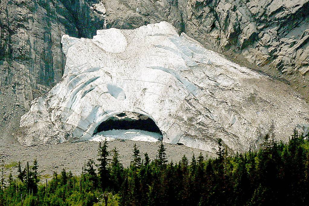
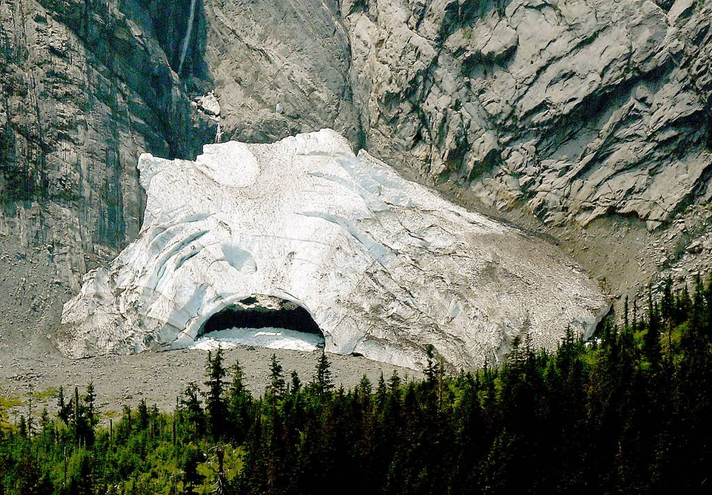
Posts on social media show that hikers already have been adventuring up into the shadow of Big Four Mountain this spring. A snow field stretches out around massive mounds of snow, ice and avalanche debris where the caves usually form, in a gully on the north side of the mountain. Snowmelt and warm air start to hollow out caverns as the weather heats up. The caves have not yet formed this year.
Even before openings are visible, the snow is unstable, with unseen hollows just below the surface. Large chunks of ice can break off and tumble down. As the caverns widen and the layer of snow above thins, the caves are at risk of collapsing. It’s dangerous inside, near the openings or on top.
This weekend, emergency response teams are scheduled to be at the ice caves to train for a disaster there. Access was expected to be limited or blocked until Saturday evening, and helicopters may be noticed in the area during the training.
Four people have been killed at or near the caves in the past two decades. One of them, 11-year-old Grace Tam, was struck by falling ice while she was about 20 feet away from the caves on a family hike in 2010. Two years ago, a cave partially collapsed while people were inside. A woman was killed at the scene and her brother died months later of his injuries. A 27-year-old Bothell woman also was killed by falling ice in 1998 near the mouth of the caves.
The U.S. Forest Service is working with Baylor and Texas A&M universities to study the hiking destination, Ranger Peter Forbes said. Researchers plan to look at the social dynamics, or why people do risky things, as well as the route and design of the trail. The goal is to have a report done by October, after which the forest service will review the recommendations.
Meanwhile, rangers remind hikers to enjoy the trail safely. They are stationed there on weekends this spring and summer. They’ve reported avalanches as recently as three weeks ago.
“It’s fair to assume that there’s more snow up there after a winter like we had,” Forbes said. “Even though we got a lot of rain at lower elevations, most of what feeds the ice caves comes from 4,000-feet-plus. There is still snow up on the hillside that could come down.”
Along with the study focused on the end of the trail, the forest service is working on some improvements closer to the trailhead. Next year, crews plan to replace the boardwalk over the wetland between the Big Four Picnic Area and the start of the Ice Caves trail.
Another popular but potentially dangerous destination on the Mountain Loop Highway is being studied, too. Gold Basin Campground, the largest in the Mount Baker-Snoqualmie National Forest, closed in 2014 because of the risk of a landslide on the hill above. A team of geotechnical engineers is expected to visit this summer and gather data on the slide risk. The goal is to learn if the campground can be partially or totally reopened.
Kari Bray: 425-339-3439; kbray@heraldnet.com.