Smith Island tidal marsh reclamation is well underway
Published 9:00 pm Saturday, August 20, 2016


NISQUALLY — Within earshot of I-5, a landscape of green and yellow opens up toward Puget Sound.
Birds cruise through marine-fresh air, above watery channels where chinook, coho and pink salmon migrate inland to spawn.
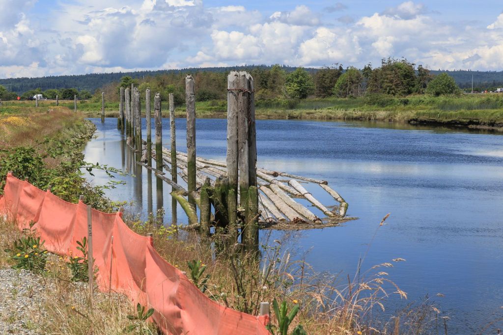
This is the Nisqually River Delta seven years after the federal government and the Nisqually Tribe oversaw a project to breach dikes to re-flood farmland. Channels snake their way through mud and marsh, reviving an estuary that had long lain dormant.
“A 5-mile dike blocked off approximately 1,000 acres of land for agriculture,” said Glynnis Nakai, who manages the area for the U.S. Fish &Wildlife Service. “That 1,000 acres was no longer influenced by daily tides. It was like that for a century.”
The transformation taking shape in the Nisqually delta, north of Olympia, is similar to what Snohomish County leaders hope to accomplish in the Snohomish River delta: turning old farmland back into tidal marsh to benefit salmon and other aspects of the ecosystem. The county has been preparing its habitat-restoration project on Smith Island for more than a decade. Heavy construction on the 400-acre makeover got started last year and has been going full bore since spring.
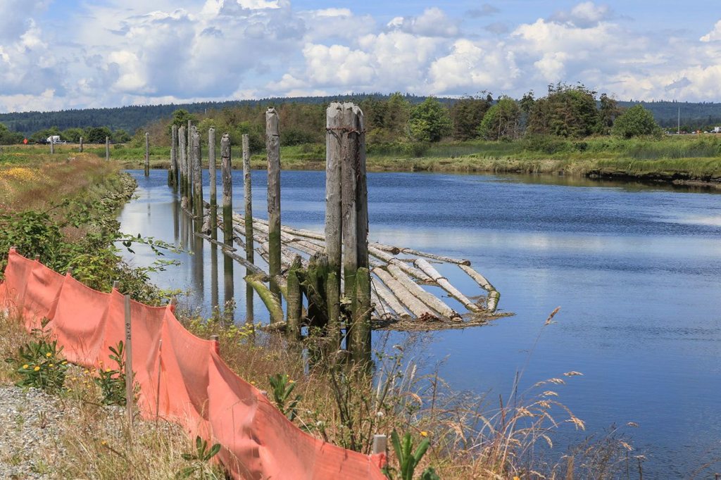
Stand on an existing dike near Everett’s wastewater lagoons east of I-5 and you can take in the scope of work. When complete, the new dike will extend a mile north from here toward Union Slough. The trapezoidal mound will rise about 12 feet above ground, measuring some 80 feet at its base and 15 feet up top. It’ll look a bit like the dikes upriver along the Snohomish.
To build the project, contractors need to cart in some 9,000 truckloads of fill. Workers have been been digging a 9-acre pond and building an access road alongside the future dike, which will sit back farther from the water than existing dikes, which will be breached later, allowing more land to flood with the tides.
When finished, the project will cover an area bounded to the north and east by Union Slough and to the west by I-5. Everett’s wastewater lagoons lie to the south.
The budget for the Smith island work is expected to reach $28 million, including land acquisition, engineering and permitting. The project has received about $20 million in state and federal grants.
It’s been controversial in some quarters. Farm advocates have criticized the idea of allowing hundreds of acres of what’s now ag land to slip underwater. Opponents also have questioned the wisdom of spending millions of dollars on a project that might save fewer than 900 returning adult chinook salmon per year. While that’s an accurate number, county documents project that the new habitat also would support 43,000 chinook smolts. That’s a critical life stage for young salmon, when they are first transitioning from fresh to salt water.
On Smith Island, as in the Nisqually delta, the impetus for re-configuring the dikes was the 1999 listing of chinook salmon as threatened under the Endangered Species Act. Other salmonid species that use the Snohomish estuary include coho, chum, and pink salmon, sea-run cutthroat trout, steelhead trout, bull trout char and mountain whitefish, according to an environmental impact statement.
Proponents are convinced their plan will bring back eelgrass and other features of the historical habitat that oceangoing fish need to survive. They can point to completed projects in the region with similar goals: the Deepwater Slough on the Skagit River and the Port Susan Bay Preserve on the Stillaguamish River. The work in the Nisqually delta is the largest example in the Pacific Northwest showing what Snohomish County and its partners are trying to accomplish at Smith Island.
“The project will succeed because bringing down those levees will help restore the natural estuary processes,” said Aaron Kopp, a county water resources engineer who’s helping to manage the Smith Island effort. “First and foremost, it will allow fish to access the area during the tidal cycle … they’re going to be able to get into the site during river conditions that aren’t flood stage.”
Beyond habitat, the new dikes are intended to provide better flood protection for nearby infrastructure, including I-5.
In remaking the land, county engineers hope to turn back a page in history.
University of Washington geomorphologist David Montgomery became intrigued with how salmon and the Pacific Northwest landscape shaped each other. The professor wrote about the relationship in his 2003 book, “King of Fish.” In it, he asks what caused once-thriving salmon populations to plummet in places such as New England and Europe and what lessons that might hold for the Northwest.
Four factors led to those declines: harvesting, hatcheries, habitat loss and hydropower dams — “the four H’s” for short.
Projects on the Snohomish, Skagit and Nisqually rivers focus on one of those aspects, by expanding habitat. That entails reversing the changes brought about when farmers started diking and draining Puget Sound estuaries in the late 1800s.
On Smith Island, the taming of the salt marshes began during the Civil War era. Dr. Henry Smith arrived at the mouth of the Snohomish River in the early 1860s when perhaps 100 settlers made their home in the county. He and other pioneers envisioned turning the area into a “New Holland.” Smith reclaimed 75 acres with an extensive system of dikes, according to an article on Historylink.org. Today, the sparsely populated island bears his name.
The work begun under Smith is about to be undone.
“The point of taking the dikes out is getting more areas that fish can use,” Montgomery said. “If it’s not submerged, it ain’t fish habitat.”
That may not be enough to reverse the population losses given the other influences on salmon survival.
“It’s hard to track because there are other factors,” Montgomery said. “There are the ocean conditions, there’s the hatchery effects and there’s fishing.”
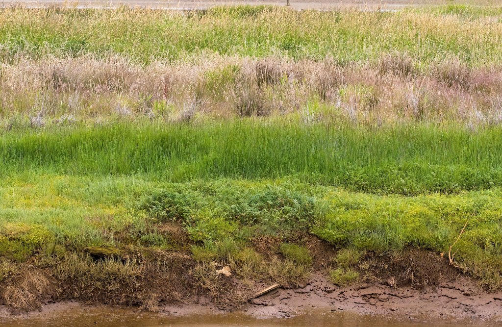
Only about a sixth of the Snohomish delta remains intact; the rest has been altered.
Experts from the state agency known as the Puget Sound Partnership see that as a huge opportunity. Unlike urban watersheds that have been turned into ports and industrial areas, such as the Duwamish River in Seattle and the Puyallup River in Pierce County, breaching dikes on the Snohomish River could provide a comparatively easy way to recreate habitat.
“Snohomish is kind of a standout because it has so much potential,” said Leska Fore from the Partnership’s science evaluation team. “The more (salmon) feed and the bigger they get before heading out into the ocean, the greater the chances are that they will come back as adults.”
Over time, scientists hope to track what kinds of fish are using the estuary and how many are able to return. Judging success — or failure — won’t be quick.
“You can’t just count on one or two years of data of returning fish to establish a long-term trend,” said Jeanette Dorner, who directs the Partnership’s local ecosystem recovery efforts.
A clearer picture is unlikely to emerge for at least a decade.
“Probably in 10 to 20 years, which is not a very satisfying answer, but it’s the truth,” Dorner said.
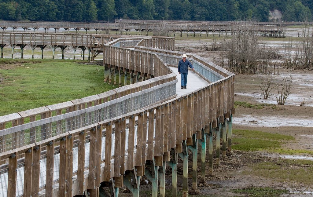
Biologist Chris Ellings is several years down the path of tracking changes in the Nisqually delta. Ellings, who manages salmon-recovery programs for the Nisqually Indian Tribe, walked the site back in June with Nakai from U.S. Fish &Wildlife.
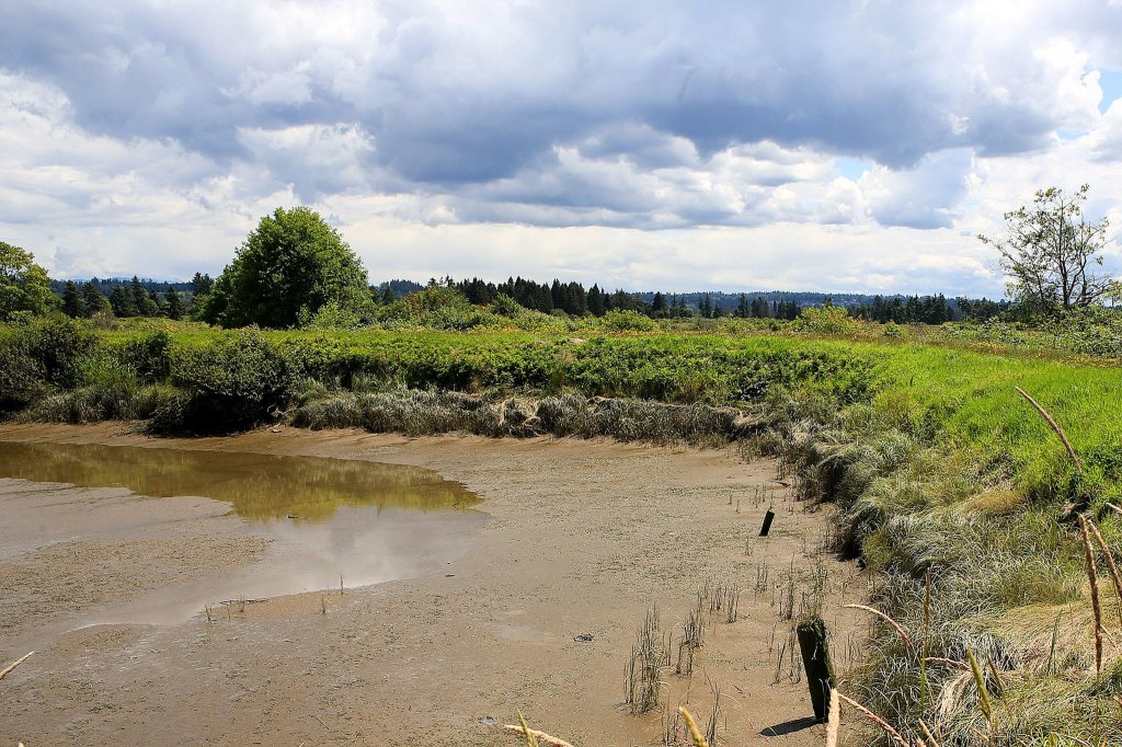
By the time the dikes were breached there in 2009, the river delta was no longer very productive farmland, Ellings explained. Overrun with invasive reed canary grass, it wasn’t providing fish habitat either.
Things started changing almost as soon as they reflooded the area.
“From the first spring in 2010, both wild and hatchery (fish) were using the area, even though it looked like a bomb went off,” Ellings said. “Despite that, fish were accessing those channels right away.”
He’s watching the long-term effects as sediment builds up in the channels. Changes in elevation will determine the salinity of the water, what kinds of vegetation can grow and what kinds of wildlife can survive. Six inches in elevation can be the difference between “salt marsh and meadow or just mud.”
“Too little inundation and you get reed canary grass,” he said. “Too much and you get mud.”
It’ll take more time to understand the changes. One interesting observation has been that a quarter of the fish in the delta come from other areas, Ellings said. The fish in the delta also appear to be bigger and healthier than before the dikes were breached.
“There’s an impact on the fish that are rearing here and their growth is readily apparent,” he said.
Smith Island could start seeing changes in a couple of years.
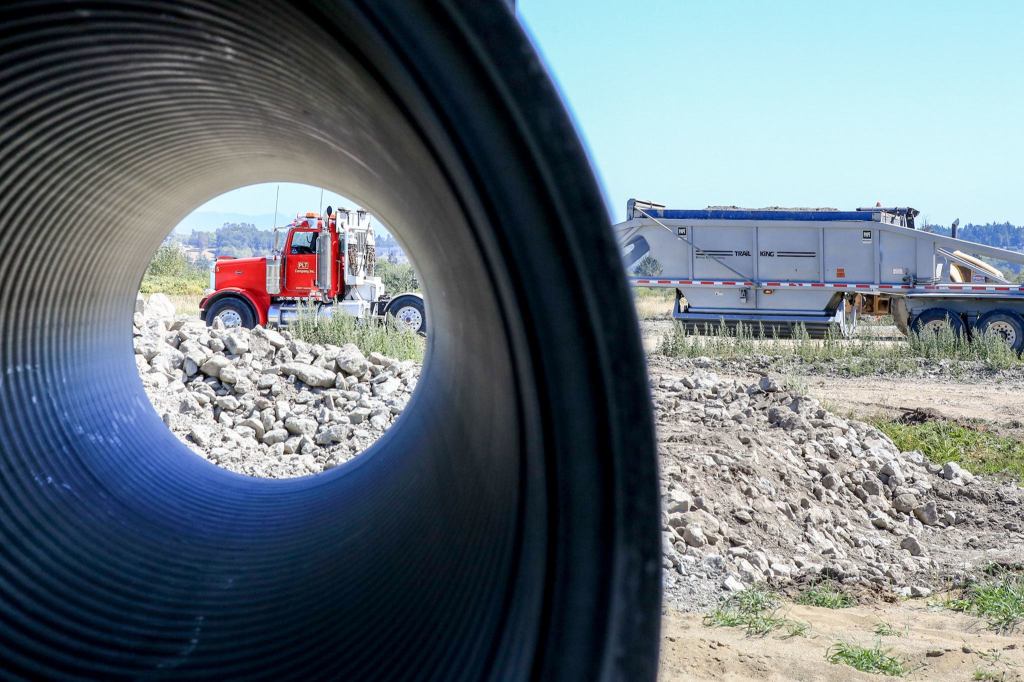
The county awarded Scarsella Bros. Construction of Kent a $12.3 million contract for the first phase of work underway now, which involves building the new dike and the retention pond.
“Our current project is projected to be completed sometime in the summer of 2017,” said Charlie Green, a county construction supervisor. “People will see a lot of trucks through the area, so we appreciate everybody’s patience.”
Work won’t be finished until after a second phase of construction in the spring or summer of 2018. It involves breaching the old dikes and restoring natural features in the channels that run through the area. That portion is estimated to cost about $2.5 million.
Nearby, two other projects of similar size are taking shape in the Snohomish delta’s tidal marshes between Everett and Marysville.
The Tulalip Tribes a year ago oversaw the breaching the levee at the Qwuloolt Estuary in Marysville, letting the tides return to the lowlands for the first time in a century.
The Port of Everett is gearing up to build a berm at Blue Heron Slough starting late next year. The project aims to recreate 350 acres of fish habitat on Spencer Island on the former site of the Biringer Farm. The port hopes to complete the project by early 2019, spokeswoman Lisa Lefeber said.
The Nisqually River originates inside Mount Rainier National Park. It empties into Puget Sound between Lacey and DuPont in a federally protected area known officially as the Billy Frank Jr. Nisqually National Wildlife Refuge.
Removing the dike associated with a long-standing farm there in 2009 exposed 762 acres of the Nisqually delta to the tides. Authorities, working the Ducks Unlimited conservation group, built new dikes to protect 250 acres of freshwater wetlands as waterfowl habitat.
Seven years later, those involved with the project talk of the area as restoring rather than restored.
“We don’t say that we restored the area, because it’s going to be a continuous process for years to come,” Nakai said.
“We restored the tidal process, but we did not restore the area, the ecological structure and the ecological functions that go along with it.”
While that may be true for Smith Island as well, Kopp, the county water resource engineer, predicts: “We expect the fish to come with the tides.”
Noah Haglund: 425-339-3465; nhaglund@heraldnet.com. Twitter: @NWhaglund.