Washington snowpack low and similar to 2015 drought year
Published 1:30 am Monday, December 30, 2019
Associated Press
Washington’s snowpack is less than a year ago and officials say it’s similar to the start of 2015, the state’s last big drought.
The statewide snowpack is 47% of normal. It was 46% of normal at this time five years ago.
“It’s very reminiscent of 2015, but this year we are way behind on mountain precipitation,” said Scott Pattee, state water supply specialist for the Natural Resources Conservation Service in Mount Vernon. “It’s worrisome. It’s the third-slowest start in snow accumulation statewide since the 1990s and we had one of the driest Novembers on record.”
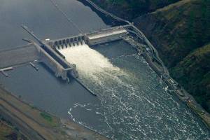
The biggest concern is the five mountain reservoirs serving the Yakima Basin are significantly behind in recharging, and 130% to 135% of normal snowfall is now needed in the Upper Yakima to get it back to normal by April 1, he said.
Elsewhere, normal snowfall from here on out would mean 70% to 80% of normal snowpack by April 1, he said.
A majority of the Cascades are 25% to 50% of normal snow water equivalent, said Douglas Call, U.S. Bureau of Reclamation Yakima River operator.
The U.S. Climate Prediction Center says the odds are good for temperatures slightly above normal through March. The outlook for precipitation is better than normal west of the Cascade crest and normal to the east.