Site Logo

Yakima County landslide slows down to 2 inches per week

Published 7:01 am Wednesday, October 13, 2021

In this Monday, Jan. 8, 2018, photo, James Gleeson, a surveyor with the Washington State Department of Transportation, takes measurements from the shoulder of Interstate 82 to monitor a slow-moving landslide on Rattlesnake Ridge beyond in Union Gap, Wash. Large containers line a road below the ridge, an effort to help block rocks and debris from reaching the highway. The threat has forced evacuations as officials prepare for what they say is inevitable – the collapse of the ridge near the interstate highway that experts say should occur sometime from late January or early February. (AP Photo/Elaine Thompson)
1/2
In this Monday, Jan. 8, 2018, photo, James Gleeson, a surveyor with the Washington State Department of Transportation, takes measurements from the shoulder of Interstate 82 to monitor a slow-moving landslide on Rattlesnake Ridge beyond in Union Gap, Wash. Large containers line a road below the ridge, an effort to help block rocks and debris from reaching the highway. The threat has forced evacuations as officials prepare for what they say is inevitable – the collapse of the ridge near the interstate highway that experts say should occur sometime from late January or early February. (AP Photo/Elaine Thompson)
In this January 2018 photo, James Gleeson, a surveyor with the Washington State Department of Transportation, takes measurements from the shoulder of I-82 to monitor a slow-moving landslide on Rattlesnake Ridge near Union Gap, as large containers line a road below the ridge in an effort to block debris from reaching the highway. (AP Photo/Elaine Thompson, file)

Associated Press

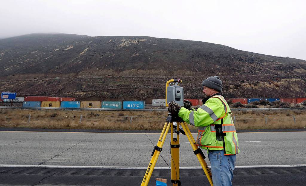
YAKIMA, Wash. — The pace of the 20-acre Rattlesnake Ridge landslide in central Washington near Union Gap is continuing to slow, officials said.

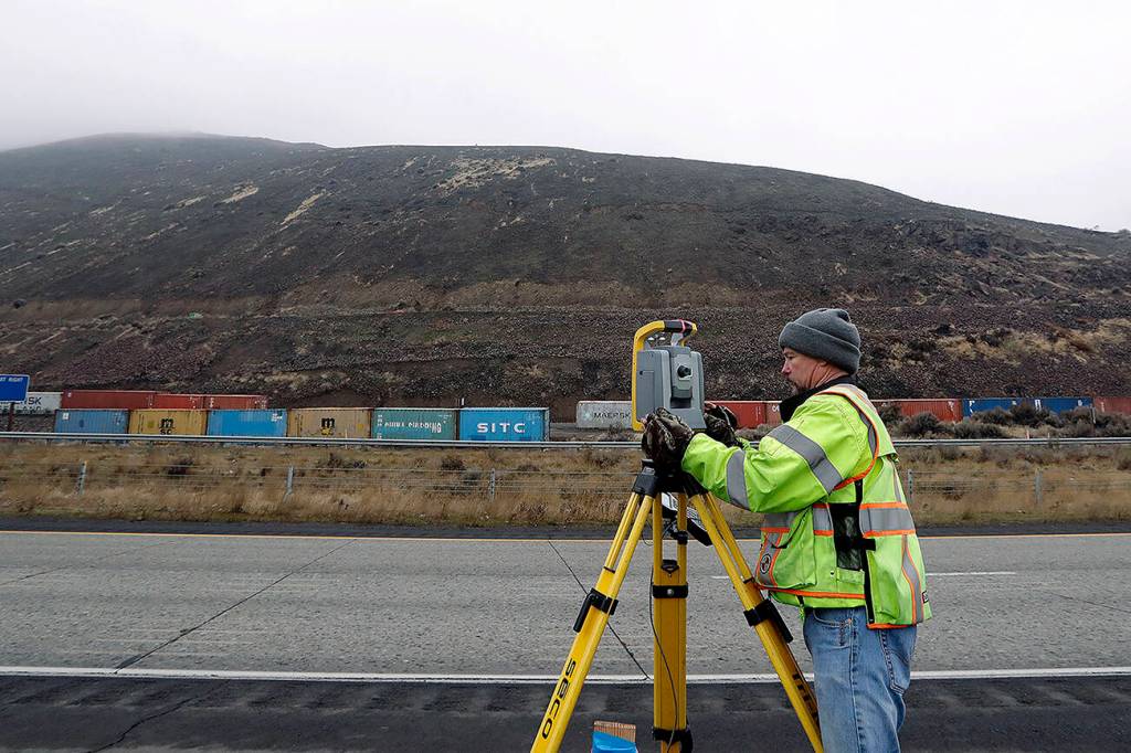
Yakima County emergency services director Tony Miller said measurements taken in August show the slab is moving less than 2 inches each week, The Yakima Herald-Republic reported.

In 2020, the slab was sliding 2 to 3 inches each week. The slab is expected to continue sliding south, with debris depositing in a nearby quarry.

“It’s moving a little bit, crumbling and falling right into the pit,” Miller said.

State and county officials, as well as scientists, have been monitoring the slide since a crack was spotted on the ridge in 2017.

Initially, officials said the slide could pose an immediate danger and 60 people living nearby were evacuated. Some residents returned after an assessment firm hired by the state confirmed the landslide was not likely to rapidly slip.

Stephen Reidel, a research faculty member at Washington State University, said the slab is sliding on a sedimentary layer between basalt flows. As the basalt slides into the quarry, it will stack up and eventually build up enough to act as a barrier, stopping the landslide.

“It’ll just stabilize itself and then stop moving,” he said.