Everett riverfront study raises concerns
Published 11:12 pm Friday, March 21, 2008
EVERETT — The city’s attempt to spell out the impacts of a proposed $500 million development with riverfront condos, shops, a movie theater, hotel and boat docks is incomplete.
That’s how state agencies, neighborhood groups and the Tulalip Tribes responded to a draft environmental impact study of the proposed 221-acre development called Everett Riverfront.
The city is evaluating 20 written and oral comments, including claims that its review of the project used inaccurate floodplain maps, was too vague when describing salmon habitat restoration projects and did not fully evaluate the impact of traffic.
The comments are typical for such a large and complex project, a city spokeswoman said.
The city is required to respond to the comments in a final environmental impact statement and to make appropriate adjustments in its evaluations of the impacts on the surrounding environment.
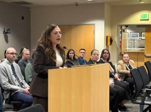
“In some places, it’s technical, in others it’s as simple as, ‘Thank you for your comment,’ ” said Dave Koenig, Everett’s long-range planning manager.
Koenig said the city hoped to release the final environmental impact statement next month, but that may be delayed because it is still gathering information. The study’s release is a critical step before groundwork can start on the development.
San Diego developer OliverMcMillan proposes to build up to 1,400 houses and add more than 1 million square feet of commercial space on a two-mile-long strip of industrial land between I-5 and the river.
The company is negotiating to buy from Everett the land, which includes former mill and landfill sites. City officials say the $8 million deal is on pace to close this fall, although the negotiation deadline has already been extended three times during the last year.
OliverMcMillan paid for most of the exhaustive study. Everett provided staff time to review it.
The land still has to be rezoned and specific development plans approved before development.
A methane gas collection system over the former dump also has to be created before much of the fenced-off property can be opened to the public.
One of the most detailed responses to the draft environmental impact study came from the state Department of Ecology.
The state agency said floodplain maps incorrectly listed the 100-year flood level in some areas 2 feet below the river’s actual flood level of 18.3 feet.
It also questioned the size of wetland buffers, asked the city and OliverMcMillan to more clearly define their roles in the project and said the project should take a more comprehensive approach to wetlands restoration.
“We didn’t send any of these comments in with the thought that anything here represents a show-stopper,” said Geoff Tallent, a manager with the state Department of Ecology’s shorelands and environmental assistance program. “On balance, we think this is a good project and we think this is a good applicant.”
Everett and OliverMcMillan plan to set aside about 100 acres of the 221-acre project for trails, buffers, open space, wetlands enhancements and a city park.
The wetlands enhancements are guided in part by agreements the city reached in 2003 and 2004 with the Tulalip Tribes, the Pilchuck Audubon Society and Public Employees for Environmental Responsibility.
The Tulalip Tribe’s response to the draft environmental study recommends additional shoreline enhancements and wider buffers next to the river.
“Many enhancement and restoration actions are suggested, but because of ambiguity in the (environmental impact study) it is unclear what will actually be completed and where,” wrote Kurt Nelson, a fish and water resources scientist with the tribe.
Peggy Toepel, president of the Everett Shorelines Coalition, which represents the Pilchuck Audubon Society, suggested the city revisit flooding studies to take into account the potential impacts of global climate change.
The state Department of Transportation requested more details on projected traffic from the development, which could reach 25,741 new daily vehicle trips per day by 2030.
State transportation officials said they are concerned that heavy traffic from local intersections could “spillback” and create unsafe conditions on the northbound I-5 offramps at 41st Street and Pacific Avenue as well as the southbound offramp at 41st Street. Project traffic on eastbound Hewitt Avenue, heading toward U.S. 2, was also pinpointed as a concern.
Everett Public Schools requested the developer enter an agreement to pay for new students the project would generate.
Alex Alexander, a vocal critic of the riverfront project, submitted a 50-page report with historic flood photos and a graph using county flood prediction data. Alexander said floods along the river will be progressively more severe in the future because of increased runoff from upstream development.
“There’s a good argument from backing away from that project and replanning it,” Alexander said. “If you pick a fight with the river, ultimately you’re going to lose.”
Sandee Little, an Everett real estate agent, said in her estimation, the city’s appraisers have undervalued the land by millions of dollars. She also requested a breakdown on what the massive project’s total cost to the public will be, including moving a railroad line, studies and environmental cleanup.
M.J. and Bob Creamer, both former heads of the Riverside Neighborhood Association, wanted assurances that Everett taxpayers wouldn’t be liable for future flood damage.
Sheri Lungstrom, a Lowell resident, asked that the city require OliverMcMillan to build a community center as part of the project.
Sean Edwards, a Port Gardner Neighborhood Association member, asked city transportation planners to tie Everett Riverfront with existing neighborhoods.
“We want to make sure that this area is connected with the rest of the community and does not become sort of a gated community or some kind of exclusive area,” Edwards said during a public hearing in January.
Reporter David Chircop: 425-339-3429 or dchircop@heraldnet.com.