‘Active’ weather brings rain, snow, hail, fresh powder to Snohomish County
Published 4:20 pm Monday, February 26, 2024


EVERETT — Rain, snow. More rain and more snow. And then some more rain and snow.
That’s about how the forecast this week looks in Snohomish County.
After some residents awoke to a dusting of snow Monday morning, Everett could get a sequel. On Tuesday morning, there was a 20% to 30% chance of an inch of snow accumulation in the lowlands, National Weather Service meteorologist Kirby Cook said.
Like usual, inland parts of the county were predicted to see slightly more snow than at sea level. Starting around 5 p.m. Monday, Darrington was expected to get 1 to 3 inches of snow accumulation was possible later in the evening.
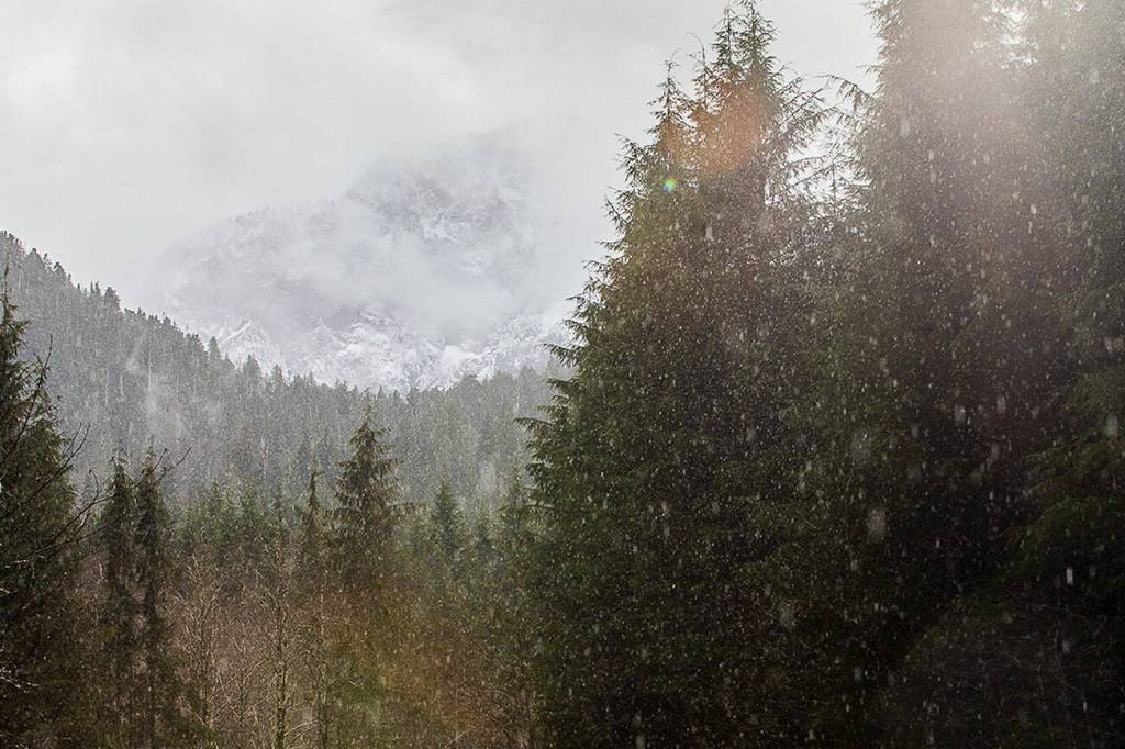
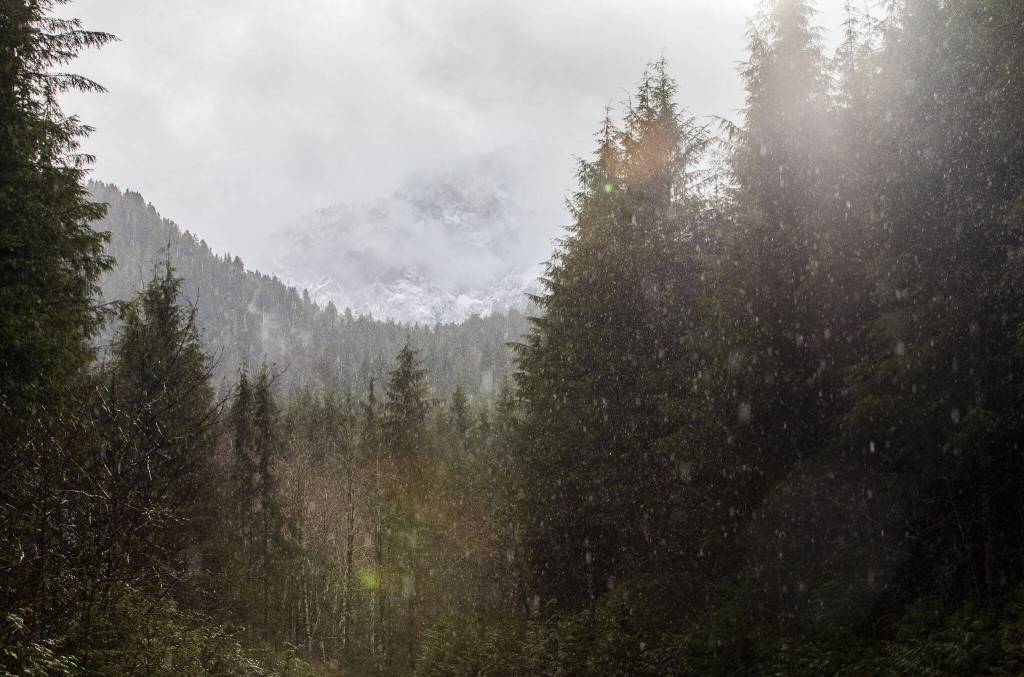
Good news for skiers: The Cascade Range could see 1 to 3 feet of snow over the next few days, according to the weather service. In mid-February, Stevens Pass was around 60% of its normal range of snowpack. The National Weather Service announced a winter storm warning for the Cascades, lasting until 4 a.m. Tuesday. The mountains could see 6 inches to a foot of snow by Tuesday morning.
Stevens Pass’ director of mountain operations, Vince Arthur, said this year’s levels are about 100 inches lighter than a usual season — so an incoming snowstorm is welcome.
“We’re actually doing quite well up here,” he said.
Arthur advised guests to follow state Department of Transportation updates to watch for U.S. 2 closures.
The Northwest Avalanche Center also considered avalanche danger to be “considerable” in the Cascades.
As of Monday evening, the snow level along U.S. 2 was about 500 feet elevation, according to the Northwest Avalanche Center. By Wednesday afternoon, it was expected to rise to 4,000 feet.
As the week wears on, snow was expected to turn into rain at sea level. Then back into snow. Then rainy snow, or snowy rain. Or sleet, hail, graupel — you name it.
From Tuesday to Thursday, Darrington could see over 3 inches of precipitation, mostly in the form of driving rain. Elsewhere, meteorologists predicted 1½ inches of rain in Monroe. Marysville could see up to an inch of rain.
Cook said this kind of random weather is not unusual for this time of year. With the weather getting warmer, stints of sunshine can appear. But overnight and in the early morning, when weather hovers around freezing — there’s a chance of snowfall.
The “active” weather was expected to last until the end of the week, Cook said. A showering of rain mixed with snow was also expected to cover Snohomish County on Friday and Saturday, too, Cook said.
As temperatures hang around the low 30s, Cook said drivers should look out for ice on the roads.
Herald writer Maya Tizon contributed to this report.
Jonathan Tall: 425-339-3486; jonathan.tall@heraldnet.com; Twitter: @snocojon.