Wildfire smoke to ‘get worse from here’ as plume moves north
Published 5:25 pm Thursday, September 10, 2020
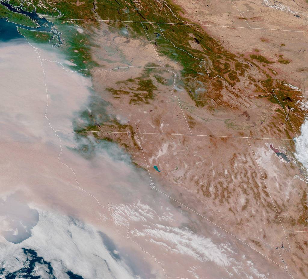


EVERETT — A massive plume of wildfire smoke spanning the entire West Coast reached Snohomish County Thursday night and is expected to linger a while.
The cloud is a combination of smoke from Oregon and California, according to the state Department of Health.
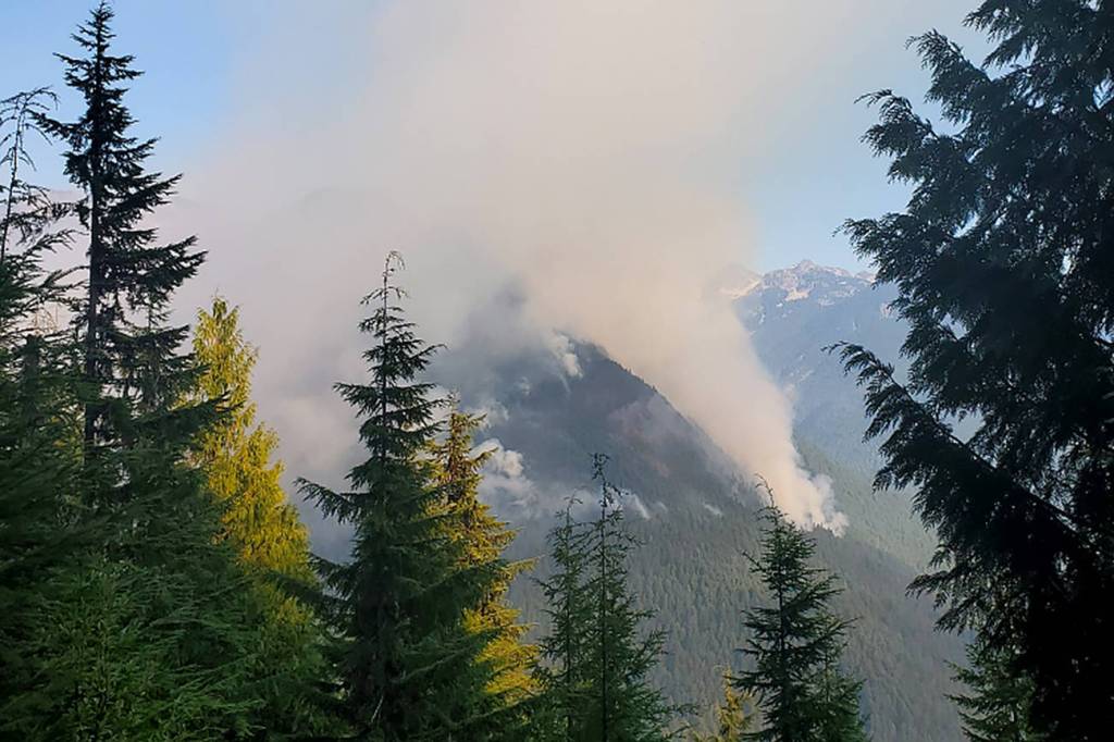
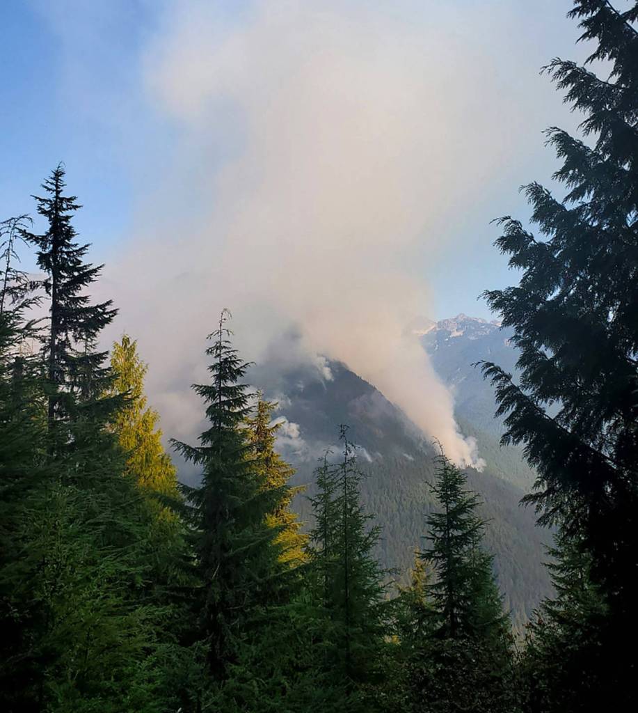
Meanwhile, a smaller fire in Snohomish County spread Wednesday, east of the Downey Creek Trail in the Glacier Peak Wilderness. It had burned about 350 acres by Thursday morning, according to the U.S. Forest Service.
The National Weather Service tweeted satellite images of the fire, with smoke seeming to erupt several times almost like a volcano over the course four hours Thursday afternoon, “to illustrate the potential for explosive fire behavior and rapid increases in smoke output during hot, dry weather.”
An estimated increase in the fire’s size had not been released as of Thursday evening. It was burning just north of Suiattle River Road, a route lined with popular trailheads for hikers and climbers.
By Friday morning, air quality in much of Western Washington was unhealthy for everyone, not just sensitive groups, according to the Puget Sound Clean Air Agency.
The southern cloud joined a haze that already covered Everett Thursday afternoon from the Downey Creek Fire.
“It’s mostly going to get worse from here,” agency forecaster Joel Creswell said.
To illustrate the potential for explosive fire behavior and rapid increases in smoke output during hot, dry weather, here's a visible satellite loop looking at the Downey Creek Fire in the Glacier Peak Wilderness over just the past 4 hours. #wawx pic.twitter.com/epEBAzaoSY
— NWS Seattle (@NWSSeattle) September 11, 2020
Those with underlying heart or lung diseases (including COVID-19), the elderly, those who are pregnant and children are particularly at risk.
If you don’t need to go outside Friday, officials urge you to stay indoors.
If you must go outside, consult the agency’s real-time air quality map at map.pscleanair.gov to check the current conditions in your area and plan accordingly.
Here is forecast model that shows “integrated smoke” or total smoke through a deep layer of the atmosphere. Notice the increase in concentration beginning late tonight and continuing into Saturday. #wawx pic.twitter.com/0XtH9rH2ru
— NWS Seattle (@NWSSeattle) September 10, 2020
The agency also recommends creating a clean-air space. To do so, close all the windows and doors to one room and use an air cleaner. Or make an air cleaner with a box fan and a furnace filter.
Officials also recommend minimizing the use of gas-powered appliances like gas stoves. They contribute to indoor air pollution.
The smoke is expected to stick around through the weekend. Sunday could bring wind from the west, Creswell said. Normally, that would mean fresh ocean air. But with so much smoke pouring out of Oregon and to the Pacific Ocean, it could mean a fresh batch of haze.
An Air Quality Advisory is in effect until noon Monday.
Wildfires have burned over 900 square miles in Washington this week.
In Snohomish County, the Downey Creek Fire has closed campgrounds and trails in the Glacier Peak Wilderness, off of the Mountain Loop Highway. It’s burning between the Downey Creek Trail and the Sulphur Creek Campground along the Suiattle River, a few miles from the Skagit County border.
The fire was discovered Aug. 16 and likely was caused by a lightning strike. The Forest Service has monitored the hotspot, but firefighters have not tried to extinguish it because of rough and steep terrain.
On Wednesday, it spread from about 12 acres to 350 acres within hours. A number of trails and other sites near the Mountain Loop Highway have been closed.
Crews still had not started to extinguish the fire by Thursday afternoon because the main priority was to get hikers out of the area, Forest Service spokesperson Jim Chu said.
Workers have been visiting trailheads to collect license plate information from cars, to get in touch with the owners.
So far the Forest Service is the only agency working in the area and has designated an incident commander and placed a fire engine on scene. On Thursday, a column of smoke was visible from Darrington.
Firefighters have been busy with other fires in the region that have posed a greater risk to people.
“I think we are a pretty low priority,” Chu said. “The risk to property and homes is not that great because of where it is in the landscape.”
Sites that have been closed include: Sulphur Creek Campground; Suiattle River Road FS Road 26 at Buck Creek Campground; Green Mountain Road FS Road 2680; Green Mountain Trail No. 782; Downey Creek Trail No. 768; Sulphur Creek Trail No. 793; Sulphur Mountain Trail No. 794; and Suiattle River Trail No. 784, from the Sulphur Creek Trailhead to the Pacific Crest Trail junction.
Reporter Caleb Hutton contributed to this story.
Julia-Grace Sanders: 425-339-3439; jgsanders@heraldnet.com; Twitter: @sanders_julia.
Stephanie Davey: 425-339-3192; sdavey@heraldnet.com; Twitter: @stephrdavey.
Keep an eye on air quality
Check forecasts at wasmoke.blogspot.com. For more information on how to protect yourself from wildfire smoke, visit doh.wa.gov/smokefromfires.