Snohomish County preps for floods
Published 7:36 am Monday, November 5, 2007
Flood season has arrived in Snohomish County, but the people who plan for disasters are still thinking about last year.
When the Snohomish, Skykomish and Stillaguamish rivers jumped their banks on Election Day in November 2006, the floodwaters exposed flaws in how the county prepared for and responded to disasters, said John Pennington, director of the Snohomish County Department of Emergency Management.
With the anniversary of the Election Day floods approaching, Pennington believes the county is more ready than ever to deal with rising waters.
“From an operational standpoint, we have essentially fine-tuned the response capabilities of our department to make sure we’re better at what we do,” he said.
This past week, about 50 people in charge of coordinating aid during floods underwent a day of training to better understand their roles, Pennington said.
On Saturday, the training continued for more than 20 emergency planners when they piled into a bus and toured flood-prone areas along the Snohomish and Skykomish rivers. The tour included representatives from the American Red Cross, the U.S. Army Corps of Engineers and the county Department of Emergency Management.
“The people who are working in emergency operations centers both for Red Cross and the county need to know what’s going on out in the field when they’re making decisions,” said Mike McCallister, a Red Cross employee who used to work as a planner for the Department of Emergency Management.
Snohomish County’s flood season usually runs from mid-November through mid-February.
Floods usually roll through local valleys every three to 10 years. Most of the flooding happens when storms, often accompanied by warmer temperatures, bring heavy rain to the mountains. Snowmelt can add to the severity of floods.
More than 510 people in Snohomish County applied for aid with the Federal Emergency Management Agency in the wake of the Election Day floods. Residents reported $8.8 million on flood damage to homes and personal property. In all, the county incurred $28.9 million in flood damage for people, businesses, and government buildings and roads.
Some flooding is expected in Snohomish County this flood season, but there are no indications of any severe floods on the way, Pennington said. The county’s river levels are as they should be, and the coming La Nina winter is expected to be cool and wet.
“Right now, things look very good, and we’ve had that experience so we know what to look for now,” Pennington said. “But all of that can change in about a week with a period of rain that just stays here.”
In addition to more training, the county has invested in technology to be more prepared.
Emergency planners can now download real-time images of flooding from heat-sensing cameras mounted on police airplanes and helicopters. The cameras produce clear images even at night, Pennington said.
During the Election Day floods, people near Highway 9 and the Snohomish River were asked to evacuate their homes because of false reports that water had breached a levee. That may not have happened if emergency planners could have seen pictures of the area, Pennington said.
The Department of Emergency Management used federal grants to install more than $1 million of new communications equipment at its Paine Field headquarters. The department also moved its emergency operations center into a room that can fit more people.
Places to drop off sand bags have also been established in cities throughout the county, Pennington said.
“We’ve really prepared internally to address the needs a lot better,” he said. “We got better by simple default.”
Preparing for floods also requires an understanding of global warming, Pennington and McCallister said.
The Election Day floods hit with amazing speed, mostly because there was no snow in the foothills to slow down a deluge of rain that fell in the Cascades, Pennington said.
If warming trends continue, the lack of mountain snow could lead to more of what Pennington calls “rural flash floods” in towns such as Index and Sultan.
Warmer sea temperatures also cause stronger, fiercer rainstorms to move in from the Pacific Ocean. It’s those kinds of storms that overwhelm rivers and create flooding, McCallister said.
“The time to prepare is getting narrower and narrower,” Pennington said. “We had essentially all of a day (before the Election Day floods) to realize and understand what was about to hit. A lot of people didn’t realize how serious it was until after it was over.”
Reporter Scott Pesznecker: 425-339-3436 or spesznecker@heraldnet.com.
Tips to protect your home from flooding
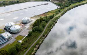
Snohomish County has flood-prone areas along all of its rivers and streams. The largest floodplains are in the Snohomish, Snoqualmie, Skykomish, Stillaguamish and Sauk river basins. Floods sweep across those areas every three to 10 years. The high water often arrives in late fall, spurred by heavy rains and warming weather that melts mountain snow.
People who live in floodplains should take the following steps:
n Find out if you live in a flood-prone area. Call the Snohomish County Department of Planning and Development Services at 425-388-3311.
n Have an evacuation plan. Be sure to turn off gas, electricity and water lines if forced to leave your home. Also, plan ahead to stay somewhere else until the floodwaters recede. To check emergency road closures during floods, go to the Snohomish County Web site at www1.co.snohomish.wa.us and search for “road closures.”
n Do not attempt to drive through flooded areas. Even a four-wheel-drive truck can go out of control in just 8 inches of water.
n Watch out for flood watches and flood warnings. Routinely check the National Weather Service Web site at www.weather.gov/seattle or call the weather service at 206-526-6087.
n Keep emergency gear on hand, including a portable radio, cooking equipment, flashlights and batteries, drinking water, nonperishable foods, medicines, and a first-aid kit.
n Buy sand and sandbags and know how to use them. Pile sandbags in doorways and close storm shutters.
n Store belongings on shelves. Move livestock and vehicles to high ground.
n Make sure underground storage tanks are sealed. Install flood shields on doors and openings to keep the water out.
n Install a sump pump with backup power in crawl spaces or basements, and put backflow-prevention devices in sewer connections.
n Have flood insurance and photograph and document property and belongings.
n For more information on flooding, call the Snohomish County Department of Emergency Management at 425-388-5060.
n Call 911 if faced with an emergency.
Source: Snohomish County Public Works and Department of Emergency Management
Recent floods in Snohomish County
November 2006: Heavy rain in the mountains and lowlands caused flooding on Election Day along the Snohomish, Stillaguamish and Skykomish rivers. Snohomish County residents reported to the county $8.8 million in flood damage to homes and personal property. In total, the flooding racked up between $16 million to $19 million in costs, including damage to roads and levees and the salaries for people needed for rescues and to manage the disaster.
October to November 2003: Heavy rains sent the Snohomish, Stillaguamish and Sauk rivers over their banks, causing an estimated $18 million in damage. Forest roads and hiking trails were especially hard hit.
February 1996: Roads, dikes and levees from Snohomish to Marysville sustained $1.2 million in damage. One man drowned when he drove his pickup truck into floodwaters on Ebey Island.
November 1995: A large accumulation of early mountain snow melted rapidly when storms moved in from tropical areas, bringing heavy, warm rains. A hunter drowned when trapped by high water near Monroe. Floodwaters destroyed part of the Lowell-Larimer Road outside Snohomish, requiring nearly $9 million in repairs.
November 1990: A combination of heavy rains and rapidly melting mountain snow brought rising water that caused more than $3.6 million in damage. The Snohomish River reached its highest levels in more than 90 years.
December 1975: More than 3,000 homes were damaged and 3,500 head of cattle and other livestock were killed when a pumping station collapsed at French Slough. Most of the Snohomish River valley was underwater for weeks. Damage was estimated at more than $42 million.
Source: Snohomish County Natural Hazards Mitigation Plan
2006 Election Day flood by the numbers
Nearly 1 foot: Rain that fell on the North Cascades during the four days prior to the flooding
10 billion gallons: Amount of runoff into Spada Lake from the rain
34.9 feet: Crest of the Snohomish River during the flood
550: Homes damaged
27: Homes destroyed
$8.8 million: Damage to homes and properties
$16 million to $19 million: Total costs in damage and pay to emergency workers