Bipartisan commission fails to draw new political boundaries
Published 10:38 am Tuesday, November 16, 2021


OLYMPIA — Washington entered uncharted political waters Tuesday when the state Redistricting Commission failed to approve new legislative and congressional district maps, punting the chore to the state Supreme Court.
In a statement, commissioners said that “after substantial work marked by mutual respect and dedication to the important task,” they were unable to complete the once-a-decade redrawing of boundaries ahead of a legal deadline — even though they apparently cast votes on purported maps at the conclusion of a marathon virtual meeting Monday night.
An explanatory news conference was cancelled Tuesday morning, and commission members could not be reached for comment.
“The late release of the 2020 census data combined with technical challenges hampered the commission’s work considerably,” the statement read. “The Supreme Court now has jurisdiction to adopt a districting plan. The commissioners have every faith that the Supreme Court will draw maps that are fair and worthy of the people of Washington.”
This will be the first time in state history the Supreme Court draws the political maps which will be in force for elections from 2022 through 2031. Under state law, the nine justices have until April 30 to do the job.
“If the deadline was missed, the Supreme Court will create a plan and process for the justices’ consideration,” according to a statement issued by the high court’s communications office. “We will keep you updated as details emerge.”
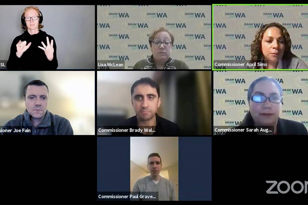
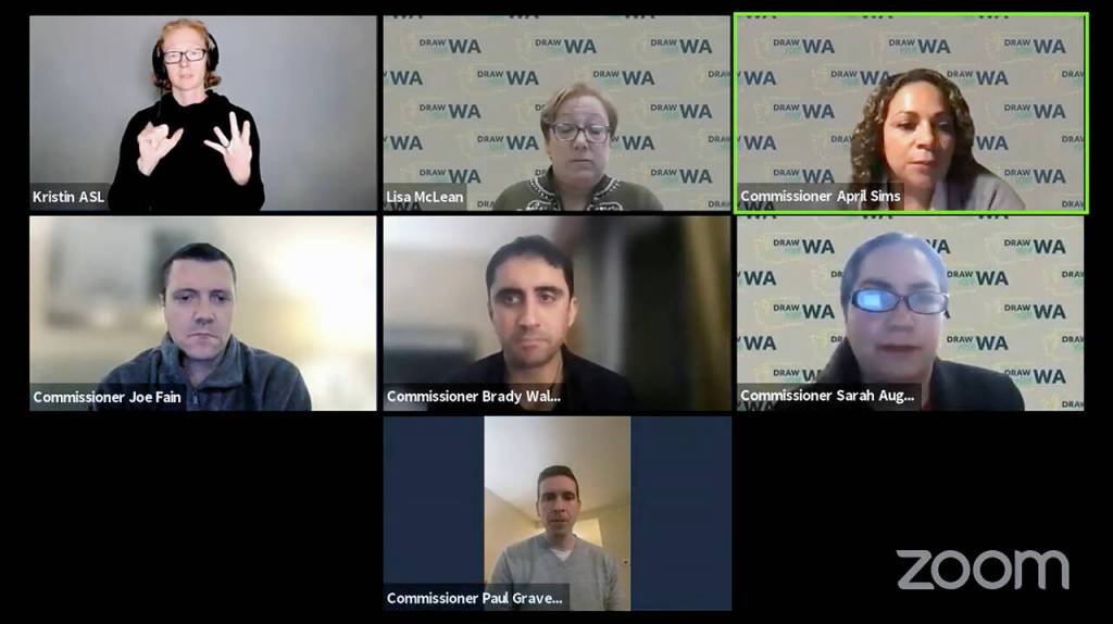
As the clock reached the deadline of 11:59 p.m. Monday, it appeared that final maps of the state’s 49 legislative and 10 congressional districts were unanimously adopted by the four voting members — Democrats April Sims and Brady Walkinshaw Pinero, and Republicans Joe Fain and Paul Graves.
Their votes came at the end of a five-hour virtual meeting during which commissioners negotiated privately off-camera, in groups of two. There was no discussion or deliberation in public before they cast a series of votes to seemingly carry out their duties.
“Great job everybody. Congratulations,” chair Sarah Augustine, the panel’s non-voting member, said after the vote. She then adjourned the meeting.
Augustine said during the meeting that the actual maps they approved still needed to be drawn and that they should be done by “sunrise.” None were posted online Tuesday morning, though one appeared briefly on the web before being taken down.
An hour after the Tuesday news conference was cancelled, they admitted failure.
“Now it will be up to the state Supreme Court to finish the job,” Senate Majority Leader Andy Billig, D-Spokane, said in a statement in which he also applauded the quartet for their yearlong effort.
Others with an interest in the proceedings are counting on the nine justices for a clearer process and outcome.
“On balance we hope this ends up being a better opportunity for communities of color to advocate for fair and equitable maps that provide all communities a fair shot to elect candidates of their choosing,” said Colin Cole, of Lynnwood, policy director for More Equitable Democracy, a national nonprofit that works to advance racial equity through electoral reform. “I just hope we are not waiting until 11:59 on April 30 to find out what the new maps look like.”
More Equitable Democracy is part of the Redistricting Justice for Washington Coalition, which is prepared to sue to ensure that the new maps comply with the federal Voting Rights Act. In a news release, the coalition said it is pushing for a legislative district in the Yakima area that is majority Latino by citizen voting age population.
“We are disappointed with the lack of transparency in the last stages of the commission’s process. We hope the state Supreme Court will actively engage in community outreach and proceed with more transparency than the commission,” said Andrew Hong, a coalition leader.
Meanwhile, the redistricting commission’s inaction complicates the landscape for candidates and auditors ahead of next year’s primary and general elections.
Absent settled legislative or congressional boundaries, candidates and incumbents cannot be sure what districts they’ll be running in. The filing period begins May 16.
And election officials need the new maps to determine the borders of precincts. Some will be the same, but many could shift or might need to be redrawn. The information must be uploaded into election management systems to make sure voters get ballots with the correct races for where they live. Ballots in Snohomish County will be mailed to overseas and military voters in mid-June.
“If the Supreme Court takes all the way to April 30, it will make things extremely difficult,” said Snohomish County Auditor Garth Fell.
Every 10 years, after the U.S. Census, boundaries of legislative and congressional districts get redrawn to account for changing population. After the 2020 count, Washington’s allocation of U.S. House seats did not change. Today the state has seven Democratic U.S. House members and three Republicans.
Under state law, updated boundaries must create districts that are nearly equal in population, are as compact as possible, are geographically contiguous areas and do not not favor or disfavor any racial group or political party. The new districts should also coincide with existing natural boundaries and preserve communities of related and mutual interest.
Achieving those goals while equalizing population in each district wasn’t easy because much of the population growth the past decade occurred on the west side of the state. That meant shifting lines in a way that pushed blocs of population eastward without sacrificing other goals.
This commission faced challenges its predecessors didn’t.
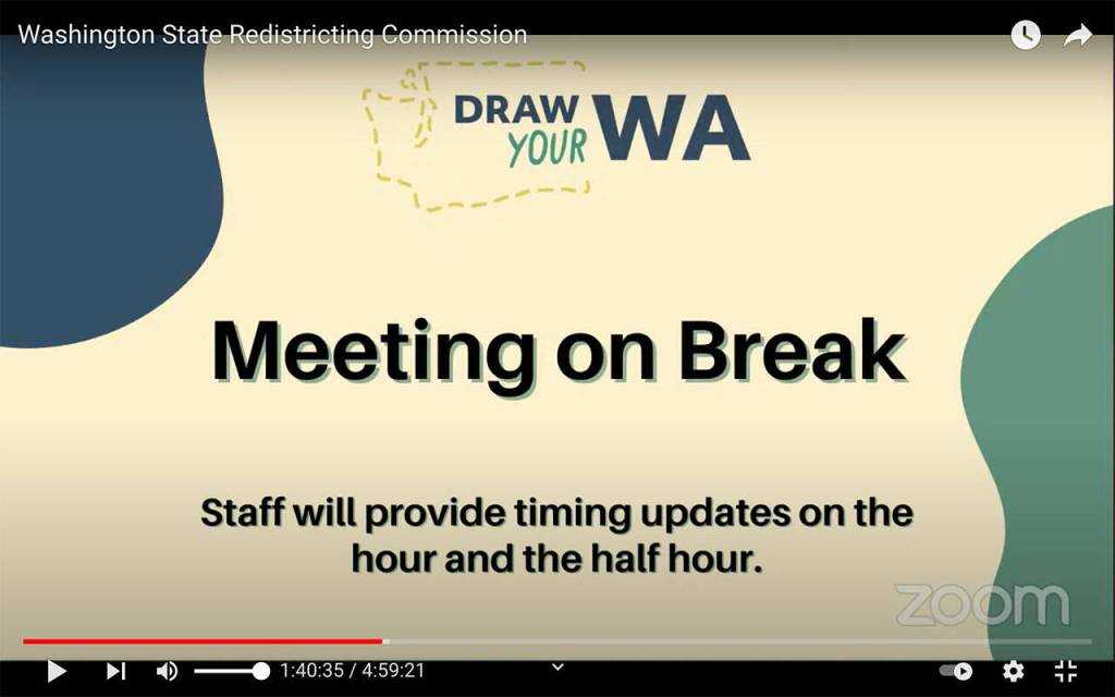
A 2016 law moved the deadline up from Dec. 31 to Nov. 15. Census data arrived in mid-August, rather than April 1, and the maps are based on that data. And the ongoing COVID-19 pandemic forced the crux of the process — commission meetings, public hearings and negotiations — to be conducted virtually.
In September, each commissioner produced their own legislative and congressional maps. Since then, commissioners have been trying to settle differences in their political cartography outside of public view. They continued to negotiate in that manner Monday evening, to the chagrin of open government advocates.
“That’s not the way it’s supposed to work,” said Juli Bunting, executive director of the Washington Coalition for Open Government. “Our beef is the fact they shut the public out.”
Commissioners couldn’t do it in three months. The Supreme Court will get five months to get it done.
Washington, like many states, used to leave the political map making in the hands of the majority party in the Legislature, which created a path for gerrymandering to bolster their political strength.
But voters in 1983 passed a constitutional amendment establishing a redistricting commission comprised of two members of each major party. The first time that the Redistricting Commission was formed and redrew district boundaries was in 1991.
It has not kept politics out of the process. But by requiring at least three commissioners to approve maps, the method prevented the kind of brazen partisan map-drawing seen in states with one-party control.
“This is a political exercise,” the late GOP Sen. Slade Gorton said in 2011, when he served on the commission. “The whole genius of it is that it is a partisan exercise but one where each party has the exact same strength and influence. It was set up with an even number so neither side could gerrymander it.”
This year, Republicans will have sole control over drawing congressional maps in 18 states and legislative maps in 20 states, according to a report by the Brennan Center for Justice. Democrats will have sole control of congressional maps in seven states and legislative maps in nine states.
Material from The Associated Press was included in this report.
Jerry Cornfield: jcornfield@heraldnet.com; 360-352-8623; Twitter: @dospueblos.