Forest Service green-lights new seismometers at remote Glacier Peak
Published 1:30 am Wednesday, July 6, 2022


DARRINGTON — New seismometers officially have the go-ahead at Glacier Peak, classified as one of the most dangerous volcanoes in the United States.
There’s just a single monitor there now, meaning we’re ill-prepared to detect impending catastrophe, according to federal agencies. More early warning sensors could provide precious time to evacuate.
The U.S. Forest Service issued a final decision last month, determining the project would have no significant impact on the environment. The proposal got two objections, from the North Cascades Conservation Council and Missoula-based Wilderness Watch, opposing the use of helicopters in a wilderness area. The Forest Service determined a “full range of alternatives” was considered, and the impacts weighed, in making the decision to move forward.
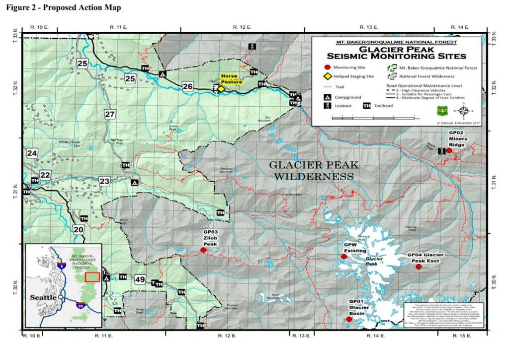
Crews with the U.S. Geological Survey can now start installing four new monitors at the remote volcano, and upgrade the old one, as part of a 30-year special use permit.
Government officials estimate the GPS stations could detect and locate eight times as many earthquakes. The equipment will be able to detect tremors, gas emissions and geologic changes on the volcano’s surface.
Technically, the seismometers could be installed as soon as this summer. But the work might not happen until at least next year, according to USGS.
According to a Geological Survey assessment published in 2018, Glacier Peak is the 15th potentially deadliest volcano in the nation, out of 161, based on proximity to communities, previous eruptions and air traffic, among other factors. It was graded as a “very high” threat, along with Mount Rainier, Mount Baker and Mount St. Helens. Mount Adams is considered a “high” threat.
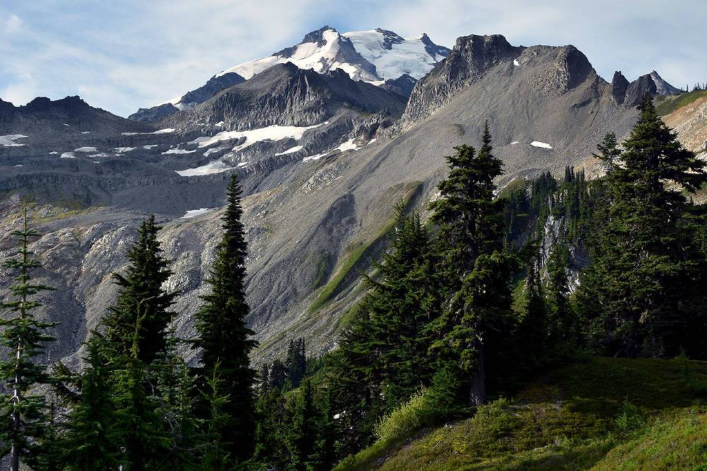
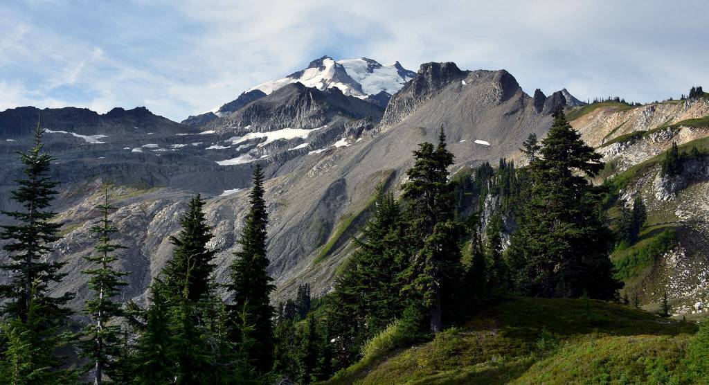
At 10,541 feet, Glacier Peak is one of the region’s most active volcanoes, according to the Geological Survey. About 13,000 years ago, in one of the largest eruptions in the Cascades since the last Ice Age, the volcano blew off five times as much rock as the 1980 explosion of Mount St. Helens.
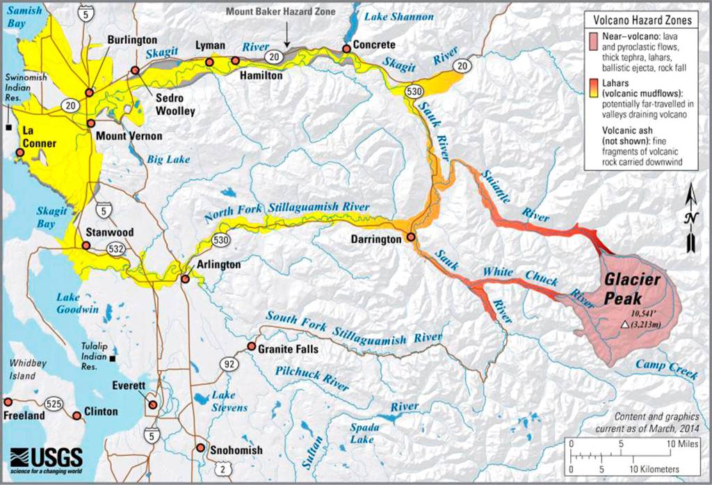
Scientists have found evidence of volcanic mudflows, called lahars, along the North Fork Stillaguamish and Skagit rivers, stretching to Puget Sound. Another eruption could wipe out present-day communities like Darrington, a town of about 1,000 people.
According to the Forest Service, 11,000 people visit the Glacier Peak Wilderness each year. An average of 930 visitors climb the volcano.
The new stations will consist of a seismometer, 10 batteries, a fiberglass enclosure, solar panels and antennae for GPS and data transfer, according to a report from the Forest Service. The equipment for each site totals 1,900 pounds. Each battery weighs about 70 pounds.
Each monitor would take about three days and five helicopter trips to install. A helicopter may be needed again every three or five years to replace the batteries.
Crews will not be transported by helicopter. They’ll backpack in to install and maintain the monitors, cutting down on flight time through the wilderness area.
Zachariah Bryan: 425-339-3431; zbryan@heraldnet.com; Twitter: @zachariahtb.