Study that could pave parts of Mountain Loop nearly finished
Published 1:30 am Wednesday, March 13, 2019


GRANITE FALLS — For most, it has never really been a loop.
More like two meandering routes through lush wilderness with self-imposed dead ends.
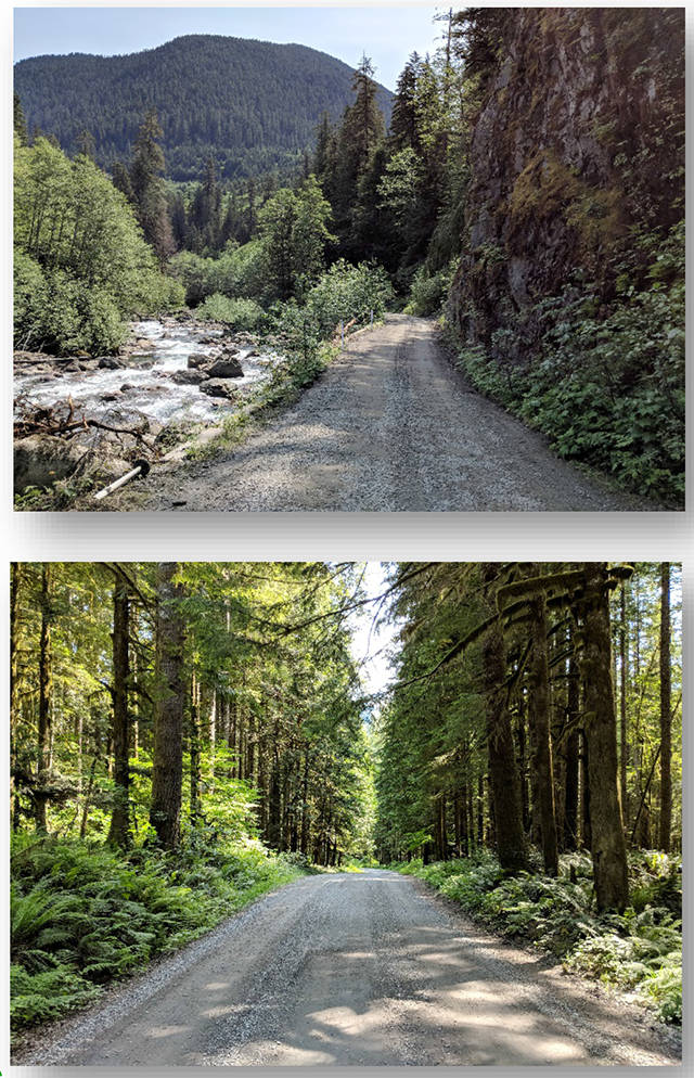
Few dare drive beyond the paved roadway, where curiosity gives way to common sense. That’s when a 14-mile gravelly stretch begins. It becomes narrow and marked with potholes that can be deep and plentiful.
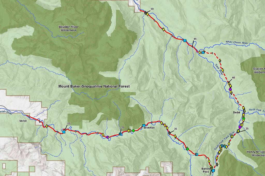
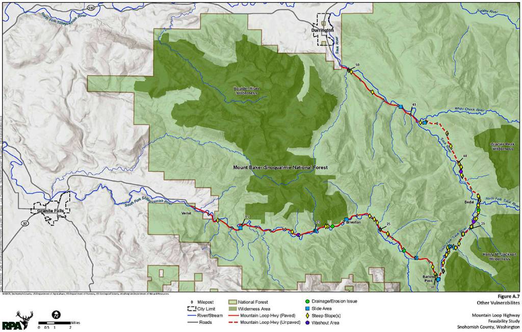
An ongoing Federal Highway Administration study shows that someday, the Mountain Loop Highway — a byway separating Granite Falls and Darrington — could be paved.
It would open up a corridor of forest, rivers and mountain views to those who don’t want to risk their axles and undercarriages. Others worry that the work could harm fragile ecosystems in the wilderness.
Talks about paving that primitive stretch of the Mountain Loop have been ongoing for more than 30 years. The highway administration recently unveiled three options for public comment, including a pricey proposal to pave on through.
More than 40 miles of the highway are under review, but extra attention has been paid to the unpaved portion, between Barlow Pass and White Chuck River.
Once the report is finished, it’s up to Snohomish County and the U.S. Forest Service to make a decision. Construction would still be years away.
Last week, about 30 people gathered in a bright room with linoleum floors at Granite Falls Middle School. Guests walked inside from the snowfall to see several posters printed with facts about the Mountain Loop project, propped up on easels.
The findings were presented by Jeff Key, a project manager who works for the civil engineering firm Robert Peccia & Associates. Researchers looked at traffic, population growth and safety.
For now, there’s no speed limit posted on the unpaved portion, but people usually drive under 20 mph, Key said.
“When you get to the gravel section, all bets are off,” he told the crowd. “One gentleman had a comment about taking his motor home down there, and he’ll think twice about doing that again.”
Each option is more expensive than the last and requires more work.
In the first, the road would still be made of gravel or compacted rock. It would come to a peak in the center so water could roll off.
This option would require the most maintenance, said Michael Traffalis, a project manager who works for the highway administration.
“When you drive on gravel, you see wheel ruts,” he said. “And when it rains, the road gets potholes and there’s gravel sitting in the roadway. So that’s the existing condition.”
The second proposal includes a number of variables. It could either be pavement or gravel, and up to 32 feet wide. The speed limit could be set for 25 mph if parts of the road were altered.
“There are a few curves we would recommend changes to so it’s not such a sharp curve, or to improve sight distance,” Traffalis said.
The last choice is basically the same project that was proposed decades ago. It would make the gravel part consistent with the rest of the highway.
Kathy Johnson opposed this idea when it was presented in the 1990s, she said.
She’s lived in the area and has been a member of the Pilchuck Audubon Society for more than 30 years. The group’s mission is to protect local wildlife.
She felt better about these ideas than previous ones, and hopes to learn more.
“It’s not as aggressive as I was afraid it was going to be,” she said. “They haven’t talked about either side of the road, and sometimes they cut large swaths of trees, which I would be against.”
The study began more than a year ago and is expected to wrap up in May. Estimating the costs is one of the last parts of the project. After that’s finished, the study would be presented during a final round of public meetings.
Stephanie Davey: 425-339-3192; sdavey@heraldnet.com; Twitter: @stephrdavey.