Living a dream: Lake Stevens senior to broadcast pro baseball
Published 1:30 am Friday, May 3, 2019


This certainly isn’t your typical summer job for an 18-year-old.
Just three days after graduating from Lake Stevens High School next month, Payne Patchett is slated to make his professional debut behind the mic as a minor league baseball play-by-play radio broadcaster.
The Salem-Keizer Volcanoes, the short-season Class A Northwest League affiliate of the San Francisco Giants, announced earlier this week that Patchett will be their radio voice for the 2019 season.
Patchett will call all of the Volcanoes’ games this summer — home and away — on the Keizer, Oregon-based KYKN 1430 AM radio station.
“He’s a talent far beyond his years — that’s for sure,” Salem-Keizer co-owner and general manager Jerry Walker said.
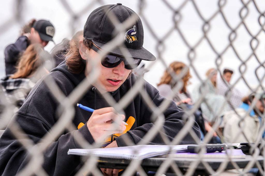
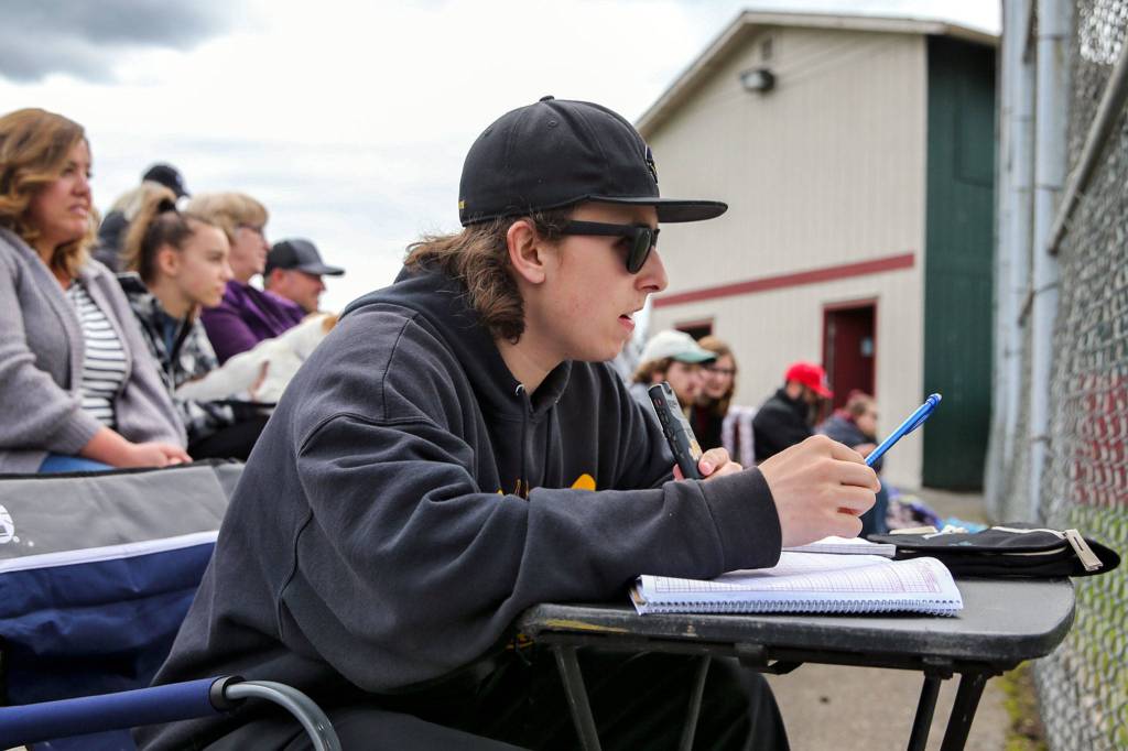
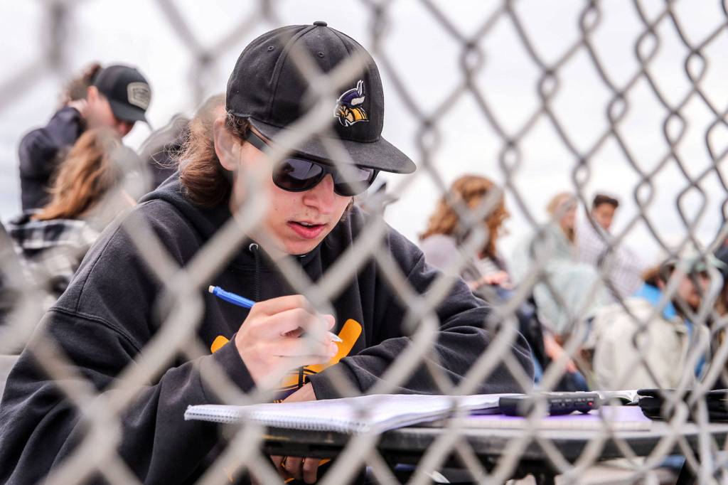
Patchett, a Lake Stevens senior who was featured in The Herald last month for his broadcasting talent, was a constant presence at Vikings varsity baseball games over the past eight seasons. He kept score and recorded play-by-play audio for nearly 200 contests, and along the way developed into a polished broadcaster whose skill far exceeds his age.
“This was basically what I’ve been practicing for ever since middle school,” said Patchett, whose ultimate goal is to become a Major League Baseball broadcaster. “This is what I’ve been wanting to do.
“I didn’t really expect this to come this early, but I’m happy that it is,” he added. “I am pretty fortunate that the team is giving me the opportunity this early.”
https://soundcloud.com/user-838483760/17-lake-stevens-senior-and-future-minor-league-broadcast-payne-patchett
Walker said it’s very possible Patchett is the youngest broadcaster in professional baseball.
“If there’s a younger one out there, I’m not aware of it,” Walker said.
And no matter what age, Walker said landing a job in the highly competitive baseball broadcasting industry is immensely challenging.
“The broadcasting industry in minor league baseball is very, very difficult to break into,” he said. “There’s literally hundreds of applicants, and that’s not an exaggeration. (At the MLB) winter meetings, there’s like several hundred kids — college graduates, young people — looking for employment in minor league baseball as a broadcaster, and the jobs are few and far between.
“Payne landed a job while he was still in high school, but that is such a rare exception.”
Patchett sent emails in March to all eight teams in the Northwest League — which includes the Everett AquaSox — inquiring about any broadcasting-related opportunities within their organizations. Walker said he received numerous other emails similar to Patchett’s, despite not even having a job posted.
“I’d say over the last six months, I probably received 50 applicants,” Walker said. “And I didn’t have anything posted. Had I posted a job opening, I would’ve had hundreds, literally, without exaggeration. There’s so many people in this industry that are looking for jobs.”
Walker said he was struck by Patchett’s announcing style after listening to several Lake Stevens baseball broadcast recordings he submitted.
“I liked the way he called the action,” Walker said. “I liked the way that he melded together a play-by-play and color commentary (at) the same time. He just had a good flow about him.”
Walker also said he liked the way Patchett balances enthusiasm and authenticity behind the mic.
“Most all the announcers have a style about them when there’s a home run or a terrific play, and sometimes it almost seems overdone,” Walker said. “With Payne, it just seemed really real. … He has a good way of bringing the fans into the game, painting a picture of what’s going on and expressing it in a way that doesn’t appear to be overdone, but certainly gets the message across (of) what just happened on the field.”
Walker, an Everett High School graduate, said Patchett’s relative proximity to the Salem-Keizer area also played a factor.
“We like to bring people in (from) somewhere close,” Walker said. “It makes a lot more sense than bringing people in from back east, (because) the orientation factor just takes so long.”
In addition, Walker said he was more than happy to provide an opportunity for a talented up-and-coming broadcaster like Patchett.
Walker did something similar in the mid-1990s when he gave current AquaSox play-by-play voice Pat Dillon his first job in baseball radio, back when the Salem-Keizer franchise was in Bellingham. Dillon, the longest-tenured broadcaster in the Northwest League, is entering his 23rd season as the AquaSox play-by-play announcer.
“The fact that I could give a kid a chance always means a lot,” Walker said. “… I was willing to overlook a lack of (professional) experience — as far as doing something at a higher level than high school — because I wanted to give (Patchett) a chance and I liked his style.”
Upon finding out he’d received the job, Patchett said he tried to remain calm and keep his excitement in check. His mother, however, was a different story.
“I was trying to be cool and calm with it,” Patchett said. “I tried not to think over my head. My mom, on the other hand, was freaking out.”
Patchett, who is scheduled to graduate June 11 from Lake Stevens, said he’s currently focused on preparing to move to the Salem-Keizer area for the summer. Similar to a high school graduate going off to college, it will be his first time living away from home.
“(It’s) basically like summer camp for the next three months,” said Patchett, who plans to attend Everett Community College this fall and get involved with the school’s newspaper.
The Volcanoes open their season June 14 in Keizer. The following night, Walker said Patchett will have an opportunity to interview former six-time MLB All-Star pitcher Vida Blue, who is scheduled to make a guest appearance. Blue played six seasons for San Francisco — the Volcanoes’ major league affiliate — in the 1970s and 1980s.
“(Payne) is a month away from talking to former big-league ballplayers, because we get a lot of coaches and (people) like that in (as guests),” Walker said. “We’ve just gotta make sure he’s well-grounded and doesn’t get overwhelmed by the magnitude of the opportunity. But I’m sure he’ll be fine. And I’m there every day, so I’ll be there to help counsel him through those moments.”
Just one week after the Volcanoes’ season opener, Patchett will have a Snohomish County homecoming.
Salem-Keizer’s first road trip of the season is a four-game series against the AquaSox on June 21-24 at Funko Field at Everett Memorial Stadium. It’s the Volcanoes’ lone scheduled trip to Everett this summer.
“It’s cool (that) it’s the first road series,” Patchett said. “I do feel like it’s going to help me a lot to get situated with the team, because I’m going back home basically.”
Walker said he anticipates there will be lots of interest in Patchett because of his age.
“People are going to take notice and say, ‘Wow, the kid’s right out of high school and he’s doing professional baseball,’” Walker said.
“We’re happy to have him,” he added, “and we’re looking forward to working with him.”