Mukilteo’s new road offers slower parallel to Speedway
Published 1:30 am Monday, August 16, 2021
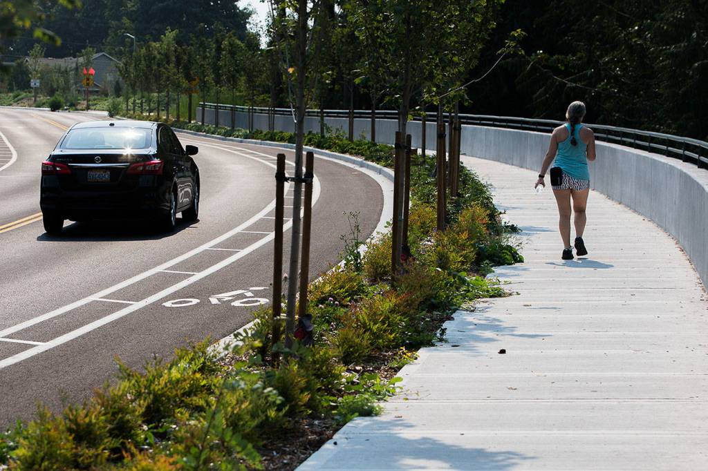
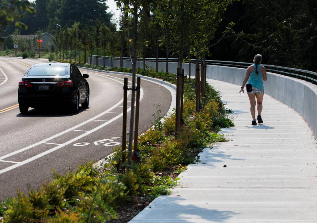


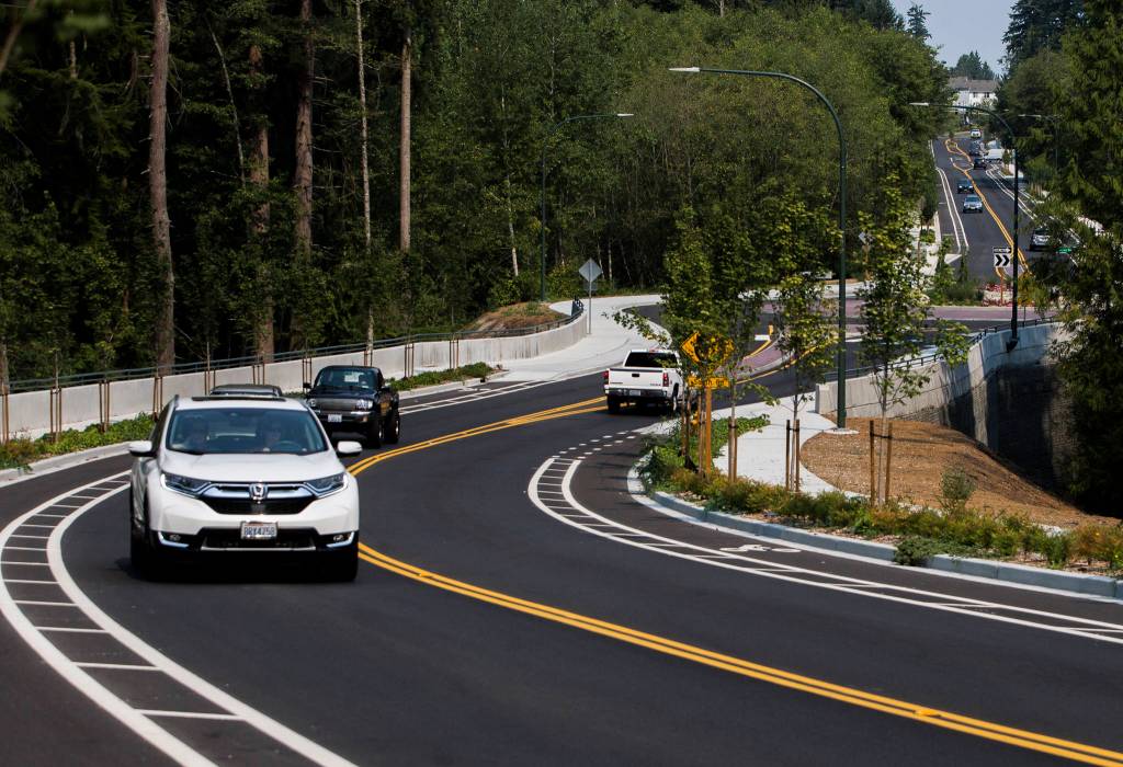


People on bikes, foot or motor vehicle can skirt the hustle of Mukilteo Speedway with a new road that parallels the highway.
Harbour Reach Drive provides what city leaders call a much-needed 0.7-mile connection between Beverly Park Road and Harbour Point Boulevard SW.
Mukilteo spent over 15 years working toward the $18 million Harbour Reach Corridor Project. Previously, there was a short dead end road and then a lot of undeveloped forested property.
“If the speedway is blocked for any reason, this is a good alternative route,” Mukilteo Mayor Jennifer Gregerson said.
Highway 525, also called the Mukilteo Speedway through the city, connects I-5 and I-405 with Whidbey Island via the Clinton-Mukilteo ferry route. An average of 30,000 vehicles use the section parallel to Harbour Reach Drive each day, according to Washington State Department of Transportation data.
That stretch used to only have one other north-and-south link via Picnic Point Road/Maplewood Avenue. In 2017 when a small airplane crash landed on the highway near Harbour Pointe Boulevard, it pushed all of the traffic to that route and caused hours-long delays for travelers, Gregerson said.
The city started acquiring property for the road in 2005 and construction started in fall 2019. As of June 26, Harbour Reach Drive opened as a tree-lined two-lane road with bike lanes and sidewalks in both directions. City staff estimate 11,000 vehicles will use the twin 11-foot travel lanes daily.
“It is a shorter alternative to almost anybody in Harbour Pointe or Beverly,” Gregerson said. “They’ve got a quicker route, so a touch less emissions.”
But the new 35 mph road isn’t expected to spur development along the corridor, Gregerson said. There’s a vacant lot just south of South Road that could be developed but she had not heard of any interest in it.
Those who bike, scoot or skate through have five-feet-wide bike lanes with painted lines two feet wide separating them from drivers. The sidewalks are mostly six-feet and 10 feet at the roundabout at South Road. Like much of Mukilteo, it’s a bit of a hill. Gregerson, who is a regular bike rider, said the new route is an attractive alternate to the fast and noisy traffic along Highway 525 for people biking, rolling and walking.
“I’ve seen kids bike up it on bikes without gears. But it is a little steep,” said Gregerson, who has ridden the road on her electric bike. “If you’re a Mukilteo bicyclist, you’ve probably hit some of our hills.”
Initially the city envisioned roundabout intersections at Beverly Park Road and Harbour Pointe Boulevard SW, but costs pushed the city to scrap those plans in favor of traditional signals. A roundabout was installed at South Road.
Over $15 million in funding came from the Connecting Washington package in 2015, $2 million from the state Transportation Improvement Board, and about $950,000 from the city.
It crosses Picnic Creek, which is a salmon-bearing stream. To help reduce the pollution, a stormwater vault almost as long as a football field runs under the roadway, where the runoff can be treated before joining the watershed and flowing toward Puget Sound.
Two fish and wildlife crossings are under the road near the base of the ravine as well.
“You could have a party in it, it’s so big,” Gregerson said. “A basketball player could stand in it.”
Have a question? Call 425-339-3037 or email streetsmarts@heraldnet.com. Please include your first and last name and city of residence.