At Monte Cristo ghost town, a big fight over a short road
Published 1:30 am Sunday, June 27, 2021


MONTE CRISTO — One side wants to preserve history.
The other, nature.
Historic preservationists and environmentalists are locking horns over a mile or so of temporary access road leading to a ghost town well east of Granite Falls.
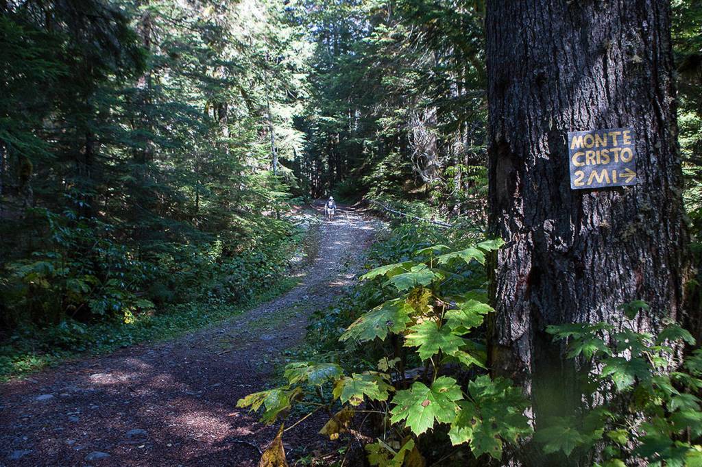
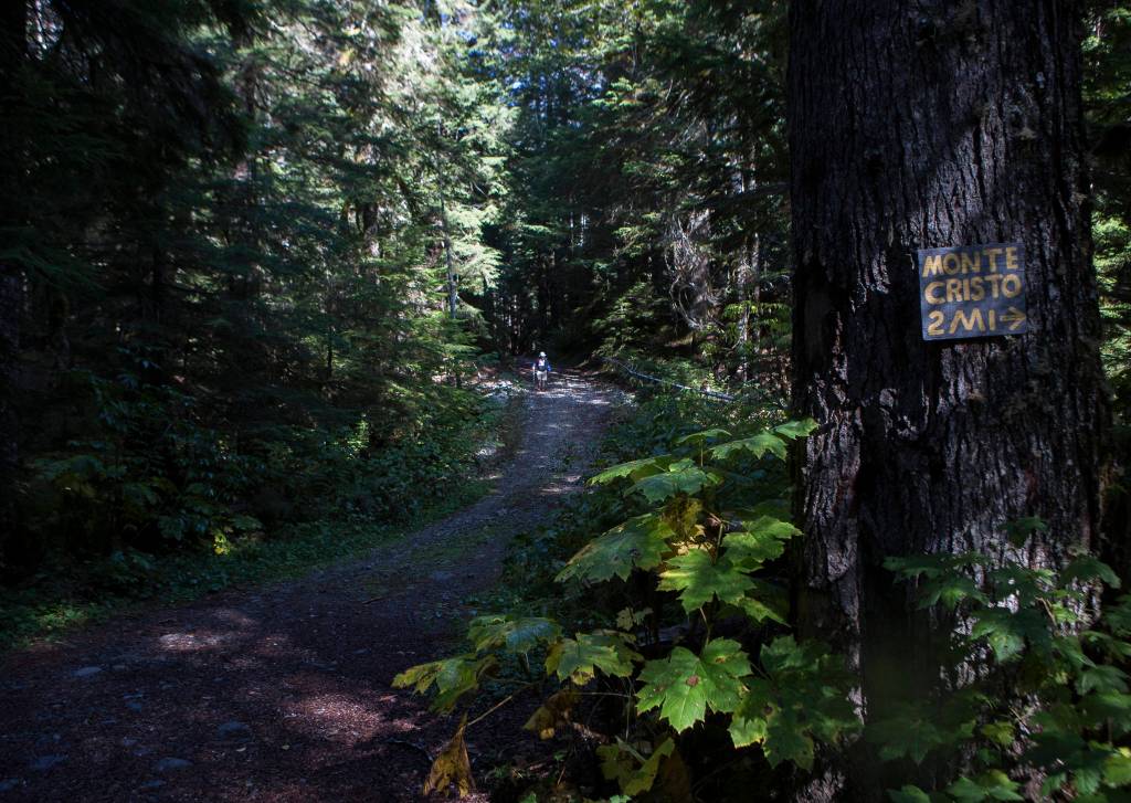
It’s called the CERCLA road, named for the Comprehensive Environmental Response, Compensation and Liability Act. And it lies beyond a gate about a half-mile past the main trailhead for Monte Cristo.
The route was built so crews could access the mining sites near Monte Cristo, to clean up old and rather toxic tailings — the crud leftover after all the valuables have been sifted out. The tailings here had high concentrations of arsenic and lead, found naturally in the same rocks where miners once searched for gold and silver in the late 1800s and early 1900s.
In 2009, then (and now once again) U.S. Agriculture Secretary Tom Vilsack approved the road as an exemption to the 2001 Roadless Area Conservation Rule, a landmark environmental policy designed to protect swaths of land from logging, mining and other development. New roads can be exempted from the rule for special purposes, such as for cleanup, but should be decommissioned after its intended purpose is completed.
Looking at a map, the CERCLA route is on the outer edge of what is supposed to be a designated roadless area.
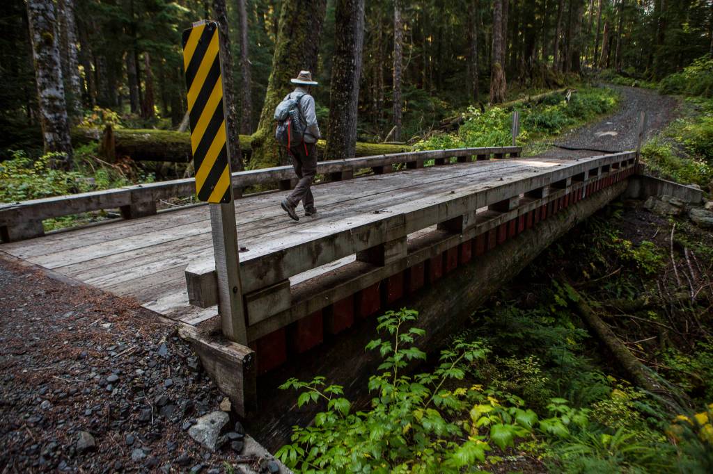
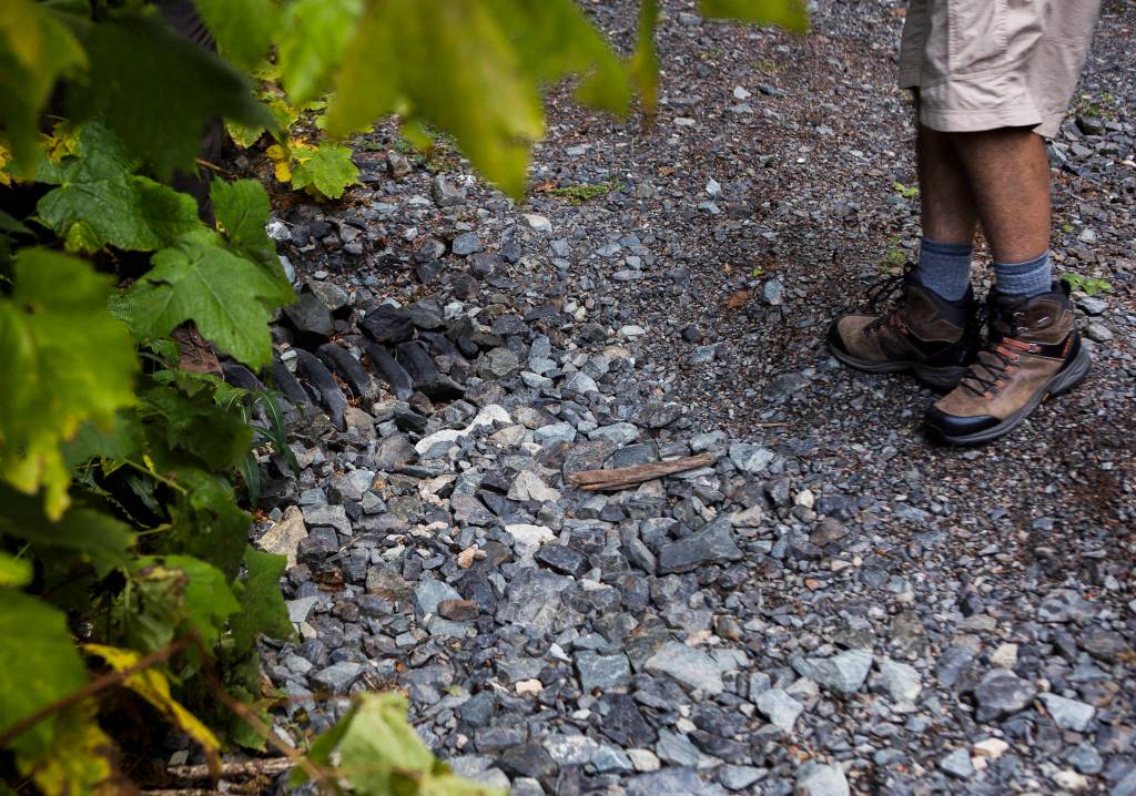
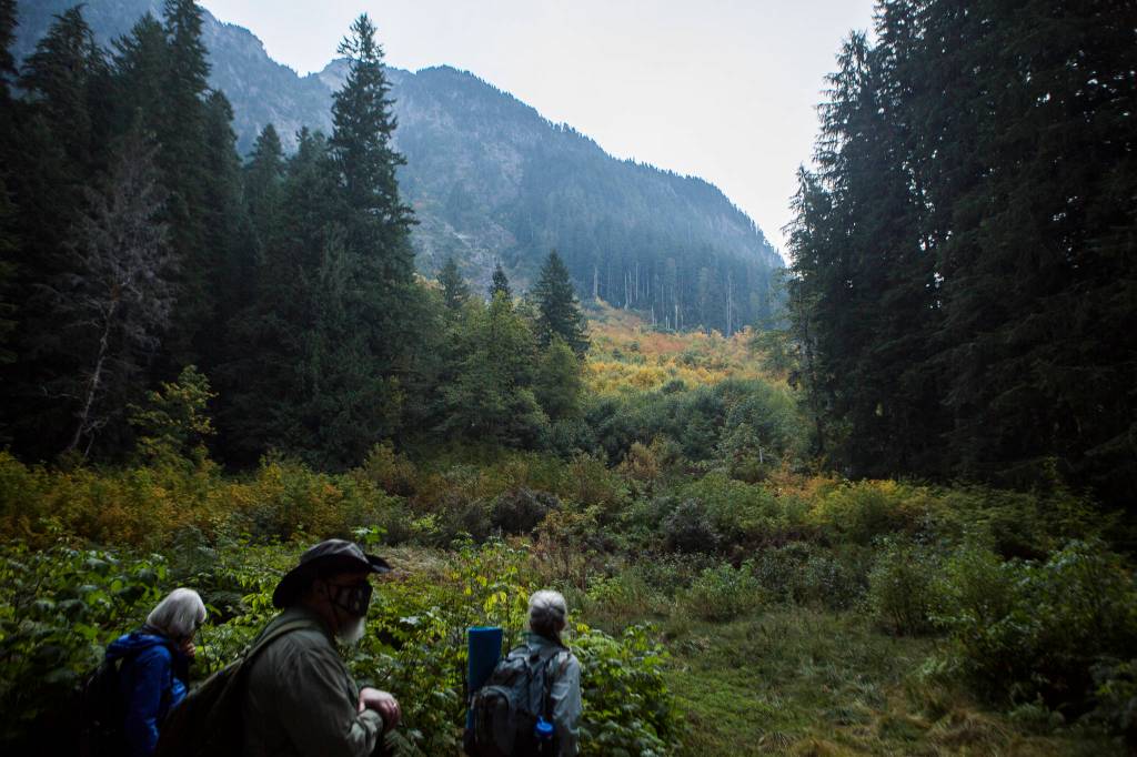
It’s not technically built up to road standards, said Joe Gibbens, the U.S. Forest Service site manager at the Monte Cristo cleanup site. It’s more like a pathway of gravel. The route is narrow, steep in some places, and weaves around large trees. There’s limited drainage. And it goes through habitat for the marbled murrelet and the spotted owl, birds protected under the U.S. Endangered Species Act. After about two miles or so, it connects with a former logging road. In another mile, it joins the main trail that leads to Monte Cristo.
The CERCLA road was designed to do as little harm as possible, Gibbens said. Originally, it was approved to be much bigger, not unlike the Mountain Loop Highway, he said. Crews would have cut down lots more trees and disrupted a lot more land. But, ultimately, the forest service decided against that, thanks in part to objections.
“We were after a smaller footprint route with less impact to the forest,” he wrote in an email to The Daily Herald.
The cleanup was done by 2016 and is currently undergoing monitoring. Now that the main part is over, everyone is trying to figure out what to do with the CERCLA route, and how it’s used.
In a June 3 letter, Darrington District Ranger Gretchen Smith pleaded with the Monte Cristo Historic Preservation Association, the North Cascades Conservation Council, and private land owners to find a “viable, collaborative solution.” She also named Bill Lider, a Lynnwood engineer and board member of the Sno-King Watershed Council, who has been a persistent critic of the cleanup effort.
“There is no simple solution for addressing access to the Monte Cristo area,” Smith wrote. “My desire is to focus on meaningful and collaborative dialogue.”
But compromise does not seem to be an option.
Either vehicular access is allowed, or it isn’t.
Should it even be a road?
Historic preservationists say having motor vehicle access is invaluable to providing maintenance on the handful of buildings left at the townsite.
To Fred Cruger, treasurer of the Granite Falls Historical Society, the answer seems obvious. The Monte Cristo Preservation Association wants some ability to drive up to the townsite to do upkeep. They would even dedicate volunteers to help clear the road, and have offered to pump the vault toilet themselves, if the forest service would allow it.
“They have no money,” Cruger said of the forest service. He explained the preservation association has been — and could continue to be — an important partner in maintaining the trails and townsite.
He sees keeping the CERCLA road open, for those with land or with something to contribute, as “a win for the property owners, a win for tourism, a win for the cities,” and, yes, “a win for the environment.” In his view, allowing access via the CERCLA route was better for the environment than trying to rehabilitate the old county road, which became inaccessible after floods washed out the bridges over the Sauk River.
The association has already used the road, thanks to a key loan program set up by the previous ranger for the Darrington District, allowing limited access through the gate. They’ve installed new signs and built new roofs and siding, for example.
Without vehicular access, volunteers have to factor in the time it takes to walk into the townsite and back out, said David Cameron, a founding member of the Monte Cristo Preservation Association.
“Which means you aren’t getting very much work done,” Cameron said. And that’s not accounting for whether volunteers can carry all of the supplies.
Philip Fenner, president of the North Cascades Conservation Council, questioned whether the association really needed motor vehicle access to do that maintenance. Even if it does help, it’s not worth the sacrifice to the environment, he argued.
“Ancient forest is not a renewable resource,” he said.
For Fenner, constructing a road is only the beginning of long-lasting environmental harm. Roads lead to logging or mining or other forms of development that wouldn’t have otherwise existed, he said. The roads themselves, and the vehicles they bring, can be harmful to habitat, disrupting animals and plants and waterways, studies have shown.
“A road is a wound in the ground, in the forest, and it’s bleeding,” Fenner said. “You have to stanch the bleeding.”
If made permanent, Fenner argued Monte Cristo’s CERCLA route could become a rare and dangerous exception to the roadless rule. If one exemption is allowed, he wondered, what other reasons might be used to justify permanent roads in roadless areas?
Removing the road entirely isn’t currently on the table. No cost estimates have been done, but it would likely be an expensive endeavor, particularly with the three large log bridges that have been put in place.
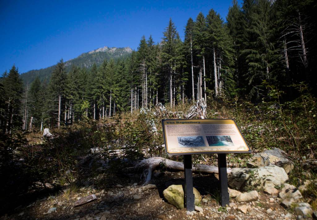
Technically, the intended purpose for this particular road hasn’t been completed, Gibbens said. That’s because the mine waste was put in a nearby repository, about a half-mile south of the townsite, and up the hill from the Sauk River. Crews need to monitor the repository — essentially a landfill that can hold 23,000 cubic yards of waste — for any leaking.
Rather, Gibbens said, the plan is to keep the road, but more as a trail. If future work needs to be done in the area, or should something happen to the repository, then the forest service can act quickly.
In providing the exemption, Secretary Vilsack didn’t give a definite end date.
Fenner said the CERCLA route, even though it’s closed off by a gate, has already seen use beyond its intended purpose, because the ranger district for years loaned out keys to people who owned property beyond the gate, and for other purposes.
For example, in the summer of 2017, there were 58 gate key requests, according to an analysis of public records done by the conservation council. About three-quarters of those requests were not for the intended purpose of remediation work, they concluded.
That program has since been shut down, Gibbens said. The U.S. Forest Service was briefly going through a process under the National Environmental Policy Act to determine the future of how the route was used, but that was dropped a few years ago.
Gibbens said he feels a compromise on the CERCLA route already has been reached.
“My position is, we’re not going to use it unless we absolutely have to, but we’re going to keep the road there in case we do need to use it,” he said.
In addition to monitoring purposes, Gibbens also said it could become an important route for emergency responders, in case of wildfire, or if someone gets injured or lost.
What’s left?
Once, this place was expected to be the gateway to wealth. People thought they’d become as rich as the Count of Monte Cristo.
Like the book, the dreams were fiction.
No one who toiled in the mines became as rich as the count, though likely someone, somewhere, profited. People had overestimated the amount of valuable minerals that lay within the mountains.
By the winter of 1920, mining there had gradually sputtered to a close, according to HistoryLink.org.
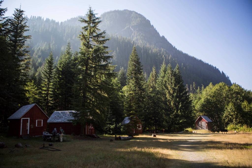
What’s left is a handful of old buildings and some metal artifacts strewn about. A large rusty railroad turntable — which, astonishingly, can still be turned by hand, with a little sweat — acts as a kind of centerpiece relic.
The mines, once industrious with workers and the comings and goings of ore, have long become stagnant.
The aerial tramways are nowhere to be seen. The impressive five-story ore concentrator building is no more. And only remnants of the old railroad can be seen.
Donald Trump’s grandfather’s disreputable hotel is gone, as well.
The lodges built for tourism after the mining rush have also vanished, having been blocked off by a washout, then burned down, leaving a forlorn sink standing in the center of rusty bits and pieces.
The rivers and rains of Washington aren’t friends of ghost towns.
Still, the site remains popular with hikers and mountain bikers and campers. The old railroad grade serves as a gentle stroll through the woods. And though the bridges are out, crossing the river via log, while not technically advised by rangers, proves to be a minor challenge. A couple stretches of rocky terrain act as another slight obstacle: You can roll an ankle if you’re not careful.
The new CERCLA route, assuming it stays as a trail, makes the walk in even easier, though the views aren’t as grand. There are no river crossings, and not as many ankle-rolling rocks. It’s open to the public, even if it’s not listed as a route on the Washington Trails Association’s website. (The WTA, however, did speak out against keeping the CERCLA road open, even as a trail, saying it weakened the roadless rule and calling it a “low quality hiking experience.”)
The town is no longer bustling with all the cacophony that comes with the mining industry, but there is still a busyness to it. Different noises fill the space now: Of couples picnicking, of Boy Scouts swarming the turntable, of families going from building to building, relic to relic, sign to sign, learning about this place that once was.
And maybe, if you come on the right day, at the right time, or if you wait long enough, you’ll find the occasional embrace of near silence. It’ll be you, the sound of water, and a landscape framed by peaks.
This isn’t a place bound to slow down anytime soon, CERCLA road or no CERCLA road.
Zachariah Bryan: 425-339-3431; zbryan@heraldnet.com. Twitter: @zachariahtb.