
EVERETT — Your world is a few clicks closer.
Thinking about buying a home? Building on property you own? Curious about what your neighbors are up to?
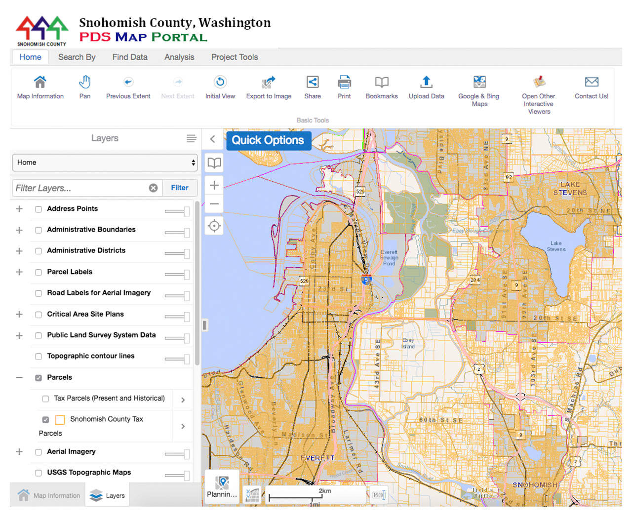
Snohomish County’s new online mapping application might tell you everything you want to know — and then some. The digital mapping system promises to make life easier for Realtors, homebuilders and just about anyone else with a personal or professional curiosity about the local landscape.
“I can sit down and, in maybe 30 minutes learn more about a property than I used to be able to in a few weeks,” said Merle Ash, a land-use consultant who serves on the county planning commission. “It’s pretty much a one-stop shopping center if you want to know anything about land use or land-use planning, if you want to build a house or buy property.”
The map portal was rolled out officially in late 2017, after appearing in various test forms over the past couple of years. It’s now in its fourth version.
Unpack its 175 data layers, and you can find out what a property’s zoning allows. It’s also easy to see whether the land has steep slopes, a creek, protected habitat or other features that might prevent someone from building there. You can layer on boundaries for school districts, fire districts, water service, voting precincts and more.
“This is another great tool as the county moves toward being totally digital and away from an older, paper-based approach,” said Raoul Comaduran, a senior GIS analyst with the county. “That’s another huge benefit to this system.”
Tutorial videos should be available online by mid-year.
County planning director Barb Mock said the application is the product of years of work, stretching back to the recession. Planning staff looked at how to provide the land-use information people needed most.
“What we did was we brought in our customers,” Mock said.
On hearing what they wanted, they got to work.
The mapping program allows users to superimpose aerial imagery going back to 1998 — even to toggle back and forth to another year to see how a given point on the landscape has changed. Other maps show topography, contours and lidar surveys. The site is designed to integrate street views and other map images from Google and Bing.
A menu provides eight stock map themes, including agriculture, transportation and tribal affairs.
Tools let you change scale or save a map in different formats.
Click a button, and the site spits out a report with eight or more pages of basic data the county collects on properties, all in one place. The information is updated continuously.
Future land-use and zoning information stops at city limits, but all other property characteristics are available for the whole county.
Ben Kaufman, a Realtor who specializes in sustainable properties and also serves as a county planning commissioner, praised the new tool as a time- and money-saver. Above all, Kaufman appreciates the topographical maps.
“Anybody who loves a map can go in there and play and really come out wide-eyed,” he said. “It’s a better system than King County’s. It’s the best one in the region. They did a really good job on it.”
The county used an existing 3 percent surcharge on permit fees to pay for the mapping upgrades. The Geocortex system was developed by Latitude Geographics in Victoria, British Columbia.
Noah Haglund: 425-339-3465; nhaglund@herald net.com. Twitter: @NWhaglund.
The site
Here’s how to find Snohomish County’s mapping portal from the the home page, www.snoco.org: From the County Services tab, click “Maps & GIS.” From the Interactive Maps tab on the left side of the screen, select “PDS Map Portal.”
Talk to us
> Give us your news tips.
> Send us a letter to the editor.
> More Herald contact information.

