My mom likes to say that when she sees snow, she’s the happiest person in the world.
Alas, those moments are all too rare.
I’ve always assumed the only safe way to play in the snow is to shell out money for a ski lift ticket or take a winter vacation in Leavenworth. Am I wrong? Are there any easy, accessible and — most importantly — safe trails in and around Snohomish County that lead to snow this time of year?
The answer is yes, at least in the case of Heather Lake Trail, which my coworker, Herald photographer Olivia Vanni, and I explored this week. But it could also be true of a handful of other nearby trails, which have a similar gain in elevation, are rated as easy or moderate to hike and have recent reports of snow.
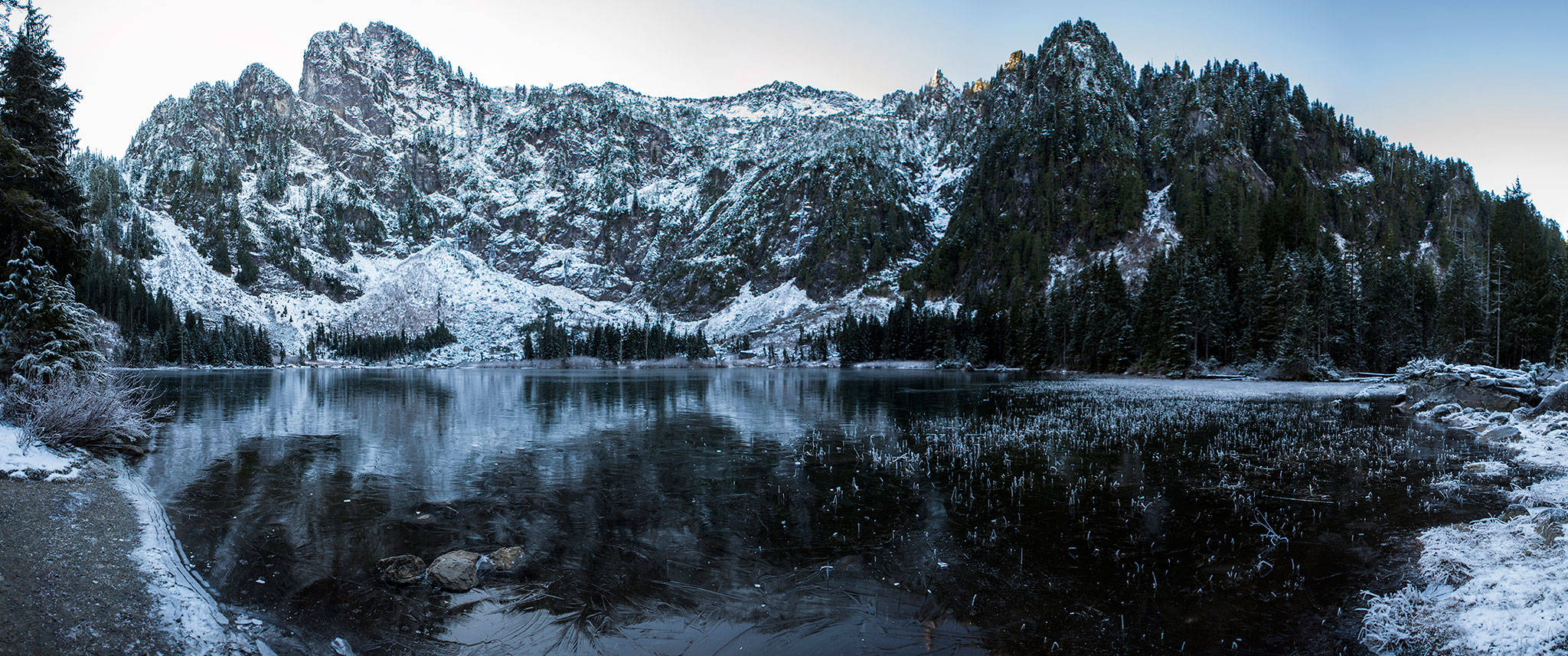
Heather Lake Trail is a 4.2-mile hike east of Granite Falls. The highest point of the trail — which culminates with a spectacular view of Heather Lake and the jagged peaks that surround it — is 2,430 feet.
The trailhead is easy to find following directions from Washington Trail Association’s website. It’s a 45-minute drive from Everett. Beware the potholes on Pilchuck Access Road. A Northwest Forest Pass, $30 per car, is required.
Olivia and I set out at 9 a.m. and only saw frost for the first hour. A recent trail report suggested we’d encounter snow by the trail’s end, but I worried we’d come away snow-deprived.
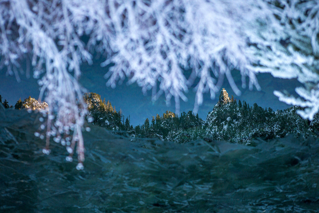
Just a few minutes later, however, we came across our first patches of snow glazing fallen trees, ferns and bushes. My mom’s face would have lit up by the sight of this alone, but I suspected more was in store for us.
There was more. In fact, as we continued the hike, it felt like a winter wonderland. Snow was everywhere, on the trail and in the surrounding forest. The weather was chilly and the snow frozen solid, so don’t expect to throw any snowballs if you head up there soon.

Snow covers a part of the hiking trail to Heather Lake on Wednesday, Dec. 5, 2018 in Granite Falls, Wa. (Olivia Vanni / The Herald)
Other than some icy patches on the way up, which made parts of the trail more difficult to navigate, our 1,000-foot climb was relatively easy. Be sure to watch out for slippery wood steps.
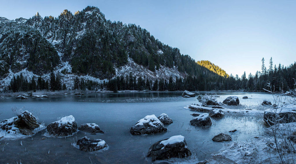
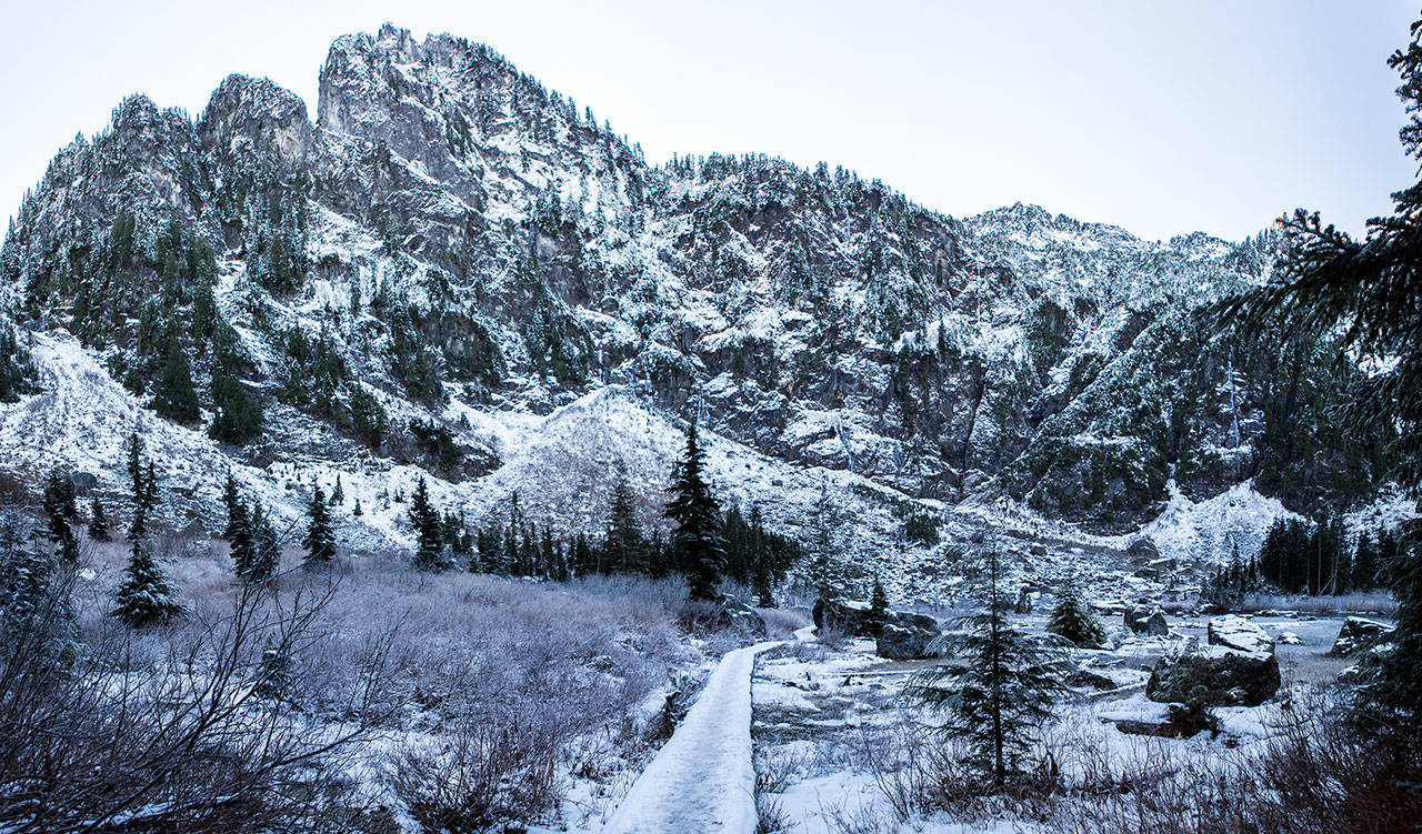
Heather Lake and its surroundings, located on the northeastern slope of Mount Pilchuck, were stunning to see. The snow-covered peaks reflected off the frozen lake with a beautiful, dark hue. A number of frozen waterfalls clung to looming cliffs.
Mountain peaks surrounding Heather Lake are reflected in the water on Wednesday, Dec. 5, 2018 in Granite Falls, Wa. (Olivia Vanni / The Herald)
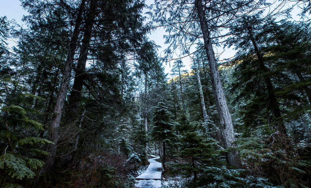
A series of boardwalks, which wrap around the lake, were covered in a thick layer of snow that reminded me of walking the streets of Leavenworth in winter.
An elevated walking path that runs along Heather Lake is covered with snow on Wednesday, Dec. 5, 2018 in Granite Falls, Wa. (Olivia Vanni / The Herald)
My mom would have been thrilled to see it. And, considering how easy the trek was, a mother-and-son trip may be in store soon.
Evan Thompson: 425-339-3427, ethompson@heraldnet.com. Twitter: @ByEvanThompson.
Five more winter hikes to try
Here are five more easy-to-moderate hikes to go on if you’re searching for snow. You may find it on the trail or covering the surrounding mountains. Hikers should be aware of road closures and unsafe conditions. Look up trail reports before planning a trip. For specific driving directions, go to www.wta.org/go-outside/hikes and search for the hike you’re interested in. A Northwest Forest Pass is required on all hikes.
Lake 22: This 5.4-mile round-trip hike off the Mountain Loop Highway leads to a pretty lake at the base of Mount Pilchuck, at 2,450 feet. Recent reports found snow around the lake, but not much on the trail leading to it. Hiking time is typically four hours.
Boardman Lake: Also off the Mountain Loop Highway, this short, 2-mile trip with a 400-foot ascent is a good snowy hike for kids. Drivers should be wary of the dirt road leading to the trailhead. Hiking time is just over an hour.
Heybrook Lookout Trail: Look for snow on the surrounding mountains at the end of this 2-mile trek, off U.S. 2 near Index. It gains 880 feet in elevation and reaches 1,700 feet at the highest point. Hiking time is about 90 minutes. The reward is views of Baring, Persis and Index mountains, and Bridal Veil Falls.
Barlow Point: Drive the Mountain Loop Highway all the way to Barlow Pass, 31 miles east of Granite Falls, for this 2.2-mile hike, which climbs 850 feet to a 3,200-foot peak. Recent hikers reported the trail being snow-free, except at the summit. Hiking time is about 75 minutes.
Lake Serene: This 8.2-mile hike near Index may require microspikes. The elevation gain is 2,000 feet, with the highest point at 2,521 feet. Similar to Heather Lake, Lake Serene is surrounded by snow-covered peaks and cliffs. Hiking time is estimated at nearly five hours.
Talk to us
> Give us your news tips.
> Send us a letter to the editor.
> More Herald contact information.
Gallery