Landslide risk widespread in county; 30,000 in hazard zones
Published 9:20 pm Saturday, March 29, 2014
A neighbor rushed to save the elderly couple after a wall of mud slid down a rain-soaked bluff and knocked their home about 10 feet off its foundation.
That wasn’t a scene from the catastrophic Oso slide — it happened just south of Mukilteo in March 1997.
A flagpole remained in the yard of Arvid Franzen and his late wife, Elsie, long after the couple moved. Now, a new house is going up in the same spot along a narrow, private road cut like a shelf partway up the unstable coastal bluff.
“They don’t think about what’s above them,” said Roy Main, 75, a relative of the Franzens whose family has lived nearby for generations. “I don’t know whether these people realize they’re in the slide.”
The approximately 50 houses east of Oso swept aside by the March 22 landslide were hardly the only ones built near unstable land in Snohomish County.
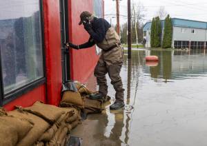
Hazard maps show almost all of the county’s coastline and mountain valleys are in landslide danger zones. An estimated 30,000 people live in those places, according to a 2010 study commissioned by the county. By 2035, the county is expected to absorb roughly 200,000 more people. There are about 730,000 today.
There are slide-prone areas in seaside communities from Woodway to Tulalip, as well as in the foothills and in the Stillaguamish and Skykomish river valleys. Property values in those areas exceed $2 billion, according to the 2010 study.
The county can’t afford to buy out property owners in landslide areas. Plus, people have a right to stay and, under certain conditions, to build.
Existing laws and policies governing development in Snohomish County didn’t keep people in Oso out of harm’s way. Under the county’s building regulations, the area where homes were built wasn’t even designated high-risk for landslides.
Scientific data and a history of slides at that hillside were warning signs, but even experts didn’t imagine a slide as big as the one March 22, which involved the displacement of an estimated 6 million to 7 million cubic yards of sand, silt and clay.
Eons of erosion
Ice-age glaciers carved deep grooves in the land, many of which filled with layers of soil and sand that aren’t solidly bonded. After the ice sheet melted, rivers such as the North Fork Stillaguamish wore through that loose fill, creating picturesque valleys.
The North Fork valley is lined with hard clay that traps water beneath weak soil. Add a slope, and it is a recipe for slides. Many valleys in Western Washington share those characteristics, according to geologists.
It’s easy for experts to speak broadly about potential hazards, but putting specific odds on a particular slope failing is much more difficult. That sort of precision requires extensive — and expensive — data collection and analysis. Even then, experts can only talk of potential risks and likely consequences.
“You don’t just plug in numbers and out comes what we should do,” said David Montgomery, a geology professor at the University of Washington perhaps best known for the books “King of Fish” and “Dirt,” best-sellers that try to explain for general readers the complexities of geology, salmon habitat and land use.
Studies and reports going back decades highlighted the risk of future slides at Hazel, the name geologists gave the 600-foot-high hillside directly across the river from the Steelhead Haven community.
Part of the slope gave way in January 2006, forcing the county to do emergency work to redirect the river’s flow away from homes. The hillside had been active long before that. A 1967 slide pushed the river channel about 700 feet south. Others hit in the early 1950s and before.
But no experts warned of anything approaching the flood of debris and mud that came down so violently starting at 10:37 a.m. March 22. A second, larger mass tumbled down around 10:41 a.m. Seismic readings recorded at the University of Washington show the land was moving for more than an hour. By the time it was over, about a square mile of terrain lay covered.
To date, 27 are known to be dead, if not yet identified, with another 30 people missing. Hundreds of emergency workers and volunteers continue to comb the debris.
Mountains of data
In a 1999 report for the U.S. Army Corps of Engineers, geologist Daniel Miller warned that a catastrophic failure could carry debris 900 feet to the south, far enough to destroy several homes on Steelhead Drive. That’s only about one-fifth the distance of the March 22 slide, which extended 4,400 feet, roughly eight-tenths of a mile.
It’s unclear whether the Corps of Engineers alerted the county about the concerns. A 2009 report the agency submitted to county planners merely noted a risk of future slides and pretty much left it at that.
The river valley contained clues that such a massive runout is possible. Mapping data analyzed this week by the U.S. Geological Survey revealed that a landslide thousands of years ago struck just a half a mile to the west, covering an area more than twice as big.
Without more advanced analysis, experts can’t say how quickly the earlier slide occurred — over weeks or in a moment, said Ralph Haugerud, a USGS geologist based in Seattle.
Even advanced analysis can only tell people so much.
“We do know what kinds of soils are susceptible to landslides, what kind of earthquake activity triggers slides,” as well as other factors, said Lynn Highland, a geographer with the USGS landslide program in Golden, Colo.
Some of her coworkers are in Oso now, trying to figure out the slide’s exact cause.
While many factors created the conditions for the slide, “it looks pretty clear that it was rain-induced,” she said.
This March has been one of the wettest on record.
What isn’t known yet are the roles played by potential catalysts, such as logging and riverbank erosion.
Before slides occur, experts can identify hazards and calculate probabilities. After that, people have to decide how much risk they want to live with.
“Cities and counties have to walk a fine line between a hazard and the freedom to use your property as you see fit,” Highland said. “That’s one of hallmarks of living in America. The human element comes into play here. I’m not saying that’s good or bad.”
Subdivided in 1960
The land that became the Steelhead Haven neighborhood was sliced into lots — some as small as a quarter-acre — in 1960. At the time, building and development codes contained few limitations intended to protect people or the adjacent North Fork Stillaguamish River, flood-prone and always changing course.
“You wouldn’t be able to subdivide (the area) under today’s regulations,” said Tom Rowe, a manager who oversees permits for the Snohomish County planning department.
Current codes might have restricted the number of homes on the road, but they wouldn’t have stopped construction. Nothing in county codes would have triggered special consideration of landslides coming from the opposite riverbank.
“None of these properties were considered landslide-hazard areas,” Rowe said.
“They’re grandfathered in as a legal building lots, but they have to comply with all applicable regulations.”
To trigger special review under county regulations, inspectors must identify a landslide area within 200 feet of a building site. The closest homes, built in the 1960s and 1970s, were well more than 300 feet from the opposite riverbank. Homes constructed more recently, including eight added since 2005, were even farther back.
County elected leaders and permitting authorities said there will be a time to reconsider building regulations. With the search ongoing for the missing and dead, however, several said it’s too early to start that conversation.
“To focus and finger-point right now is at best in poor taste. We should be focused first on recovery. Once we have that task completed, we can focus on how we can make things better in the future,” said County Councilman Ken Klein, a Republican from Arlington.
Policies elsewhere
In California, when land in an official hazard zone is sold, sellers are required to tell buyers about potential problems. Because the Steelhead Drive neighborhood and adjacent homes weren’t in an official landslide hazard zone, a natural hazard disclosure law wouldn’t necessarily have ensured homeowners knew the risk.
Landslides are vexing for policymakers. Flooding, for example, is much better understood and occurs more often in inhabited areas.
Homeowner insurance typically doesn’t cover landslides. In California, areas prone to slides have created self-insured districts, called geologic hazard abatement districts.
Some cities, including Portland and Seattle, have invested in detailed analyses to better understand risks and possible mitigation.
Data can only take policy so far. At some point, people have to decide how many rules they want about where they live.
“How do we determine what is an acceptable risk for people to take, and how do we get people the answers they need to evaluate those risks?” asked Montgomery, the UW geologist. “There is no simple or right answer.”
Noah Haglund: 425-339-3465, nhaglund@heraldnet.com.