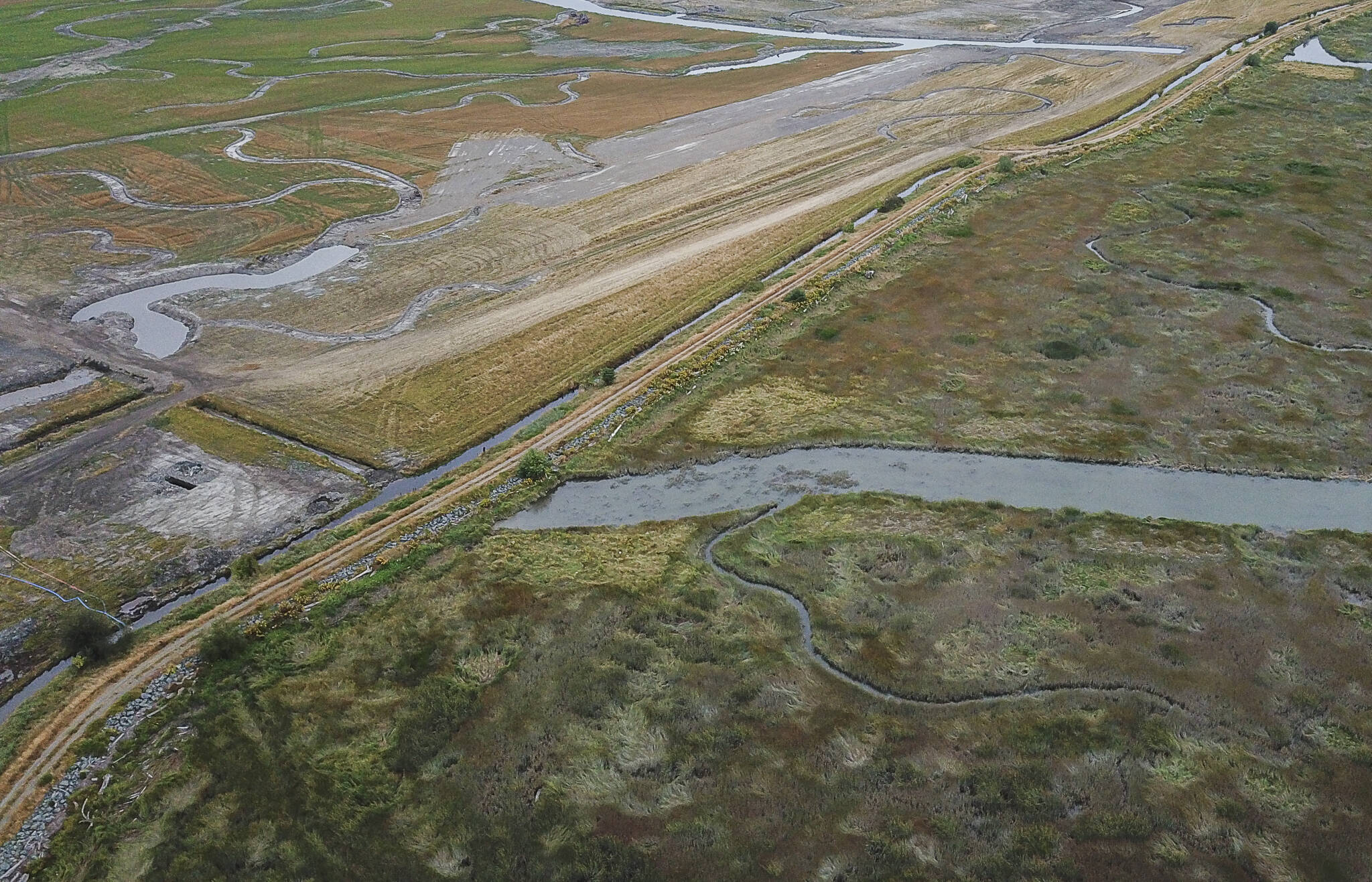
STANWOOD — On the west side of an old dike near Port Susan, seagrass sways along tidal channels as birds dart through cattails. On the east side of the dike, separated by only a few feet of dirt, dust swirls across a flat plain as excavators move mounds of earth.
The two adjacent landscapes seem worlds away from each other. One is a flourishing natural environment governed by the ebbs and flows of daily tides — a perfect nursery for threatened Chinook salmon. The other is the remnant of decades of agricultural use, the earth’s use dictated over the years by owners’ desire for certain crops or livestock.
But in 2026, the two sides will merge as the Stillaguamish Tribe of Indians resurrects 230 acres of floodplain named for a historical tribal leader in an effort to save salmon.
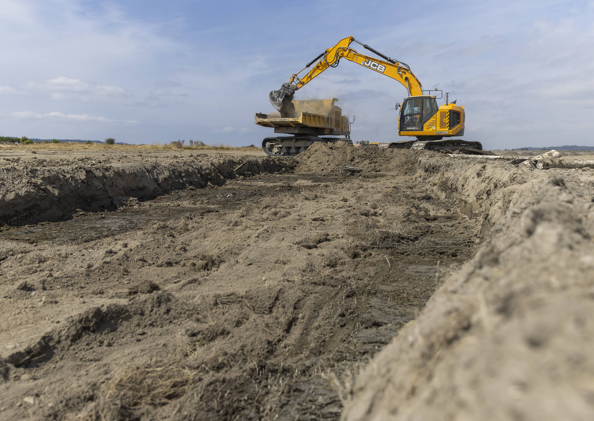
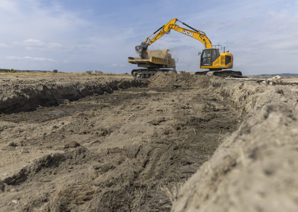
An excavator loads dirt into the bed of a rotating crawler while digging a channel on Monday, Aug. 4, 2025 in Stanwood, Washington. (Olivia Vanni / The Herald)
‘There are no fishermen in the Stillaguamish Tribe that make their living on Stillaguamish salmon’
For thousands of years, rivers making their way down from the North Cascades have carved winding paths through western Washington. When fresh water flows hit the salty tides of Puget Sound, two opposing bodies of water mix, stirring and moving the land beneath their currents.
Before European colonization, the mouth of the Stillaguamish River was a large estuary where intricate paths of water weaved between islands of waterlogged earth covered in plants, providing shelter and feeding grounds for wildlife.
Estuaries, like the ones along the Stillaguamish River, provide critical nurseries for juvenile salmon to rest, eat and grow before leaving the sanctuary of the river for the open ocean.
In the 1800s, this rich delta was largely transformed from floodplain to farmland when white settlers built miles of dikes and levees, constricting river flows to take advantage of the fertile soil.
Similar changes happened through the Puget Sound region and the West Coast, resulting in the loss of nursery habitat. Coupled with rising river and ocean temperatures, Chinook salmon runs were decimated, and the fish were first listed as threatened under the Endangered Species Act in 1999.
Historically, the Stillaguamish River supported as many as 20,000 Chinook salmon a year, but in 2024, negotiated quotas left the Stillaguamish Tribe allocated with only 29 of these fish.
“There are no fishermen in the Stillaguamish Tribe that make their living on Stillaguamish salmon of any species, not just Chinook,” said Jason Griffith, the environmental program manager for the Stillaguamish Tribe. “The tribe is really focused on building not only the culture, but also the economy around salmon that they used to have.”
Restoring the salmon’s two habitats, the river and the sea, is one of the ways to give the threatened species a fighting chance at the kind of significant recovery that would support treaty rights and ancestral traditions.
With the current collaboration between the Stillaguamish Tribe, The Nature Conservancy and the Skagit River System Cooperative, an eventually combined 1,000 acres of Stillaguamish River delta could become a hopeful example of the potential power of large-scale estuary restoration.

The outline of a channel is visible along the surface on Monday, Aug. 4, 2025 in Stanwood, Washington. (Olivia Vanni / The Herald)
‘Estuaries aren’t rivers’
In 2001, The Nature Conservancy, a global conservation organization, bought 4,000 acres of land along Port Susan Bay, including a plot of 150 acres of abandoned farmland at the mouth of the Stillaguamish River ripe for restoration.
In 2012, the organization removed and set back 7,000 feet of sea dike built on the plot, reconnecting the former farmland to the bay and river. Scientists believed the natural movement of water would channelize the area, resulting in widespread braided avenues of access for fish and vegetation to thrive.
But five years later, that was only sort of the case.
The tides and river were creating the channels, but only shallow ones that moved water quickly between systems. The legacy of farming had changed the nature of the site’s soil, so the top layer was soft and soupy, while beneath it remained a hard layer of compacted earth.
Because salmon runs mix and move throughout areas of Puget Sound, the Skagit River System Cooperative, a natural resource management organization for the Sauk-Suiattle Indian Tribe and the Swinomish Indian Tribal Community, partnered with The Nature Conservancy to figure out how to get the restoration site to reach its full potential.
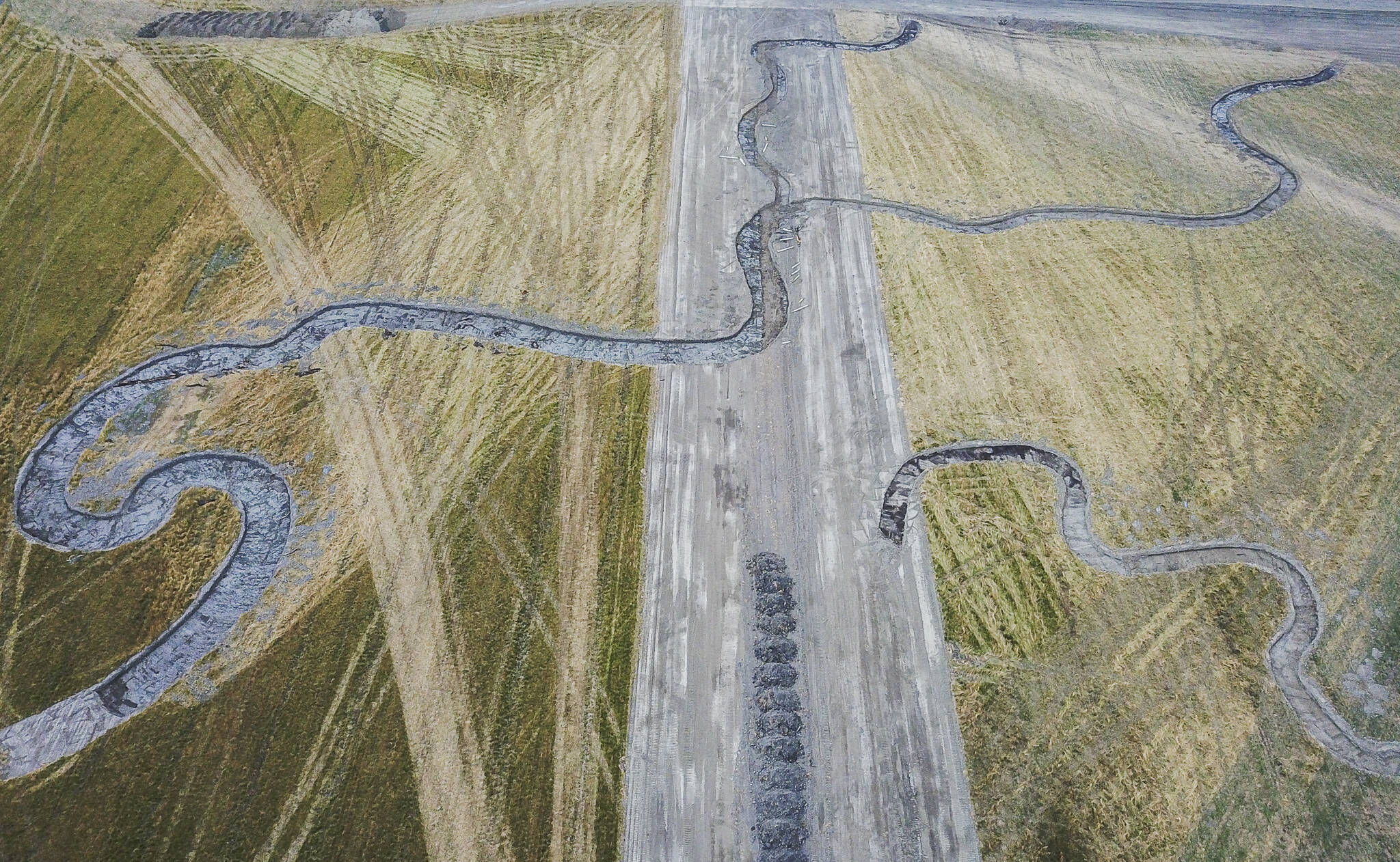
Excavator dug channels cover the surface of the Zis A Ba site on Wednesday, Aug. 6, 2025 in Stanwood, Washington. (Olivia Vanni / The Herald)
“Estuaries aren’t rivers, right? And you’re like, ‘Yeah, well, of course.’ But there’s a lot of detail in that statement,” said Mike LeMoine, director of research and recovery for the Skagit River System Cooperative. “When we’re designing restoration, most of our estuarine restoration tries to pull principles from stream [and river] restoration, and we found that some of those principles don’t hold.”
Estuarine projects like these, affected by the tides, evolve much slower than stream projects shaped by constant flowing water, he explained, but even the tides are stronger than juvenile salmon, which are sometimes just a few inches long when they migrate out to sea.
As a result, baby salmon need slow-moving channels of water to give them a chance to grow before leaving the protected marsh.
But models from the Skagit cooperative showed that, if left to its own devices, The Nature Conservancy site would take 80 years to effectively carve deep enough channels to provide refuge.
“In terms of thinking about endangered salmon and the anticipated effects of climate change, we didn’t really have the time to wait,” said Washington Stewardship Director for The Nature Conservancy Randi Shaw.
So in 2022, the Nature Conservancy went back into the site and excavated an extensive channel network across the marsh.
Today, some of those channels dead end at the dike separating the preserve from land the Stillaguamish Tribe owns. That land is called zis a ba.

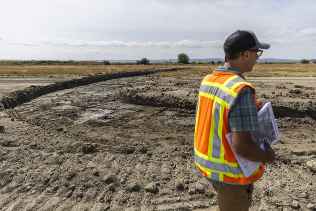
Jason Griffith talks about the dike changes and layout of the site on Monday, Aug. 4, 2025 in Stanwood, Washington. (Olivia Vanni / The Herald)
‘Bringing it back to the tribe’
“Zis a ba was a prominent tribal leader and traditionally hailed from the area,” said Stillaguamish Tribe of Indians vice-chairwoman, fisheries director and Northwest Indian Fisheries commissioner, Kadi Bizyayeva. “Whenever we acquire properties, the tribe typically refers to them based off of the name of the last property owner. But with this project being so unique, and bringing it back to the tribe and decolonizing the landscape again, we wanted to refer to it as someone who was here before all of that.”
In 2012, the Stillaguamish Tribe started restoring the zis a ba I site, which included 88 acres of former farmland along the old mainstem of the Stillaguamish River before it splits into the South Pass and West Pass routes. The tribe took out a mile of old levee, removed a tide gate and created three miles of tidal channels.
In 2020, the tribe seized the opportunity to purchase more land along Hatt Slough, the mouth of the Stillaguamish River. The zis a ba II site holds 230 acres that bridge the area from the slough to The Nature Conservancy’s preserve, further connecting the historic floodplain.
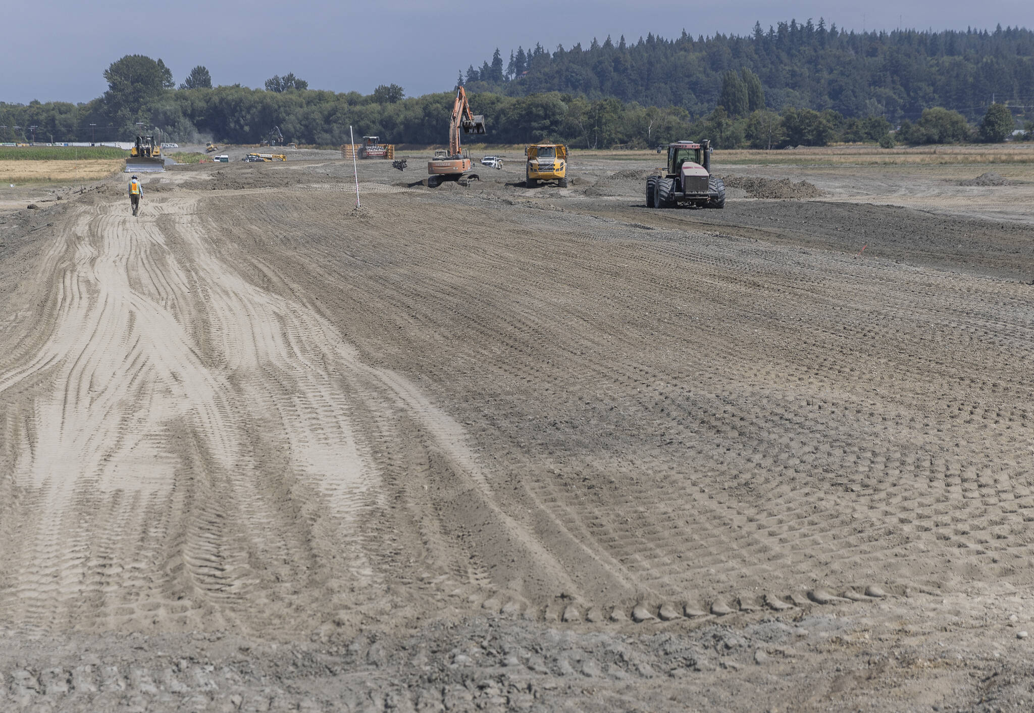
Since then, the tribe has removed 42,000 square feet of buildings and 1.5 miles of powerline and poles, constructed a new flood gate and dug miles of channels. When construction finishes in early summer next year, 10 miles of channels will be ready to connect to the conservancy’s preserve and carry the mixing waters of the Stillaguamish River and Puget Sound.
“I can’t wait to see what happens when zis a ba II is reconnected. It’s going to be such a big change,” Shaw said. “The tribe’s really pushing us all forward in such a wonderful way, to have almost 1,000 acres of restored tidal wetland and estuary habitat at the mouth of the river is going to be so phenomenal.”
The 1,000 acres will come with the next phase of zis a ba. In 2023, the tribe bought 537 acres in between the first and second site, abutting more of The Nature Conservancy’s preserve and adjacent to Leque Island, which is owned by the state’s Department of Fish and Wildlife and subsequently underwent restoration in 2019 and 2022.
In a time of uncertainty for federal funding and increasingly degraded habitat conditions, Bizyayeva said it’s paramount for government officials to understand the importance of restorative estuary projects like zis a ba for salmon recovery.
Additionally, the project connects her to both past and future generations of the Stillaguamish Tribe, she said, keeping alive a vision that spans centuries.
“It’s really wild to think that this looked a lot different 170 years ago, but my ancestors were still thinking about my generation back then when they signed the treaty, knowing that fisheries were still going to be an important part of our lifestyle,” she said. “That’s really humbling to think about.”
Eliza Aronson: 425-339-3434; eliza.aronson@heraldnet.com; X: @ElizaAronson.
Eliza’s stories are supported by the Herald’s Environmental and Climate Reporting Fund.
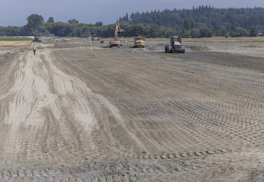
Construction vehicles work along what will be the new levy on Monday, Aug. 4, 2025 in Stanwood, Washington. (Olivia Vanni / The Herald)
Talk to us
> Give us your news tips.
> Send us a letter to the editor.
> More Herald contact information.
Gallery