Will seismometers be in place before our volcano erupts?
Published 1:30 am Thursday, August 16, 2018


DARRINGTON — Town leaders are urging the U.S. Forest Service to give the go-ahead on a long-awaited project to keep closer watch on the volcano in the wilderness east of here.
Thirteen years ago, the National Volcano Early Warning System found that Glacier Peak needs more monitoring stations. There is one seismometer, installed in 2001. And it’s expected to fail soon if it doesn’t get new batteries.
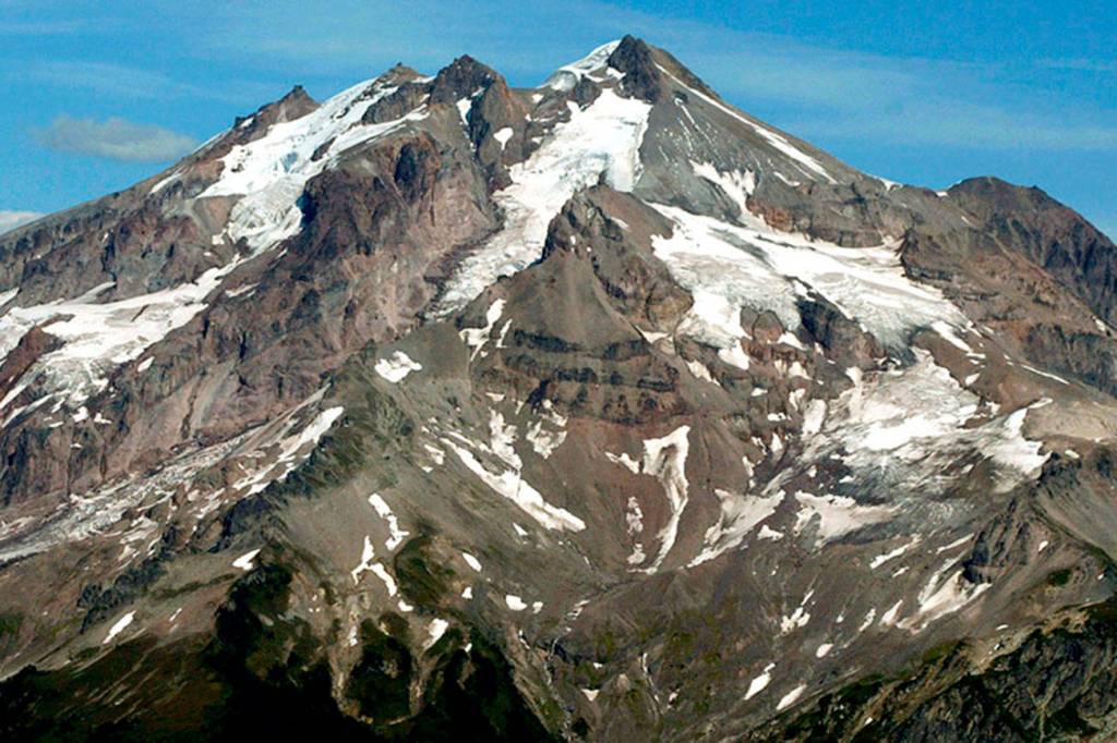
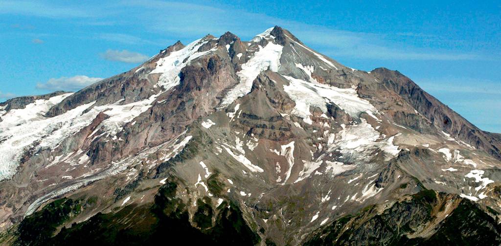
The volcano is considered a “very high threat” by the U.S. Geological Survey, based on frequency and types of eruptions, hazards, and how many people could be affected.
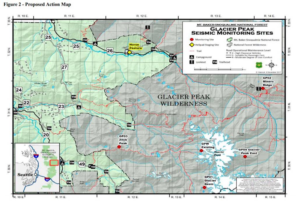
The USGS Cascade Volcano Observatory aims to add four stations and update the existing one.
It’s been under discussion for years. There have been objections to placing equipment in a wilderness area and the use of helicopters to do so.
The Forest Service is considering a 20-year permit for the USGS to put in and maintain new stations. Each would have a seismometer to measure ground movement, 10 batteries in a fiberglass enclosure with solar panels, and antennae for GPS and data transfer, according to a report from the Forest Service.
A helicopter would be used to haul supplies and crews. Each installation would take about three days, and all could be done over two to three weeks. Future maintenance would be done mostly by hiking in, though helicopters might be needed for parts.
The equipment could detect geologic changes of the volcano’s surface, increases in gas emissions and earthquakes.
“If adequate systems are not in place and Glacier Peak were to wake up quickly, it is possible that warning signs of an impending eruption could be missed, putting the lives of wilderness users and nearby residents in danger,” according to the Forest Service report.
In July, the Darrington Town Council passed a resolution supporting new stations. A letter signed by Mayor Dan Rankin notes that Darrington sits on material deposited by long-ago volcanic mudflows. The town “without a doubt would be impacted” by volcanic activity.
“This mission has our unequivocal support,” the letter says.
Meanwhile, the existing seismometer needs repairs and batteries.
A separate USGS proposal to do that work is pending. The equipment is “functioning intermittently and likely will cease operating entirely within a few months without new batteries,” according to a public notice.
“We are working to get clearance for USGS to replace the batteries,” Darrington district ranger Peter Forbes said in an email.
Some Forest Service staff have been diverted to wildfires elsewhere in the state. The need for helicopters to fight fires might limit availability for flights to Glacier Peak. Still, the goal is to fix the seismometer this summer or fall.
Wilderness Watch, a nonprofit conservation group based in Montana, sent a letter in July opposing the use of helicopters. The Pilchuck Audubon Society also shared concerns. The Montana group argued that it goes against wilderness protection laws and would violate the wilderness.
The Audubon Society worried about harm to the endangered marbled murrelet and spotted owl. Helicopter flights should not interfere with nesting and feeding times or known habitat, they wrote.
Similar concerns have been raised in the past about the plans for new monitoring stations.
In 2015, the Forest Service sought public comment and received more than a dozen responses, most in support.
However, Wilderness Watch sent a five-page letter objecting to the stations and the use of aircraft. The letter suggests that officials hold off on installation of seismometers “until indications that they are needed.”
Wilderness Watch also demanded an environmental assessment if the Forest Service moved forward with permitting.
This July, the Forest Service released a draft environmental assessment.
The document acknowledges that placing manmade structures and using motorized equipment would negatively affect the wilderness. However, stations cannot be outside of the area because they would not pick up enough information.
“Having sufficient seismometers strategically located on and around the volcano would allow for the detection and accurate location of small magnitude earthquakes and other seismic signals … to determine if a volcano is reawakening while magma is still several miles below the summit,” according to the document.
Comments are being accepted on the environmental assessment until Monday and can be emailed to comments-pacificnorthwest-mtbaker-snoqualmie@fs.fed.us.
Next steps include reviewing comments, doing a final assessment, drafting a decision and considering any objections.
“If the environmental process is completed over the fall and winter, the USGS could be permitted to start installation of stations in the summer of 2019,” said Phyllis Reed, a wildlife biologist for the Forest Service, in an email.
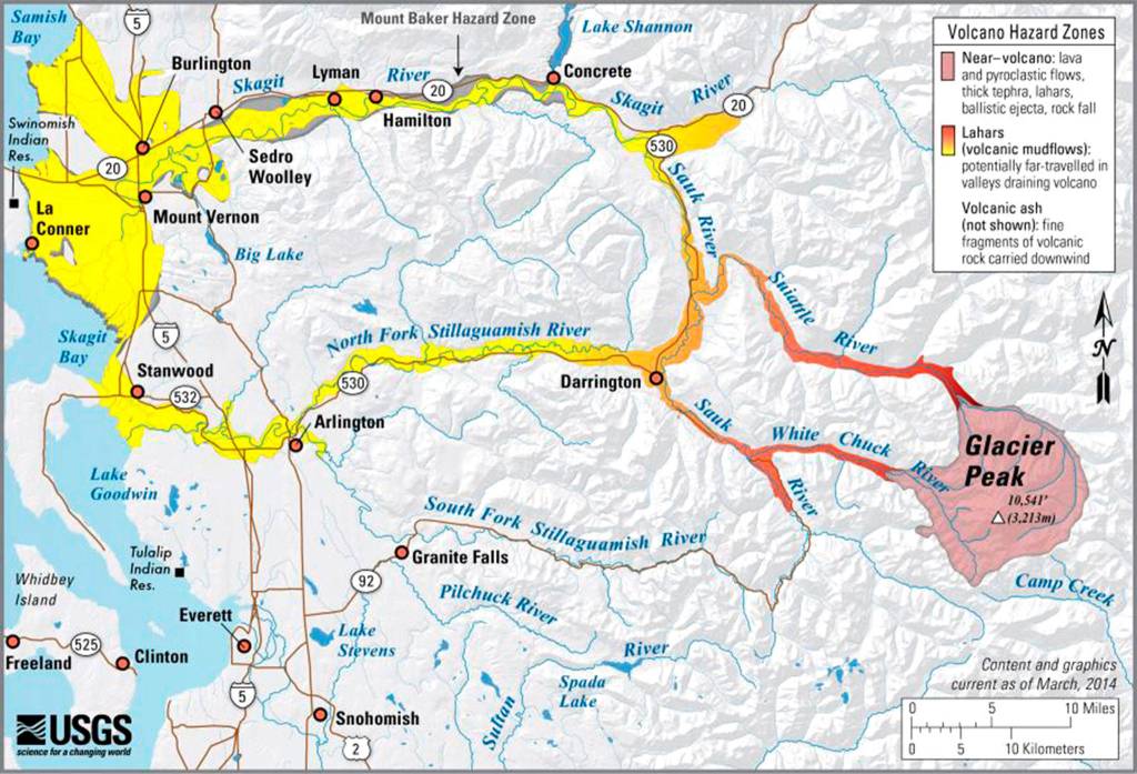
Four years ago, researchers mapped Glacier Peak and hundreds of square miles around it using technology that allows them to strip away obstacles to better see the terrain. It led to maps that show potential paths of volcanic mudflows called lahars. Lahars and ash are two major hazards should the volcano erupt.
The projected paths of lahars cover communities in the Stillaguamish and Skagit valleys. Darrington is one.
Councilman Kevin Ashe also was on the town council in the late 1990s. Glacier Peak was a topic then, he said.
“They keep doing this every four or five years, warning they need monitors,” he said during an interview in June. “I decided I’m going to see this through and get those monitors up there.”
He’s become more focused on public safety and natural hazards since the deadly 2014 Oso mudslide. In that disaster, they had no immediate warning. If there is a chance to warn people about Glacier Peak, it needs to be done.
“I don’t think I’ll ever see that volcano blow,” Ashe said. “But I never thought I’d see Mount St. Helens blow. You just never know. So let’s get some monitors up there … Hopefully we’ll never need them.”
Kari Bray: 425-339-3439; kbray@heraldnet.com.