Smoke from the Bolt Creek fire silhouettes a mountain ridge and trees just outside on Sept. 12, outside of Index. (Olivia Vanni / The Herald)

Smoke from the Bolt Creek fire silhouettes a mountain ridge and trees just outside on Sept. 12, outside of Index. (Olivia Vanni / The Herald)

Work begins to stabilize Bolt Creek burn scar for winter weather

A U.S. Forest Service report released last week identified several high-risk areas for landslides and flooding.

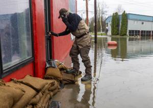
INDEX — Crews are working to stabilize the burn scar left by the Bolt Creek fire after a U.S. Forest Service report revealed the extent of the damage. Agencies say reducing the risk of flash flooding and landslides are their top priorities.

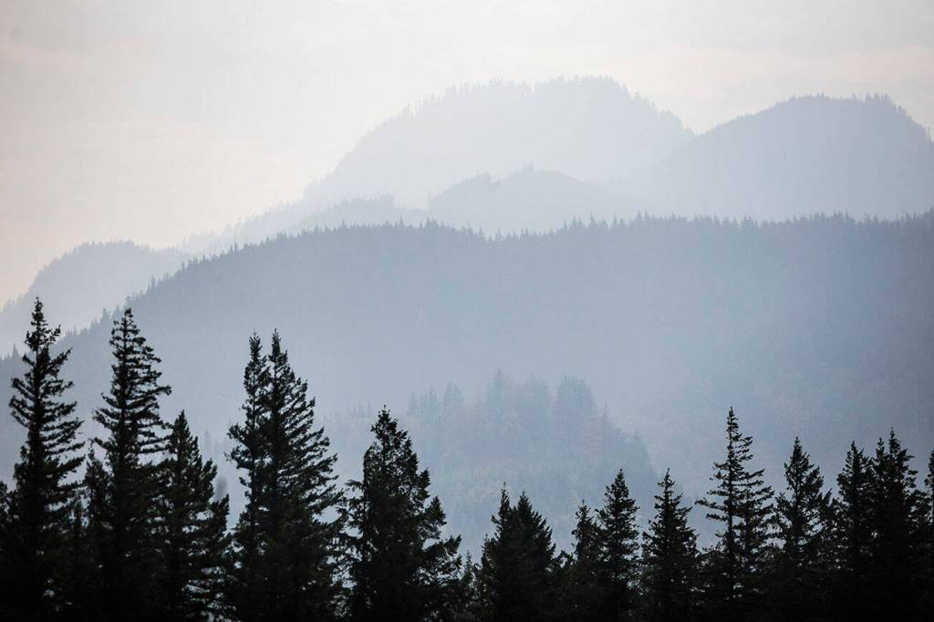
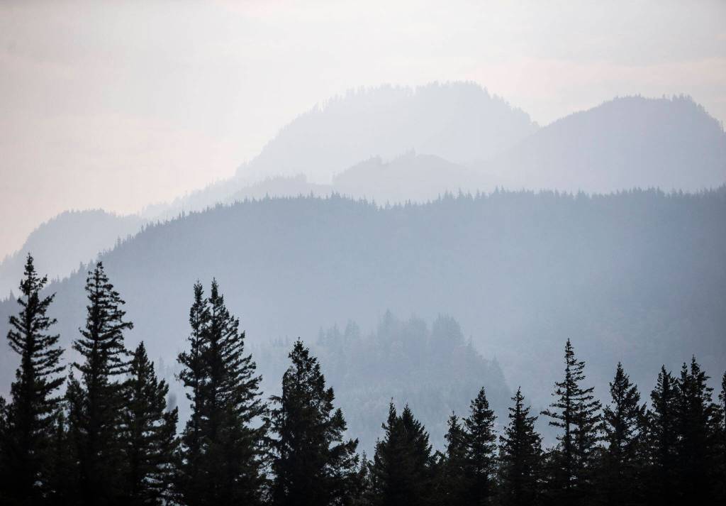
On Nov. 8, the Forest Service released a Burned Area Emergency Response report detailing its findings of fire damage. According to the report, the Bolt Creek fire blazed through 14,978 acres starting on Sep. 10 until fire crews achieved 51% containment on Oct. 21.

Most of the burned land borders U.S. 2 between Index and Skykomish. Of that area, about 75% is Forest Service land. Almost all of the rest is privately owned.

The report is the second released as part of the agency’s investigation into Bolt Creek’s aftermath. The first report, completed last month, was rendered irrelevant as the unusually long fire season continued to create further problems, according to a Forest Service press release.

BAER reports are intended to help the Forest Service and local agencies identify and prioritize dangers to habitat, infrastructure and safety in a fire’s aftermath, the press release said. The Bolt Creek report details possible plans to stabilize the area to help prevent serious landslides and flash flooding.

The team estimated certain parts of the burn scar to be at “high or very high risk of major consequences” if slides or flooding hit. Of greatest concern are dispersed campsites on Bolt Creek and Forest Service roads near the Beckler River, where the agency said the chance of debris flows or flooding causing risk to human life was “likely to very likely.”

A report released last month by the state Department of Natural Resources said boulders up to 4 feet in diameter were seen in an active runoff channel near the dispersed campsite, suggesting a high risk of “historic” debris flow should heavy rains hit the area. Snowpack this winter will increase the risk.

The Forest Service report recommended posting signs in at-risk areas to notify campers, as well as closing certain forest roads to the public until a full assessment can be made in the spring.

Forest Service crews began work on high-priority concerns identified by the report on Nov. 10, said spokesperson Colton Whitworth. The agency will address as many risks as possible until snow prevents further work, Whitworth said.

The state Department of Transportation is continuing work that began while the fire was still burning, said spokesperson RB McKeon. Early efforts included strategically felling trees “in a way that (the department) hopes will help mitigate the magnitude of any debris flow,” McKeon said.

Winter operations on U.S. 2 will begin on Nov. 20, McKeon said, meaning crews will be on 24/7 shifts to reduce response time in the event of a debris flow. Crews in that area are in contact with agencies on the east side of Stevens Pass that will be able to help clear the road if a slide blocks it.

McKeon said Department of Transportation geotechnicians have evaluated the slope along the highway and will continue to monitor it regularly for risks. Technicians were last on site on Nov. 2 checking on the areas identified by the report. McKeon said her agency will release its own report this week.

Riley Haun: 425-339-3192; riley.haun@heraldnet.com; Twitter: @RHaunID.

Talk to us

> Give us your news tips.

> Send us a letter to the editor.

> More Herald contact information.

More in Local News

Traffic moves around parts of the roundabout at the new I-5/SR529 interchange on Tuesday, July 22, 2025 in Marysville, Washington. (Olivia Vanni / The Herald)
WSDOT delays opening of Marysville interchange, ramps

Supply chain issues caused the agency to push back opening date. The full interchange and off ramps are expected to open in October.

Stanwood pauses Flock cameras amid public records lawsuits

A public records request for Flock camera footage has raised questions about what data is exempt under state law.

A Link train passes over a parking lot south of the Lynnwood City Center Station on Monday, Aug. 12, 2024 in Lynnwood, Washington. (Olivia Vanni / The Herald)
Construction to close parking spots at Lynnwood Link station

Fifty-seven parking spots out of the nearly 1,700 on-site will be closed for about two months.

Provided photo 
Michael Olson during his interview with the Stanwood-Camano School District Board of Directors on Sept. 2.
Stanwood-Camano school board fills vacancy left by controversial member

Michael Olson hopes to help bring stability after Betsy Foster resigned in June.

Traffic moves along Bowdoin Way past Yost Park on Monday, Aug. 25, 2025 in Edmonds, Washington. (Olivia Vanni / The Herald)
A new online tool could aid in local planning to increase tree coverage

The map, created by Washington Department of Natural Resources and conservation nonprofit American Forests, illustrates tree canopy disparities across the state.

Logo for news use featuring Snohomish County, Washington. 220118
Snohomish PUD preps for more state home electrification funding

The district’s home electrification rebate program distributed over 14,000 appliances last year with Climate Commitment funds.

Logo for news use featuring the municipality of Everett in Snohomish County, Washington. 220118
One person dead in single-vehicle crash on Wednesday in Everett

One man died in a single-vehicle crash early Wednesday morning… Continue reading

Students walk outside of Everett High School on Wednesday, Sept. 17, 2025 in Everett, Washington. (Olivia Vanni / The Herald)
SnoCo students perform well on metrics, state data shows

At many school districts across the county, more students are meeting or exceeding grade-level standards compared to the state average.

People get a tour of a new side channel built in Osprey Park on Thursday, Sept. 18, 2025 in Sultan, Washington. (Olivia Vanni / The Herald)
Snohomish PUD cuts ribbon on new Sultan River side channel

The channel created 1,900 linear feet of stream habitat, aimed to provide juvenile salmon with habitat to rest and grow.

Logo for news use featuring the municipality of Everett in Snohomish County, Washington. 220118
Auditor dismisses challenge against former Everett candidate’s registration

The finding doesn’t affect a judge’s ruling blocking Niko Battle from appearing on the November ballot.

The Seattle Children’s North Clinic at 1815 13th St. in Everett, near Providence Regional Medical Center Everett in 2018. (Seattle Children’s)
Seattle Children’s layoffs include Everett employees amid federal cuts

The company will lay off 154 employees this fall across five locations. It’s unclear how many positions in Everett will be eliminated.

Everett NewsGuild members cheer as a passing car honks in support of their strike on Monday, June 24, 2024 in Everett, Washington. (Olivia Vanni / The Herald)
Unionized Herald staff ratify first contract with company

The ratification brings an end to two years of negotations between the newspaper and the union.

Support local journalism

If you value local news, make a gift now to support the trusted journalism you get in The Daily Herald. Donations processed in this system are not tax deductible.