This map shows Glacier Peak’s volcano hazard zones. (USGS)                                This map shows Glacier Peak’s volcano hazard zones. (USGS)

This map shows Glacier Peak’s volcano hazard zones. (USGS) This map shows Glacier Peak’s volcano hazard zones. (USGS)

Cloaked in ice, Snohomish County’s volcano is a future danger

The U.S. Geological Survey says Glacier Peak poses a “very high threat” and needs better monitoring.

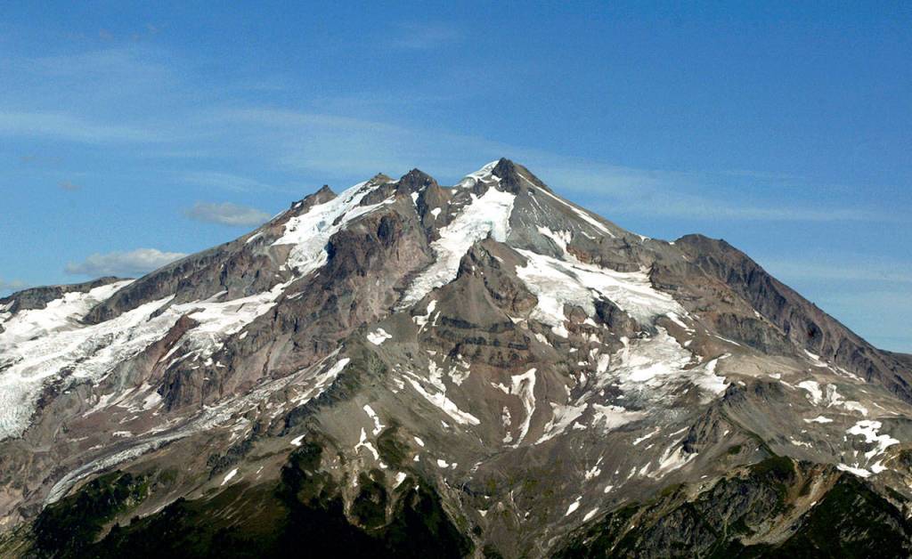
GLACIER PEAK — As the eruption of Hawaii’s Kilauea volcano has triggered evacuations on the Big Island and drawn international attention, Snohomish County’s own volcano slumbers in the wilderness east of Darrington.

Glacier Peak is considered a “very high threat” volcano by the U.S. Geological Survey, and the agency has labeled it a priority for improved monitoring. Threat levels are based on frequency of activity, types of eruptions, the hazards of those eruptions and how many people would be affected.

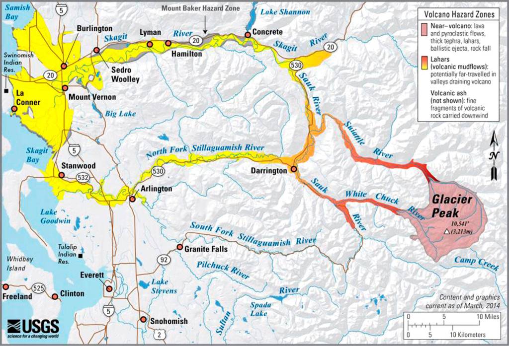
Glacier Peak doesn’t have the level of exposure Kilauea does, where fissures are opening in neighborhoods, said Seth Moran, scientist-in-charge of the USGS Cascades Volcano Observatory. But volcanic mudflows from a large eruption of Glacier Peak could reach communities in the Stillaguamish and Skagit valleys, and the volcano could spew ash as far as British Columbia.

It would be starkly different than what’s happening in Hawaii, Moran said.

An update from the Hawaiian Volcano Observatory on Monday described “lava fountaining, explosion of spatter more than 100 feet into the air, and an advancing lava flow.”

“The main thing that would be in common is that (Glacier Peak and Kilauea) are both volcanoes,” Moran said. “We wouldn’t see lava fountaining, we wouldn’t see fissures. The lava in Glacier Peak is much, much stickier than what’s in Kilauea.”

Glacier Peak as seen from the east, from Buck Creek Pass, in July 2007. (Wenatchee World file)

Glacier Peak as seen from the east, from Buck Creek Pass, in July 2007. (Wenatchee World file)

The two biggest hazards from Snohomish County’s volcano would be ash and lahars, or volcanic mudflows, which would be fed by glaciers melting on contact with hot volcanic rock. Mud, melt and debris roughly the consistency of wet cement would rush down the mountain.

“Lahars can go for a while and they can be very destructive,” Moran said.

Several communities, including Darrington, sit atop the remnants of such flows from millennia past.

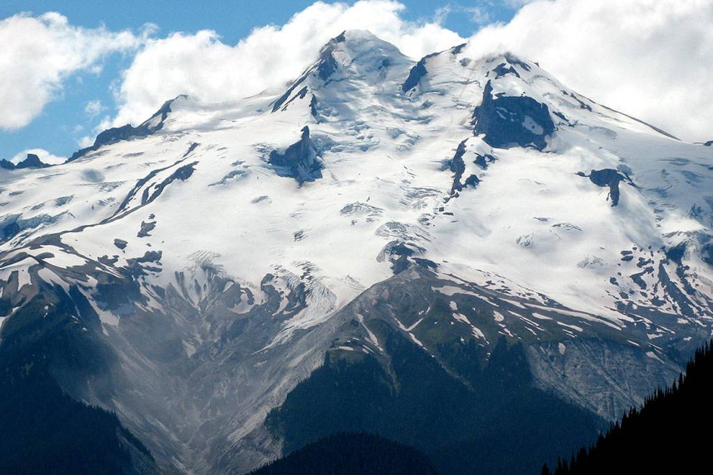
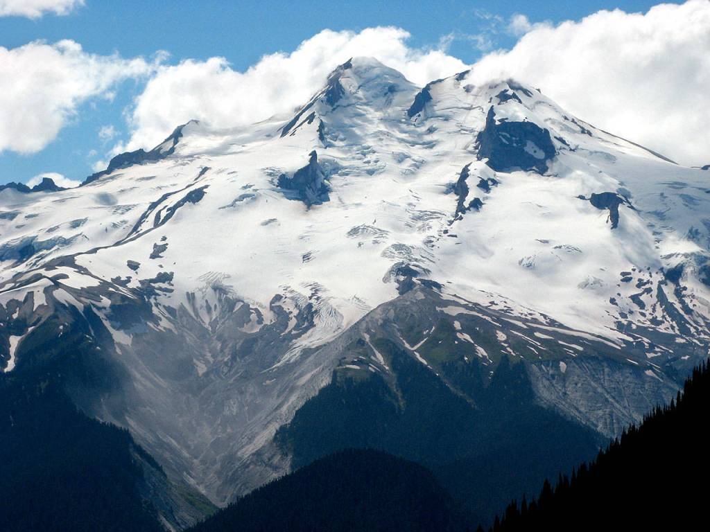
Of Washington’s five active volcanoes, Glacier Peak is the most remote. The peak is named for more than a dozen glaciers that cling to its sides. It has produced some of the largest, most explosive eruptions in the continental U.S. and has erupted at least six times since the end of the last ice age, according to the USGS. Researchers estimate the most recent was less than 300 years ago.

More than a decade ago, an assessment by the National Volcano Early Warning System found that Glacier Peak needs better monitoring. A single seismometer, installed in September 2001, is the only station there.

The goal is to add four more monitoring stations. That project is in the permitting phase with the U.S. Forest Service, Moran said.

Glacier Peak as seen from the east, near Darrington, in 2004. (Michael Martina / The Herald)

Glacier Peak as seen from the east, near Darrington, in 2004. (Michael Martina / The Herald)

In 2014, researchers used Light Detection and Ranging, or LiDAR, to map Glacier Peak and hundreds of square miles around the volcano.

“It was a really successful survey,” Moran said. “Glacier Peak is a wilderness area with lots and lots of tall trees. It’s really hard to do field geology out there and see subtle land changes associated with volcanic activity. The LiDAR allows you to kind of strip away the trees and map the layers.”

The detailed elevation information on drainages coming off Glacier Peak allows researchers to better map the potential paths of lahars.

“Another episode could happen conceivably in our lifetimes,” Moran said. “One of our roles is to ensure that we’re ready when something happens at Glacier Peak, and to make sure that the community is ready.”

The monitoring station has tracked some small quakes, including a short-lived sequence around Thanksgiving of 2015, Moran said.

Mostly, though, Glacier Peak is quiet. More monitoring equipment would be needed to better pinpoint small quakes and determine their significance.

Moran urges people to know if they are within reach of Glacier Peak or other volcanoes, and to understand the type of eruption that could happen and what hazards might affect them. He also reminds them it could be a long time before Glacier Peak awakens.

“Part of being prepared is understanding what can happen, and the likelihood that it will happen,” Moran said. “Volcanoes have some mystique. They’re the tallest mountain we see on the horizon … Take them into account, keep them in mind, but don’t be running around thinking (an eruption) is something that could happen the next day.”

Kari Bray: 425-339-3439; kbray @heraldnet.com.

Talk to us

> Give us your news tips.

> Send us a letter to the editor.

> More Herald contact information.

More in Local News

Olivia Vanni / The Herald 
The Mukilteo Lighthouse. Built in 1906, it’s one of the most iconic landmarks in Snohomish County.
The Mukilteo Lighthouse. Built in 1906, it’s one of the most iconic landmarks in Snohomish County. (Olivia Vanni / The Herald)
Mukilteo mayor vetoes council-approved sales tax

The tax would have helped pay for transportation infrastructure, but was also set to give Mukilteo the highest sales tax rate in the state.

South County Fire plans push-in ceremony for newest fire engine

Anybody who attends will have the opportunity to help push the engine into the station.

Marysville Mayor Jon Nehring gives the state of the city address at the Marysville Civic Center on Wednesday, Jan. 31, 2024, in Marysville, Washington. (Ryan Berry / The Herald)
Marysville council approves interim middle housing law

The council passed the regulations to prevent a state model code from taking effect by default. It expects to approve final rules by October.

x
State audit takes issue with Edmonds COVID grant monitoring

The audit report covered 2023 and is the third since 2020 that found similar issues with COVID-19 recovery grant documentation.

Bothell
Bothell man pleads guilty to sexual abuse of Marysville middle schoolers

The man allegedly sexually assaulted three students in exchange for vapes and edibles in 2022. His sentencing is set for Aug. 29.

Larsen talks proposed Medicaid cuts during Compass Health stop in Everett

Compass Health plans to open its new behavioral health center in August. Nearly all of the nonprofit’s patients rely on Medicaid.

A car drives past a culvert blocked by grass along 123rd Avenue NE on Wednesday, July 16, 2025 in Lake Stevens, Washington. (Olivia Vanni / The Herald)
Little Pilchuck salmon project gets boost from $4.6M state grant

Washington’s Recreation and Conservation Office announced Tuesday that Snohomish… Continue reading

Community members gather for the dedication of the Oso Landslide Memorial following the ten-year remembrance of the slide on Friday, March 22, 2024, at the Oso Landslide Memorial in Oso, Washington. (Ryan Berry / The Herald)
The Daily Herald garners 6 awards from regional journalism competition

The awards recognize the best in journalism from media outlets across Alaska, Idaho, Montana, Oregon and Washington.

Image provided by Snohomish County PUD
The three potential routes for a new transmission line between Maltby and Paradise. Construction is set to begin in 2028.
Snohomish County PUD plans open house to discuss new transmission line

The public utility will discuss three possible routes on July 31 for a new line between Maltby and Paradise.

Traffic slows as it moves around the bend of northbound I-5 through north Everett on Wednesday, May 22, 2024. (Olivia Vanni / The Herald)
Paving project will close I-5 lanes in Everett

Crews will close up to 4 lanes overnight for weeks to complete the $8.1 million repairs.

Logo for news use featuring the municipality of Snohomish in Snohomish County, Washington. 220118
Snohomish man, who trained extremists, sentenced for illegal gun possession

An FBI investigation revealed Benton posted violent extremist content, neo-Nazi propaganda, and anti-Semitic materials on social media.

‘Voter friendly’ election ballots set to go out for Snohomish County voters

Materials will include some changes to make the process easier to vote in Aug. 5 primary.

Support local journalism

If you value local news, make a gift now to support the trusted journalism you get in The Daily Herald. Donations processed in this system are not tax deductible.