
EVERETT — The first wave of a rare June atmospheric river left thousands of people without power Monday in Snohomish County.
The storm carried heavy rain and wind into Western Washington. Forecasters predicted rain from a second wave of the atmospheric river would move inland Monday night.
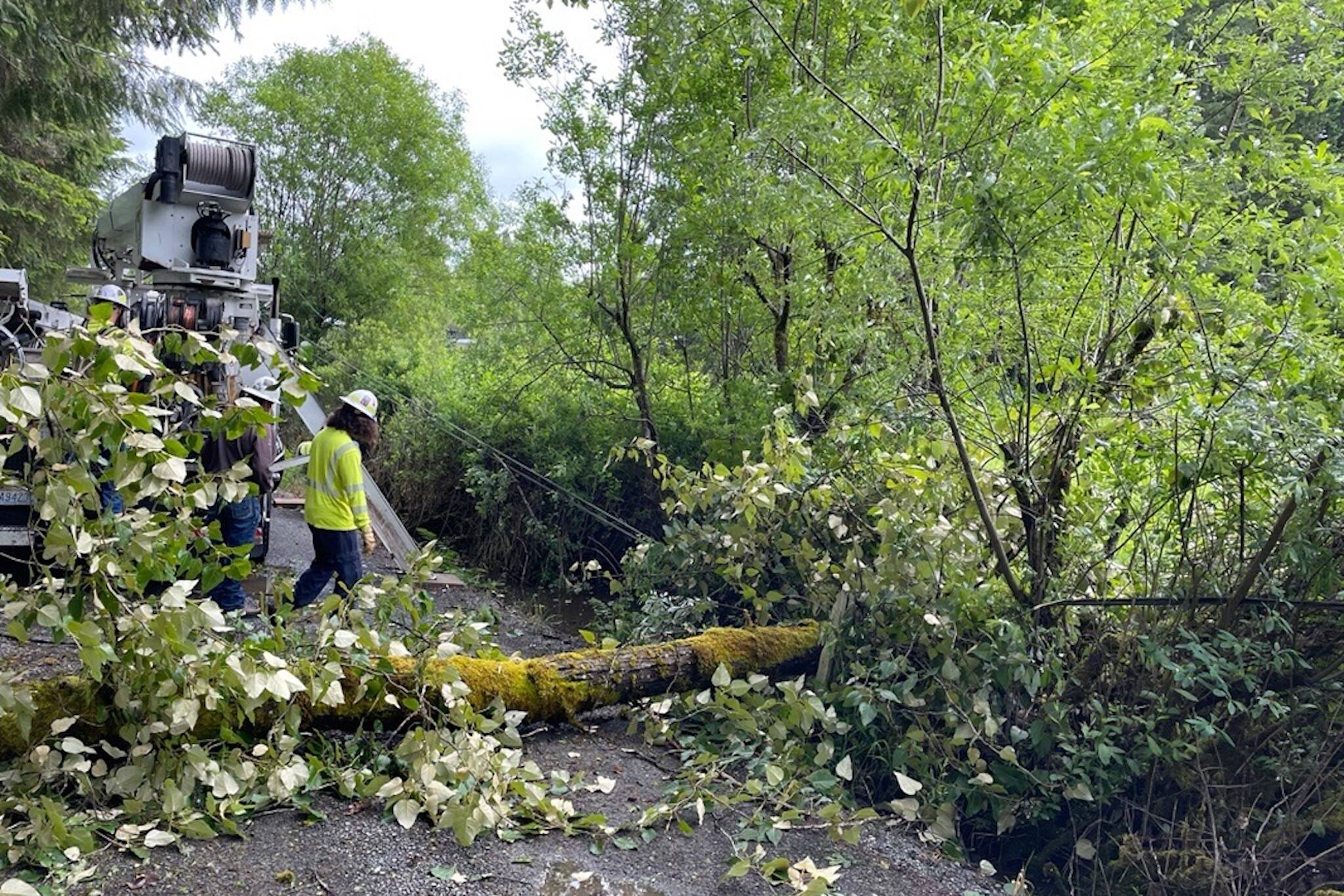
At one point Monday afternoon, the Snohomish County PUD outage map showed more than 13,200 without power in Snohomish County. Many of the outages were north of Tulalip Bay, as well as south of Mill Creek.
“Most of it is being fixed very quickly,” said PUD spokesperson Aaron Swaney. “But once something gets fixed, something else seems to be happening. The outages are all over the county.”
Trees knocking into power lines continued to be an issue Monday throughout the county. In Marysville, 51st Avenue NE was closed from 132nd Street NE to 122nd Place NE because trees knocked down several power lines, according to the Marysville Police Department.
In Lake Stevens, a mobile home caught fire amid the storm in the 13000 block of 44th Street NE, according to Snohomish Regional Fire and Rescue. A tree crashed into the home and several power lines were also down. The homeowner was away at the time, but a dog inside died in the fire. Fire authority spokesperson Peter Mongillo said there was a “good probability” the fallen tree caused the fire, but the exact cause was still under investigation.
Multiple trees and power lines down throughout the district. Including at this structure fire located in the 13000 Block of 44th St NE in Lake Stevens. Crews arrived to a tree into the house with power lines down, and a fully involved fire. More info will be available shortly. pic.twitter.com/yP8OjQs03y
— Snohomish Regional Fire & Rescue (@SnoRegionalFire) June 3, 2024
Daily rainfall records were broken Sunday across Western Washington. Seattle got 0.65 inches of rain, breaking a 23-year-old record. Everett saw 0.44 inches of rain, short of a 0.53-inch record set in 2010.
The weather service issued a wind advisory Monday, with the strongest winds expected early Tuesday. Gusts of 35 to 40 mph were expected in Everett.
A flood watch remained in effect through most of Western Washington until Wednesday morning, including the cities of Edmonds, Everett, Lynnwood and Marysville, according to the National Weather Service.
“With the extra leaves being on the trees, it’s going to be an issue with tree branches falling down,” Seattle meteorologist Harrison Rademacher said.
Another half-inch of rain was expected to shower Snohomish County through Wednesday. All the rivers in the county remained below the “active” flood stage and were expected to stay that way, according to the weather service.
Once higher pressure builds into the region in the second half of the week, much clearer skies are ahead, Rademacher said. Get ready for temperatures in the high 70s, with a potential high in the 80s Saturday.
“It’s rare to get atmospheric rivers this late in the season, especially in June,” Rademacher said. “We’re getting a good warm-up after this.”
Jonathan Tall: 425-339-3486; jonathan.tall@heraldnet.com; Twitter: @snocojon.
Talk to us
> Give us your news tips.
> Send us a letter to the editor.
> More Herald contact information.

