After big quake, Snohomish County would face jigsaw puzzle of ‘islands’
Published 1:30 am Saturday, February 4, 2023


EVERETT — When the Big One hits, you might be stranded on an island.
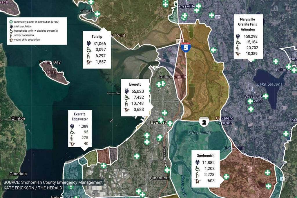
A new map of “population islands” gives you an idea of whom you’ll be stuck with — and where.
The interactive map produced by the Snohomish County Department of Emergency Management reveals how transportation system damage from a powerful earthquake could fracture our county into isolated areas, or “population islands.”
You’ll be hearing that term and seeing the map a lot in months to come in disaster planning campaigns.
“The islands are a different way of cutting up the community,” said Scott North, spokesperson for Snohomish County DEM. “We wanted to show people how things could break — what the risks really look like.”
The map looks like a jigsaw puzzle of islands.
There are 58 islands on the map that encompasses Snohomish County, part of Island County and slivers of King and Skagit counties.
Click on the islands where you live, work and play. The bright white lines defining the borders of the islands are not the same as man-made town boundaries. These are where roadways and bridges are expected to break and need long-term repairs based on a 9.0 earthquake.
On this map, towns can be split into separate islands or clustered with others. Everett, for example, is carved into about a dozen islands and is also part of a huge island with areas of Mukilteo and Edmonds.
The map details each island’s demographics, such as the number of seniors, children and people with disabilities, as well as how many households are below the poverty level or without access to vehicles.
It’s a reminder to get those two weeks of supplies ready now. Those same supplies also spare you from making a trip out during a snowstorm or if roads become blocked by falling trees after heavy winds.
The map is a first step.
In 2019, Snohomish County was chosen by FEMA to administer a $1.4 million Regional Catastrophic Preparedness Grant that involves disaster planning for eight central Puget Sound counties, five cities and the Tulalip Tribes.
“The next phase of the project is to be working with people,” North said. “In the 58 islands, we have identified 372 potential locations where relief supplies could be staged and residents trained for recovery.”
The map focuses on the forecasted impact of the Big One, a magnitude 9.0 megaquake. Scientists say the region is overdue for a Cascadia Subduction Zone catastrophe. The fault typically cuts loose every few centuries, most recently in 1700. When that next one strikes, the ground is expected to shake for up to several minutes. Energy released under the ocean could spawn tsunami waves.
Cascadia isn’t the only out-of-sight, out-of-mind threat just biding its time beneath our feet.
The South Whidbey Island Fault, which runs under much of southwest Snohomish County, is believed to be as big a threat to the county as the Cascadia is to the larger region.
‘A bad day’
For many of us, we’re hopping islands over the course of the day, without realizing it.
Think of the route between home and work, to pick up your child at school or to check on elderly parents.
Count the bridges and overpasses. Study the map for the white-lined island borders. As you drive, those imaginary white lines will start appearing in your mind. If things crumble, it might just become your new reality.
“If you know more about the island where you live and work, you can start acting on that information,” North said. “It helps people understand what could occur in a megaquake but also connects to what happens in major storms or flooding and people get isolated. We saw it happen in mudslides and windstorms.”
Islands range in population from a dozen to many thousands.
A cluster of small islands along Mukilteo Boulevard — the only road over a series of wooded gullies — is flanked by other small islands that would need to be crossed before reaching major services.
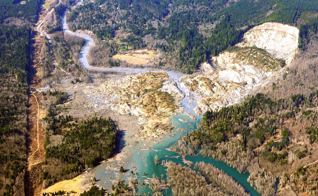
Other islands to the east, such as Darrington, are large but remote. Residents could be impeded by damaged roads for weeks, as happened in the 2014 Oso mudslide that buried a square mile of the valley and claimed 43 lives.
Portions of Everett, Edmonds and Marysville have big island populations, but that doesn’t call for complacency. There are taller buildings to topple, more people needing potable water and more homes to lose power.
“In a megaquake, there really is no safe place, even if you think you’re good,” North said. “Some land will thrust up and other land will sink. Any one of those would create a very bad day.”
Several years in the data-intensive making, the county’s population island map went live in the fall of 2022.
“We launched it in September, during National Preparedness Month. Our plan was to push it out in a major way,” North said.
The plan was derailed by a disaster. The Bolt Creek fire broke out Sept. 10 between Index and Skykomish, causing evacuations and closing U.S. 2, the main corridor for residents and through the Cascade Range.
“We went from preparedness to doing it at Bolt Creek for a month,” North said.
People in Index had to leave their homes.
The island map, which stretches a bit outside the Index limits, shows 194 people, median age of 51, with 41 seniors and 8 young children, 14 households with a disability and 10 households below poverty level.
The wildfire burned about 15,000 acres of wilderness. The danger isn’t over. The fire left behind the risk of flash flooding and landslides.
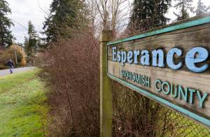
lsle of Snohomish
“Welcome to Population Island: Snohomish,” that city’s mayor, Linda Redmon, posted on social media with a link to the interactive map in September.
Redmon, advisory group chairperson for the county emergency management department, encouraged people to get involved.
“The realistic expectation that the City of Snohomish will become a population island during a wide scale disaster reinforces that all of us — residents, businesses, and government — need to be prepared to be self-sufficient …” she wrote.
Shari Ireton, city spokesperson, said reaction was mixed to the post.
“Some said, ‘This is really interesting,’ and others people were like, ‘Why are you trying to scare us with this?’” she said.
The island map of Snohomish shows 11,882 people, median age 42, with 2,228 seniors and 603 young children; 1,208 households with a person with a disability; 373 households below poverty level; and 11 homes without access to a vehicle.
“It provides a nice visual when we talk about preparedness and why it’s so important, because essentially we have two waterways and the major highways we won’t be able to connect with because of infrastructure,” Ireton said.
The city needs to be able to “work inwardly instead of working outwardly,” she said.
That includes taking into account the different time scenarios of a disaster.
“If something were to happen during noon on a weekday it is different than at midnight on a Saturday, in terms of which employees are going to be where,” Ireton said.
Helping businesses keep their doors open is key to ensure access to essentials such as diapers and medicine on the island.
“We will have to think about, where will we get our toilet paper?’” she said. “Costco isn’t on our island.”
Find your island
The interactive map is user friendly for those ages 8 to 98.
Type your address in the box to find your house or haunt.
You might not be able to walk or drive past those white lines bordering your island for days or even weeks after a major earthquake.
“Look at where your home is, look at where your work is and count how many population islands you are going through,” said Amy Lucas, county emergency planning and resilience program manager. “Look at your personal life and how these islands affect it.”
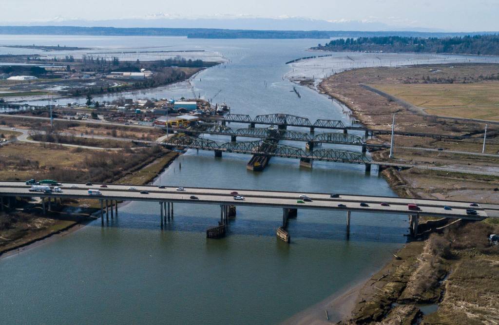
A 2021 earthquake series in The Daily Herald reported that out of 230 state bridges in Snohomish County, about 80% would sustain substantial damage from a Cascadia Subduction Zone megaquake, according to one disaster scenario. Some could take 2½ years to repair.
“We have major earthquakes so infrequently that people tend to forget the impacts. How long are you going to shake, and be traumatized and what happens afterwards?” Lucas said.
The map uses icons to represent possible community points of distribution, such as schools and churches, that can serve as sites where people receive information, food, water, medicine and basic supplies.
First, the responders and rescuers have to get there.
Who can you rely on?
“It’s your neighbors. That’s who is going to jump in to help you, and you are going to jump in to help them,” North said. “During disasters, people rise up. They do what Homo sapiens do. They pick up tools and begin to figure out how to solve the problems.”
‘Enough to share’
They rose up in Oso.
Gail and Ron Thompson were shopping at Costco on the morning of March 22, 2014, when the mudslide obliterated their entire Steelhead Haven neighborhood in Oso. Many of their neighbors died.
The couple, now married 52 years, consider themselves fortunate to only lose their home.
The community came to their aid. The Thompsons eventually found another house in Oso, about 5 miles from the mudslide, where they now keep a prepper pantry.
“If there was a disaster today, I have enough in my cupboard to feed 50 people at the spur of a moment,” Gail Thompson said. “I have enough, and enough to share.”
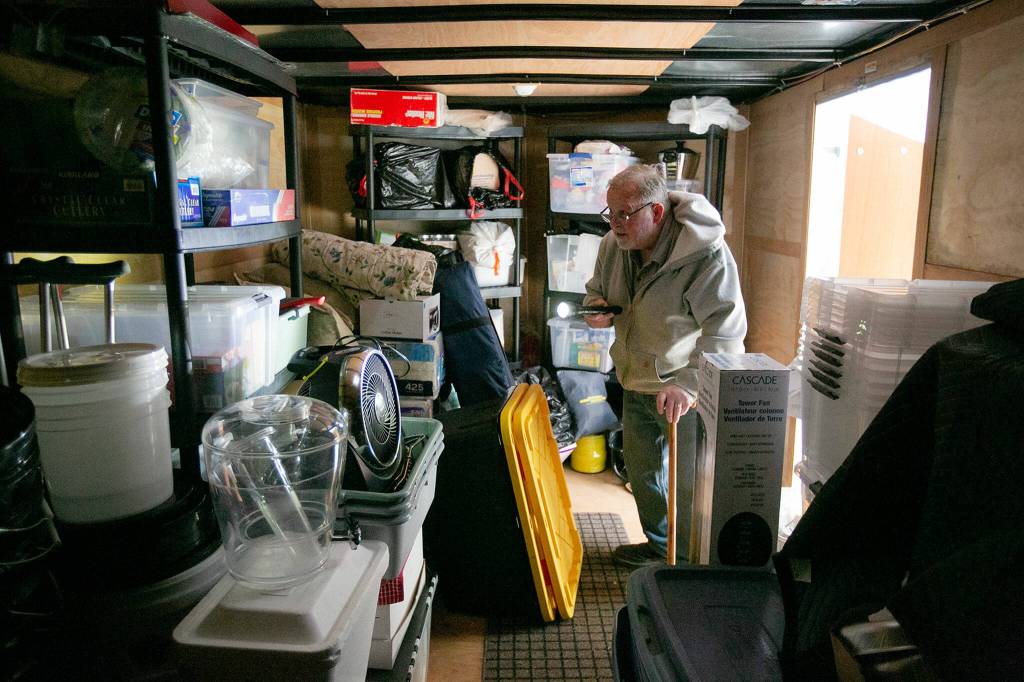
His-and-her boxes with safety vests, hard hats, gloves, clothes and toiletries are under the bed. A “go bag” is at the ready.
Outside is a 20-foot covered trailer with supplies for outreach. Inside the trailer, designed to haul cars, it’s like a survival shelter on wheels.
“We want to be prepared to help others because others helped us,” she said. “We know what it’s like to not have an address.”
The Thompsons became part of a group effort for the next calamity, assisting in the Christina Project, a hyperlocal manual for the Oso area with maps and 200 pages that outline every aspect of planning.
The project is named for Christina Jefferds, who proposed the need for a manual several years before the 2014 landslide.
The day of the mudslide, Jefferds, 45, was babysitting her 4-month-old granddaughter Sanoah at her home on Steelhead Drive. Their bodies were found 10 feet apart. Sanoah was the youngest of the 43 lives lost.
Kits, not kit
The mudslide buried a section of Highway 530.
Lucas, the county emergency planner, was on the Darrington side of the mudslide, about 3 miles to the east.
“I found myself on a population island,” she said. “Literally at the end of the road.”
Residents were cut off from Snohomish County cities unless they winded their way through Skagit County or down the gravel of the Mountain Loop Highway to reach I-5.
For several months, it took her 2½ hours to get to work at her Everett office. It took about two hours to get to Arlington for groceries on a Saturday. Her son, then 16, had been attending classes in Arlington.
“He had to transfer back to Darrington schools for the year,” she said. “It was just too long of a trip.”
It also put her preparedness to the test.
“I found myself short on dog food,” she said. “I thought I was a great prepper, until it came to my pets.”
Tailor kits for each island: home, work and car.
At home, maintain at least a two-week supply of food, water, and medication for family members, including pets, plus a first aid kit, water purification tools, flashlights and other items.
Think outside the box.
Pack toys for the kids. For those hooked on coffee, have caffeine pills or instant packs that can be mixed with water for the fix.
“Take a smaller event and think it through. If you’re in an area where you might have to evacuate for a flood or wildfire, keep your supplies nimble,” Lucas said. “If you are prepared for the worst-case scenario, you are prepared for being cut off for the weekend.”
Store in a tote. Rotate supplies.
Keep your hiking boots in the car, as well as a blanket, snacks and other items you need to get by.
“It’s easier to do it ahead of time than on the fly,” North said.
Take inventory of what you have on hand.
“A lot of people are more prepared when they start thinking about it,” North said.
Shortages during the pandemic prompted many people to keep a deep pantry.
‘The hinterland’
There is more to preparedness than packing.
When you call 911, there’s a lot of information the dispatcher doesn’t know about you.
Smart911 can change that. It is quick and easy, accomplished in 10 minutes or less.
Using the app or computer, input information and photos of family members, including dogs and cats, medical conditions, phone numbers of emergency contacts, property details and vehicles.
Rescuers then know that, for example, at the address of the two-story gray home on Colby Avenue there are two adults, ages 42 and 45, a 6-year-old child with autism, a 40-pound dog and a red Subaru.
“It helps to know what they’re rolling into and who they’re dealing with,” North said. “If you live out there in the hinterland, this is an important tool for you.”
North said the information is only available to 911 dispatchers and first responders.
“Elon Musk doesn’t have access,” North said. “Or Zuckerberg.”
Sign up for SnoCoAlerts, the county’s early warning and notification system. Load the MyShake app, which uses ShakeAlert to detect and provide data about earthquakes in progress.
Make sure you have a device to recharge your phone, and hope you can get a signal.
You just never know what the next disaster will be. Or when.
Andrea Brown: 425-339-3443; abrown@heraldnet.com; Twitter: @reporterbrown.