New Everett City Council boundaries are taking shape
Published 1:30 am Tuesday, September 8, 2020


EVERETT — The proposed districts for five city council positions look like jigsaw puzzle pieces.
Their boundaries run straight, jog at an angle, then down, then out.
Starting Thursday, the independent districting commission is scheduled to hear public input on its map proposal during six online meetings spread over a week. It’ll be the first look at what could be the city council’s electoral future for many people in Everett, a city of more than 111,000 residents per U.S. Census data.
As a cutup map of Everett, the shapes don’t immediately make sense. But the context of several layers of economic, ethnic and population data, even down to the precinct level, reveals that the areas were drawn to be equitable and done within parameters established by the Voting Rights Act, Washington state code and city criteria.
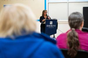
That’s by design, commission chairperson Simone Tarver said.
“The reason why I wanted to be on this commission is I grew up in Everett my whole entire life, except when I went away for college,” she said. “… There’s that thing I heard, ‘Everything happens in north Everett.’”
After years of campaigning, supporters with Everett Districts Now got Proposition 1 on the ballot in November 2018. Of 32,920 ballots cast in that Everett election, 55.86% backed city council districts, and 53.4% of 31,421 voters wanted five districts and two at-large positions. The other option was four districts and three at-large positions. Everett has 57,463 registered voters, according to Washington Secretary of State data from August.
As proposed, the districts encompass all or part of a few designated neighborhoods.
• District 1: Northwest, Delta, Riverside and Bayside.
• District 2: Bayside, Riverside, Port Gardner, Glacier View, Lowell, Pinehurst-Beverly Park, South Forest Park and Valley View.
• District 3: Boulevard Bluffs, Harborview-Seahurst-Glenhaven, View Ridge-Madison and Evergreen.
• District 4: Westmont, Holly, Cascade View and Twin Creeks.
• District 5: Pinehurst-Beverly Park, Cascade View, Twin Creeks and Silver Lake.
Each district is supposed to have about one-fifth of the city’s population based on U.S. Census data, within a plus or minus range of up to 10%. With over 111,000 people, the districts range from 19,765 residents in the proposed third district to 21,469 in the fifth district. Everett’s districting commission tried to narrow that margin to 5%.
The commission members started with identifying “core areas” from which they could base and shape a district.
“We went through dozens, I think, of these core areas, before we settled on these final five,” said Tony Fairfax, the consultant hired to do most of the technical work as the district master.
After input from the commission, he presented four plans to the members for several rounds of feedback and drafts, until the commission reached plan A-8. That’s what will be up for public input this month.
But as drawn, some people living on the east side of Broadway in the Delta, Lowell and Riverside neighborhoods criticized the map for undermining the intent of the district proposition and dispersing political power throughout the city.
“Everybody here has the feeling that it’s the tale of two cities,” said Ryan Weber, a Delta Neighborhood resident and vice chairman of the neighborhood association.
Weber criticized the proposed District 1 shape for marginalizing Everett’s northeast neighborhoods behind the historical power center of northwest Everett.
“Delta is not the Northwest Neighborhood,” he said. “We don’t have Legion Park. We don’t have a golf course. We have Everett Housing Authority.”
He created a Facebook group called East Everett River District, which would rather see the north Everett districts split along Broadway.
Districting commission members said a district east of Broadway isn’t as “compact,” a criteria meant to keep district shapes from becoming jagged or irregular, with the exception of barriers such as the Snohomish River. The requirement can prevent gerrymandered districts, and is part of the Washington state constitution for congressional and legislative districts. It requires districts to follow natural geographic, artificial, or political subdivision boundaries.
“Either way it could still meet our standards,” said Tarver, the districting commission chairperson.
The districts are set for a 10-year cycle to be redrawn or adjusted based on U.S. Census data. Everett’s will likely be updated within a year of the 2020 Census.
In November, the districting commission will present its final map to the city council, which doesn’t have much authority to reject it.
“It’d be a conflict considering the results could eliminate some members of the council,” city staff liaison Nichole Webber said.
Next year will be the first city council election by district, with four-year terms for positions representing a district. The at-large positions will be elected in 2023, also to four-year terms.
Ben Watanabe: bwatanabe@heraldnet.com; 425-339-3037; Twitter @benwatanabe.
Your chance to comment
Anyone interested in commenting on the proposed Everett City Council districts map is asked to RSVP so city staff can plan for how many people are needed to manage the virtual meetings between Thursday and Sept. 17.
To attend a meeting, call 425-616-3920 with conference ID 151-198-687, then the # symbol. The meeting is also available via Microsoft Teams, a teleconferencing service available through a web browser or the downloaded app.
Written comments can be submitted online at tinyurl.com/y2ofanlh or emailed to Nichole Webber, the staff liaison, at Nwebber@everettwa.gov.
Meetings are scheduled for 5-7 p.m. Sept. 10; 8:30-10:30 a.m. Sept. 12; 6-8 p.m. Sept. 13; 3-5 p.m. and 6-8 p.m. Sept. 14; and 5-7 p.m. Sept. 17.